|
|
|||||||||||||||||||
Dark Peak 8504(USGS Agnes Mtn, McGregor Mtn; GT McGregor Mtn)June 24-26, 2006 |
|||||||||||||||||||
|
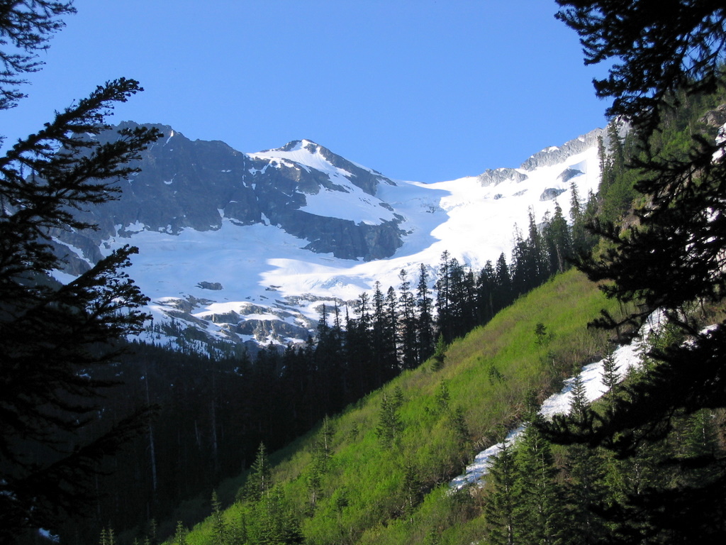
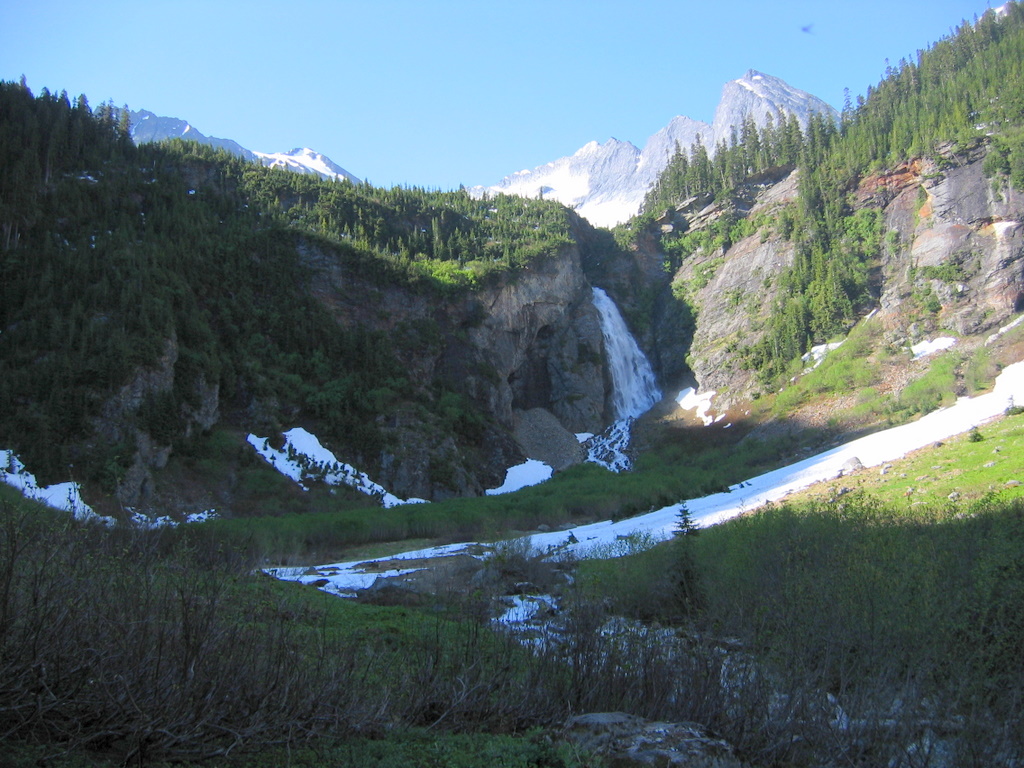
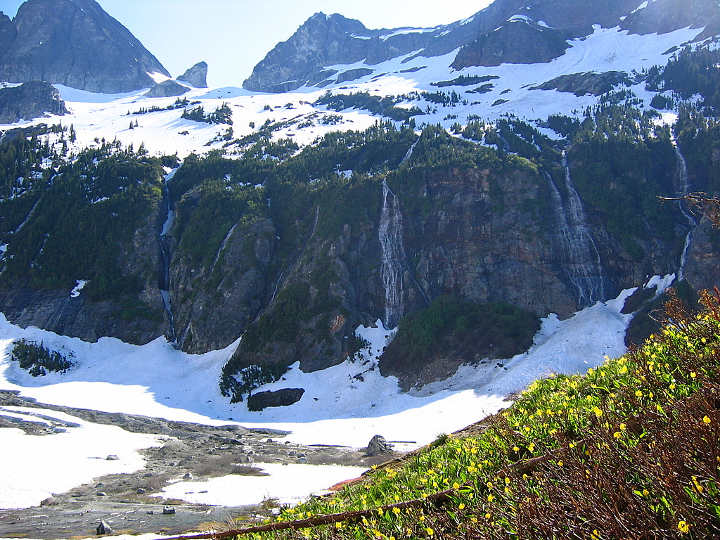
Dark Glacier & Peak from 3800 feet by Swamp Creek |
|||||||||||||||||||
|
Party: Matt Burton, Eric Johnson Introduction: The trip to Dark Peak had three parts. First was a trail hike up Agnes Creek to our camp. Second was a bushwhack up the abandoned Swamp Creek trail to the base of the glacier. Third was a snow and glacier ascent zigzagging several thousand feet up the Dark Glacier to the summit.
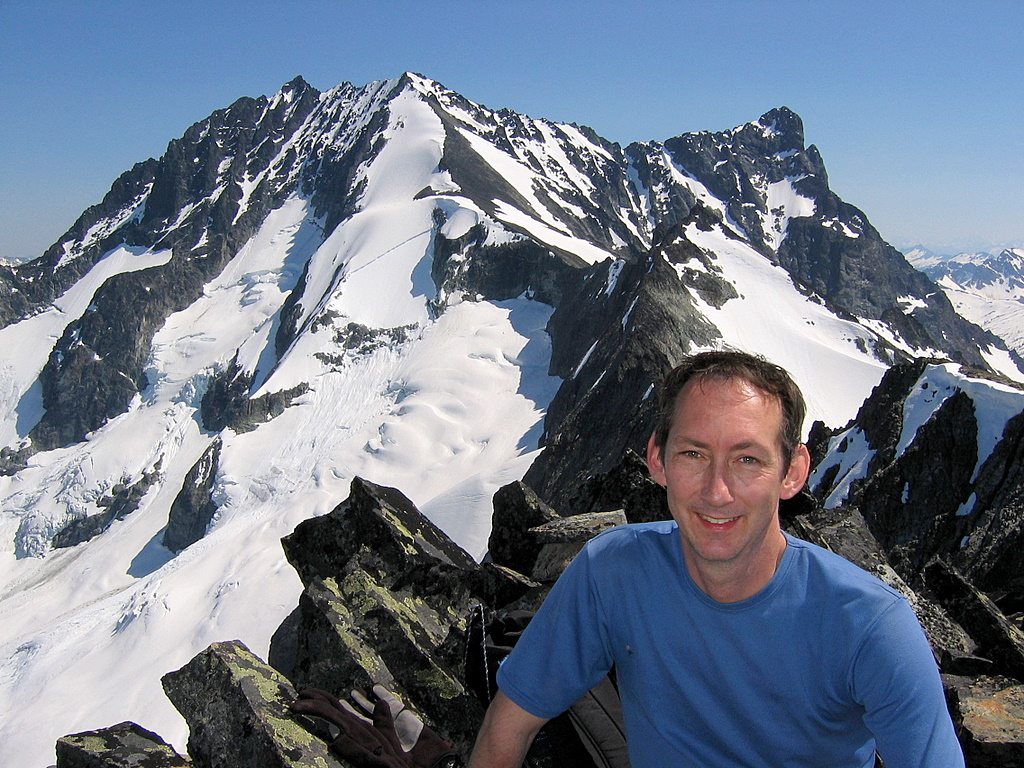
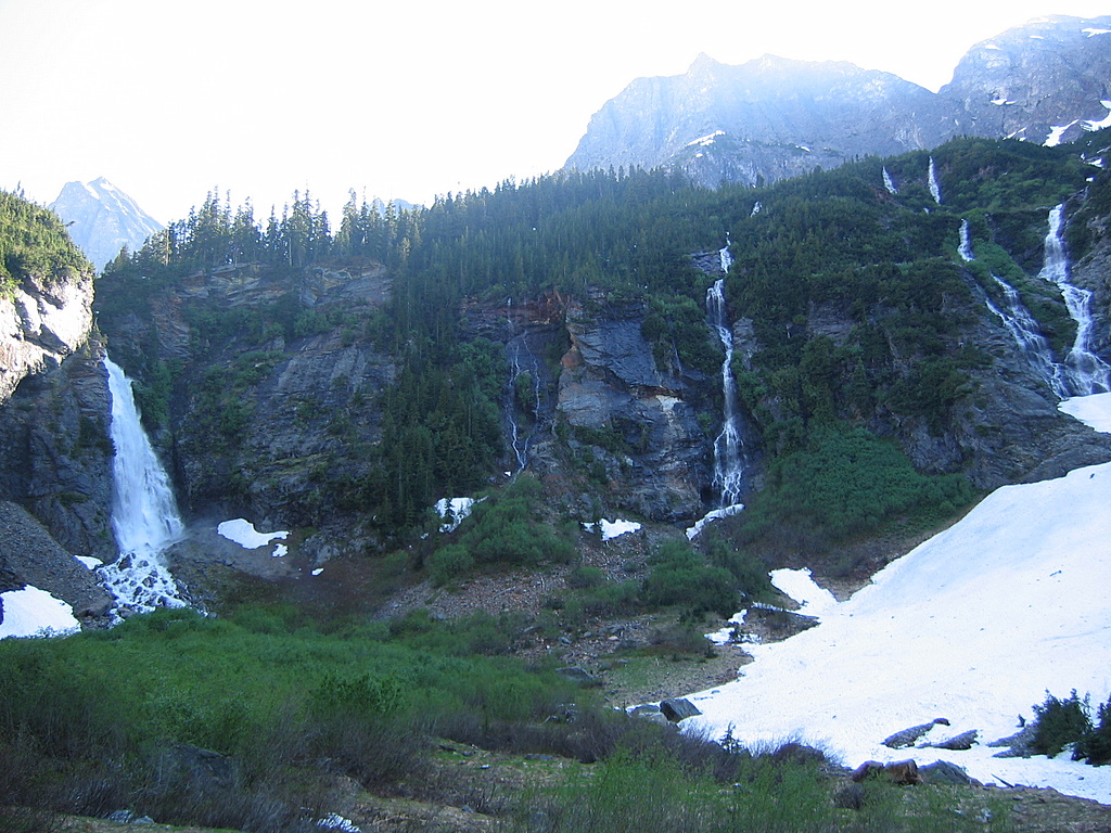
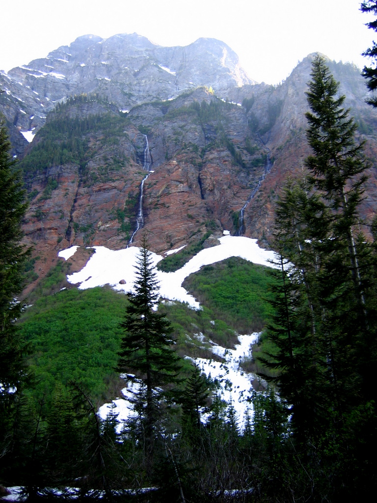
The summit has an impressive view of the north face of Bonanza. My favorite part of the trip was the many waterfalls pouring down the cliffs in the upper Swamp Creek valley, including the big waterfall of Swamp Creek itself.
Dark Peak was #82 of the 100 Highest Washington peaks for me. It was one of several awkward Top 100 peaks that I had hoped to tale care of this year, because it’s problematic in several ways. First, some argue that it shouldn’t be on the Top 100 list, because it doesn’t have 400 feet of prominence, but it was included on the original list because it is a named summit. Second, it has required multiple attempts from many of my acquaintances, because the long route requires a seasonal balance of clear trail below and snow-covered glacier above. Third, timing for the trip is complicated by schedules for the ferry & shuttle bus to the High Bridge trailhead. And fourth, the abandoned trail up Swamp Creek is notoriously brushy. Despite all that, this weekend the weather was good and the brush not too terrible, so the trip came out arduous but successful. |
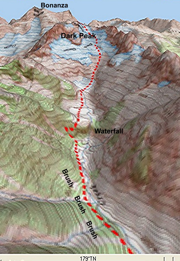
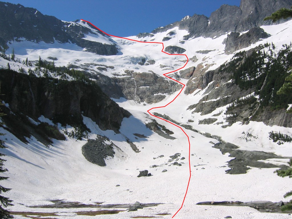
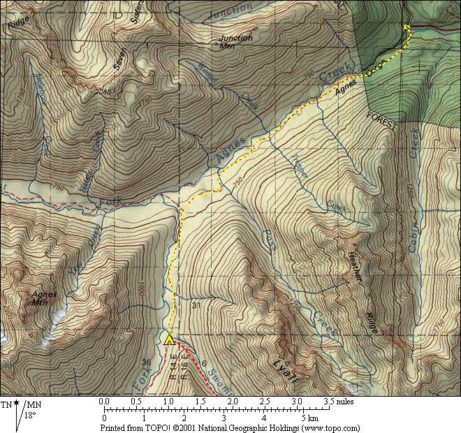
Upper Swamp Creek - Dark Glacier Route |
||||||||||||||||||
|
Report:
To get to the High Bridge trailhead, transportation provides an extra challenge at the beginning and end of the trip –a long combined car-ferry-bus journey. To get there, I picked up Eric at 6:15am and drove via US2 to Fields Point, took the 9:20 express ferry up Lake Chelan to Stehekin, and took the 11:15 Park Service shuttle bus to arrive at High Bridge at 12:15pm, six hours later.
We left High Bridge, 1600 feet, at 12:30 in very hot weather and headed up the Agnes Creek trail to the junction with Swamp Creek, 8.6 miles. Both the Stehekin River and Agnes Creek were running hard in the hot weather, with lots of swirling white rapids amid the green glacial water. Fortunately, much of the route was in forest, and we made steady progress to our camp at the junction with Swamp Creek, 8.6 miles, 2800 feet, 5:00pm.
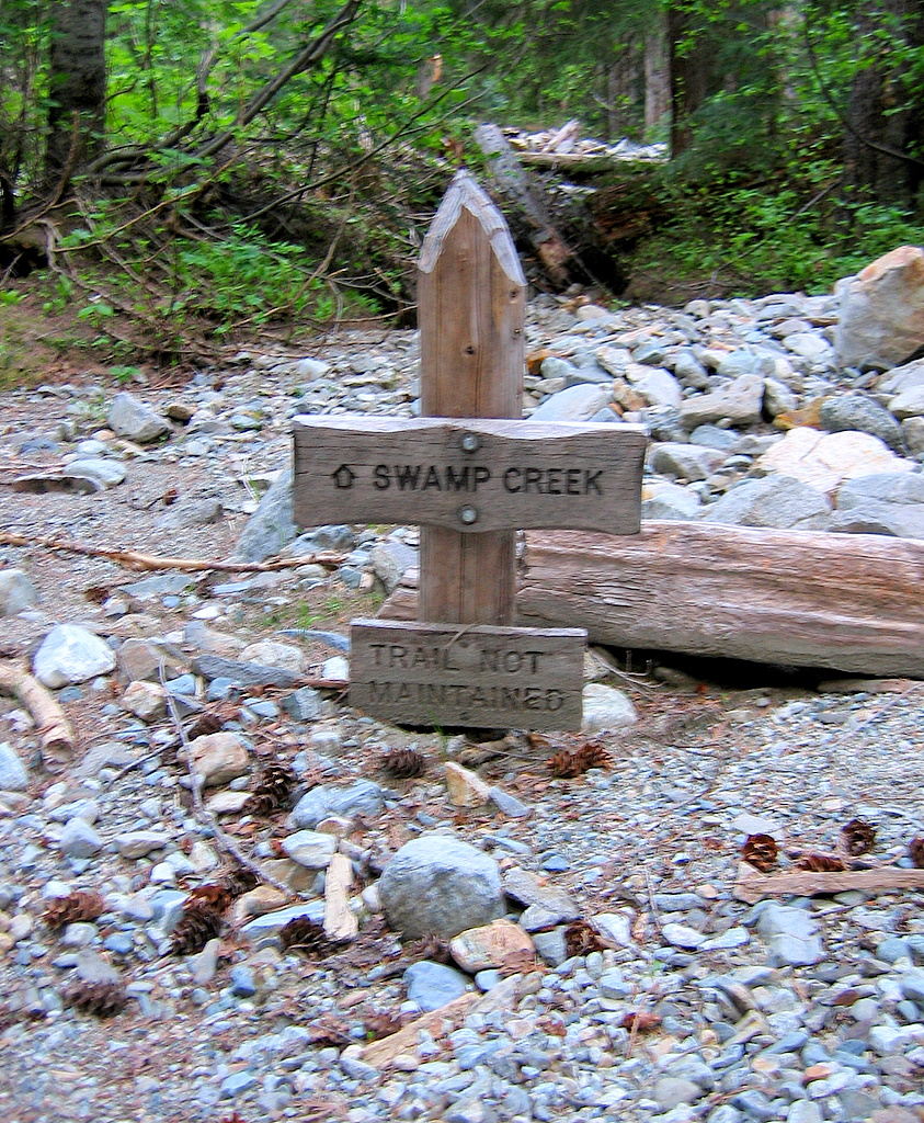
On Day 2, we left camp at 5:30am and headed up the abandoned Swamp Creek trail. Even from camp, it was obvious that the trail hadn’t been maintained, since the trail sign stood half buried in flood debris by the creek. We found some tread in the woods a few hundred feet upstream from camp. For the next couple miles, the trail was still passable in the forest, with intermittent tread, tree blazes, and cut logs. At 3800 feet, where the forest opened into brush, we crossed to the east side of the creek on a large log. The east side was mostly forest, interrupted by periodic creek/avalanche gullies choked with slide alder. So we hopped up and down over downed trees in the forest wherever we could, and forced our way through thick brush where we must. Around 4200 we had to move close to the stream to avoid denser coniferous brush, and finally were relived to arrive at open meadows below the waterfall rock band at 4500, 8:45pm.
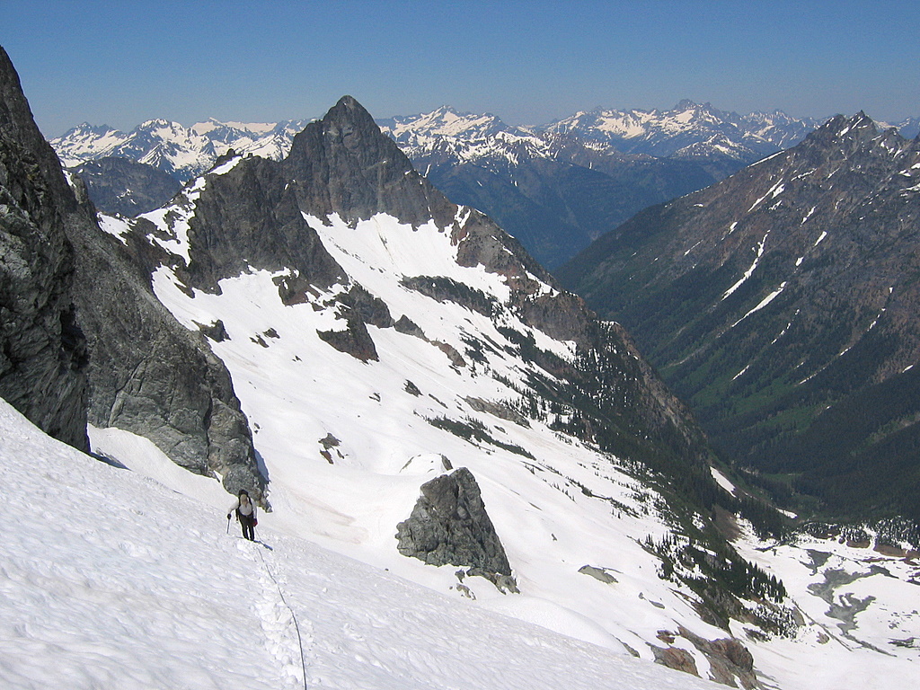
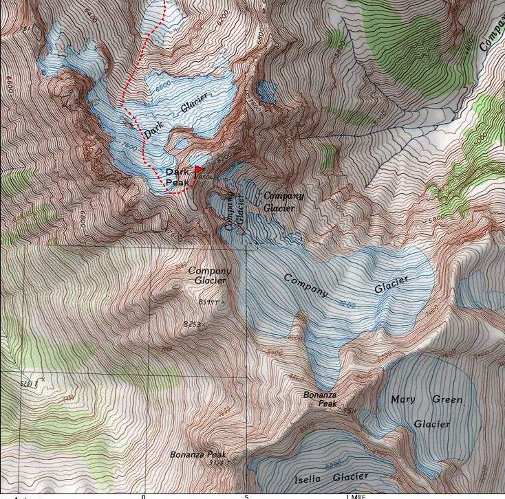
In the center of the rock band, Swamp Creek poured down a shadowed cleft. To get around the cliffs, we headed left and ascended an avalanche gully several hundred feet, then angled back rightward on steep terrain to reach the next flat basin at 5000 feet. From here, we had a clear view of the route up to the top of the glacier. Our path took us up the center of the valley to the foot of the glacier, then zigzagged up below rock outcrops toward the right side of the glacier, and finally angled back left to reach the 8200-foot ridge at the head of the glacier, where Bonanza came into view. Then we finished by following talus and the rocky crest up to the summit at 8504 feet, 2:30pm. As usual, the summit register showed that Fay Pullen had climbed the peak just ahead of us. |
High Bridge
Swamp Creek TH buried in flood debris
4500-ft meadow & waterfall
Route upward from 5000-ft basin. |
||||||||||||||||||
|
On the summit, we sat in the hot sun and enjoyed looking up at the Company Glacier face of Bonanza. I could also pick out Glacier Peak and the Bath Lakes High route to the west, and Dome Peak and the Ptarmigan Traverse to the NW. To the north , we could look back down the glacier and basins to the long brushy valley of Swamp Creek awaiting our return.
|
|||||||||||||||||||
|
|||||||||||||||||||
|
On the way down, I especially enjoyed all the waterfalls pouring down the off the side cliffs around the basins. In the hot weather, water was running everywhere. Of course, the Swamp Creek waterfall was biggest, but there were also smaller streams running, flowing, trickling, gushing, tumbling down the rocks, spraying into the air, tracing bright lines of living water down the dark walls everywhere.
|
|||||||||||||||||||
|
|||||||||||||||||||
|
|
|||||||||||||||||||
|
And then there was the brushy so-called trail. It seemed much more tedious and tiresome on the way down. After pushing our way back down through the brush, we reached camp just ahead of dark at 9pm.
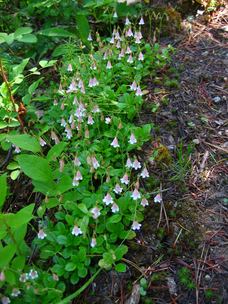
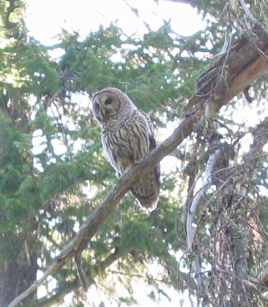
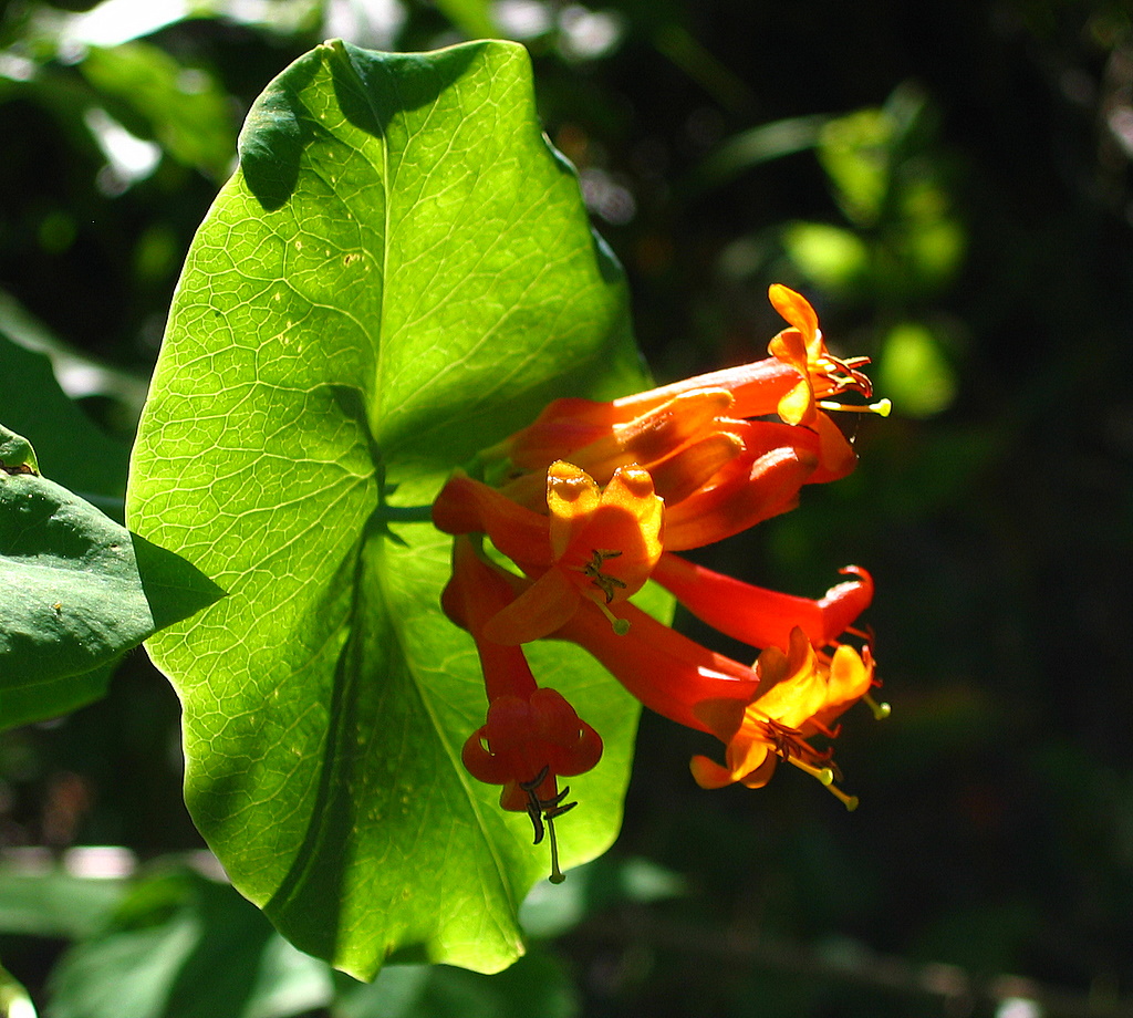
On Day 3, we made good time along the trail out, so I had time to dawdle and take flower pictures. The forested trail had fewer obvious flowers than the meadows, but when I paid attention, I found lots of woodland flowers along the trailside, including some very pretty honeysuckle catching patches of sunlight amid the shade. Eric spotted a couple of Barred Owls in the trees. |
|||||||||||||||||||
|
|
|||||||||||||||||||
|
|||||||||||||||||||
|
|
|||||||||||||||||||
|
Waiting for the bus at High Bridge, a visit to the riverside provided brisk air conditioning, at least 20 degrees cooler than the 90+ heat by the road. On the trip back to Stehekin, the bus stopped for pictures of Rainbow Falls and very appetizing pasta at the Stehekin Bakery. The bus-ferry-car transportation back home took eight hours altogether, with the slower ferry and a stop for dinner.
|
|||||||||||||||||||
|
Statistics: High Bridge TH 1600 to Swamp Creek Camp 2800: 8.6 miles, 1700 gain, 500 loss, 4:30 hours. Swamp Creek Camp 2800 to Dark Peak 8504: 5.8 miles, 5850 gain, 150 loss, one way. 11.6 miles, 6000 gain, 15:30 hours round trip. Swamp Creek Camp to High Bridge: 8.6 miles, 500 gain, 1700 loss, 3:45 hours. Total: 28.8 miles, 8200 gain.
Other
Route Info: TBD
|
|||||||||||||||||||
|
|||||||||||||||||||
|
|
|||||||||||||||||||