|
|
|||||||||||||||||||||||||||||||||||||||||||||||||||||||||||||||||||||||||||||
Boulder Peak 6377
(USGS Snowking)3/13/04 |
|||||||||||||||||||||||||||||||||||||||||||||||||||||||||||||||||||||||||||||
|
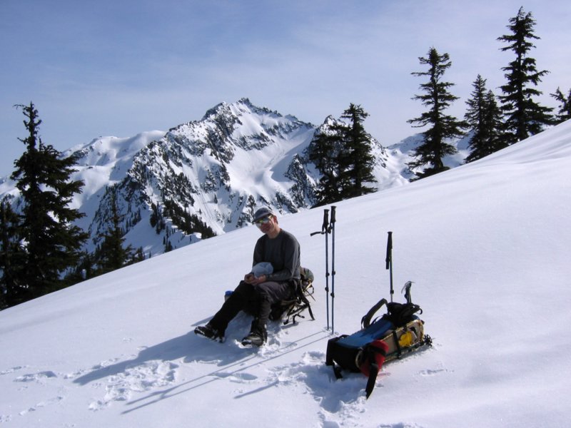
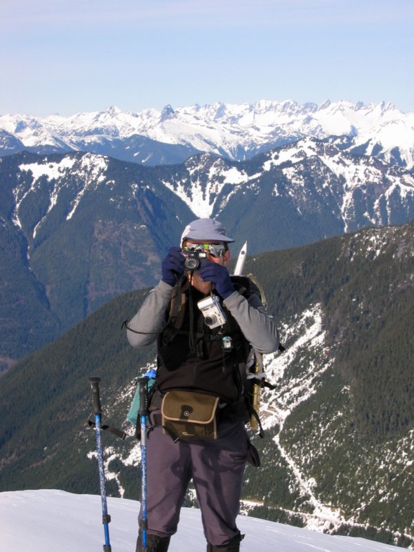
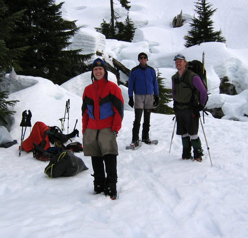
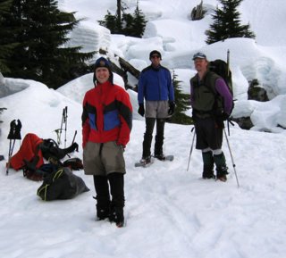
Party: Matt Burton and Mike Torok. Also Stefan Feller, Greg Koenig, and Dave Creedon, who were on an independent overnight trip.
Highlights: Perseverance pays off, producing panoramic peak perspectives, despite discouragement from ditches, dunking, and dismal skies. We had difficulties on the lower Boulder Creek Road, but carried on into sunlight on the upper road, and ascended crisp snow on the northeast ridge of Boulder Peak into ever-widening views. The summit provided panoramic views of the entire western side of the North Cascades, including most of the high traverses we had done in past years.
Mystery Ridge Traverse
Eldorado - Backbone Traverse
|
|||||||||||||||||||||||||||||||||||||||||||||||||||||||||||||||||||||||||||||
|
Narrative: The Plan Stefan, Greg, and Dave were planning an overnight trip up Boulder Creek to camp at Granite Lakes and climb the surrounding peaks. Mike invited me to go in at the same time and make a one-day ascent of Boulder Peak. Both parties were hoping to use steps kicked by the others, but we climbed different peaks on Saturday, and we never saw each other except at the beginning and end of the day. |
|||||||||||||||||||||||||||||||||||||||||||||||||||||||||||||||||||||||||||||
|
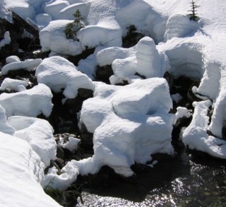
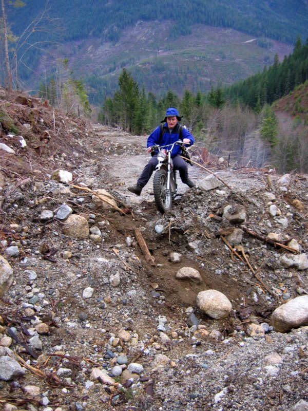
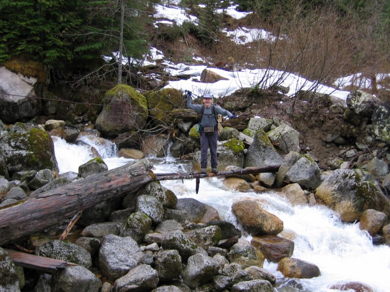
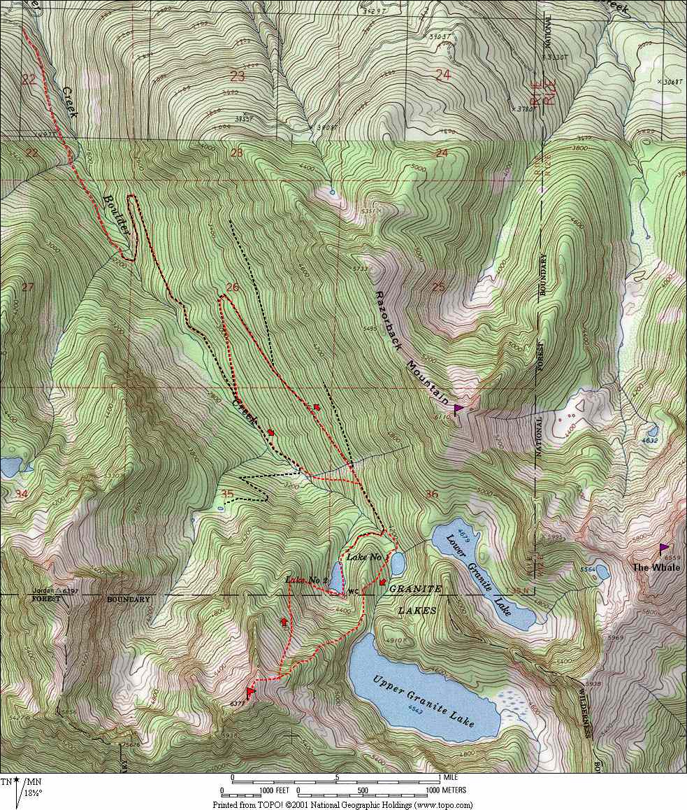
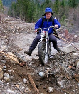
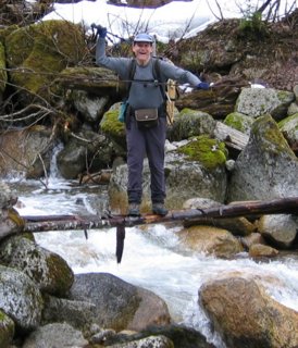
Lower Boulder Creek Road (east of the creek) The Boulder Creek logging road once led all the way to the creek below Granite Lake #1 at 4000 feet. The road is now gated at 550 feet, but Mike believed that it would be passable on a motorbike up to the crossing of Boulder Creek at 2100 feet. Stefan had gotten a gate key from Crown Pacific, and we drove cars to 1100 feet, where a berm and ditch blocked the road. We could see further berms ahead, but Mike hoped that the berms would end when we got out of the clearcut. I ended up mostly walking while Mike struggled to get his motorbike over the berms, and the other guys on foot left us behind. After crossing 24 berms, we reached a deeper stream cut and abandoned the motorbike. Crossing the stream, Mike accidentally dunked one of his feet in the water. |
 |
||||||||||||||||||||||||||||||||||||||||||||||||||||||||||||||||||||||||||||
|
Indecision We continued onward to the 2100-foot Boulder Creek crossing. The skies overhead had become uniformly gray, and our prospective summit views seemed doubtful. Mike wanted to turn back and return on a better day. I wanted to continue, and see some new territory. Neither of us had a strong opinion, so we debated endlessly. We actually turned back and walked down the trail for a few minutes, and finally decided to go ahead.
|
 |
||||||||||||||||||||||||||||||||||||||||||||||||||||||||||||||||||||||||||||
|
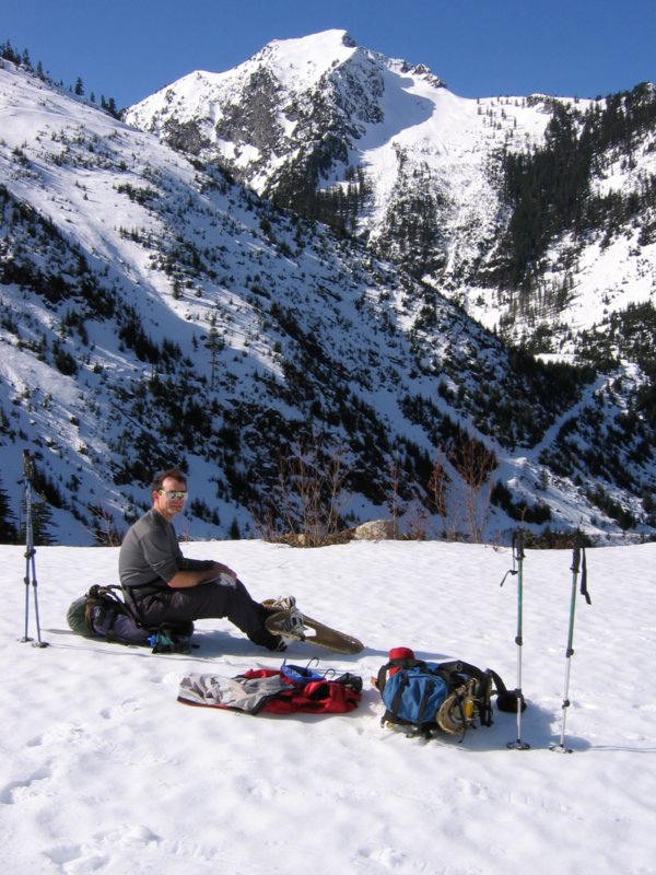
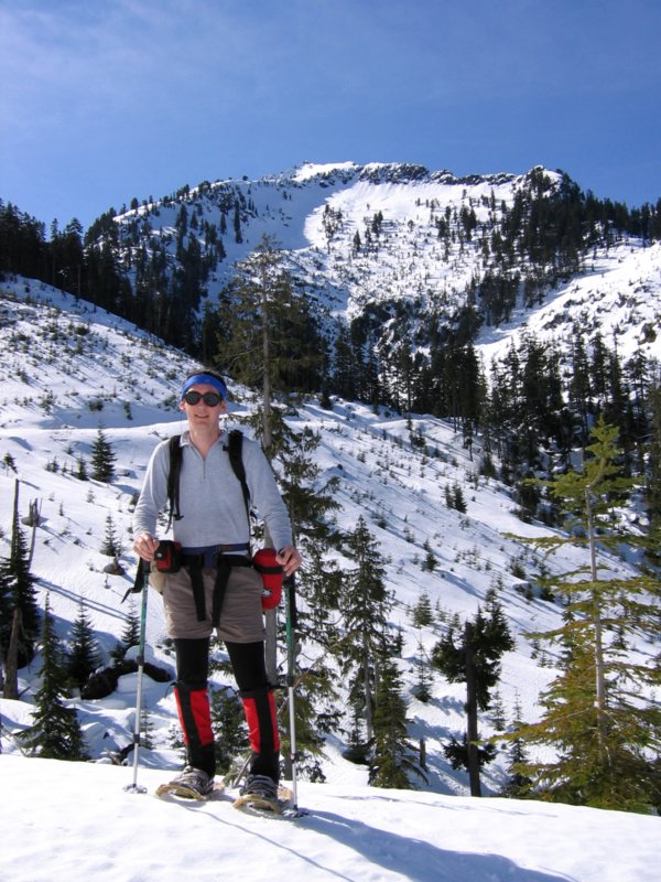
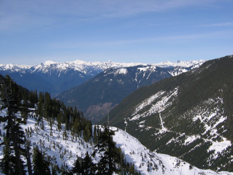
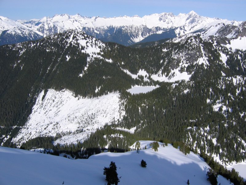
Upper Boulder Creek Road (west of the creek) We crossed the creek and made steady progress along the road. Overhead, the sun appeared as a bright ball amid the gray overcast, and then the overcast gradually dissipated into a clear blue sky. I even put on sunscreen for the first time since October. As we moved higher, we could see the ridge of Boulder Peak ahead, Jordan Peak on our right, and parts of the Mystery Ridge traverse behind us. At 2700 feet, the road reversed for a mile-long switchback, which the other group had followed. To save distance, Mike and I continued straight ahead till the road ended, and then angled steeply uphill, where our progress was slowed by underbrush in the trees or post-holing in the clearcuts. At 3800 feet, we regained the road. Ahead of us we could see the ridge we would take up Boulder Peak. |
|
||||||||||||||||||||||||||||||||||||||||||||||||||||||||||||||||||||||||||||
|
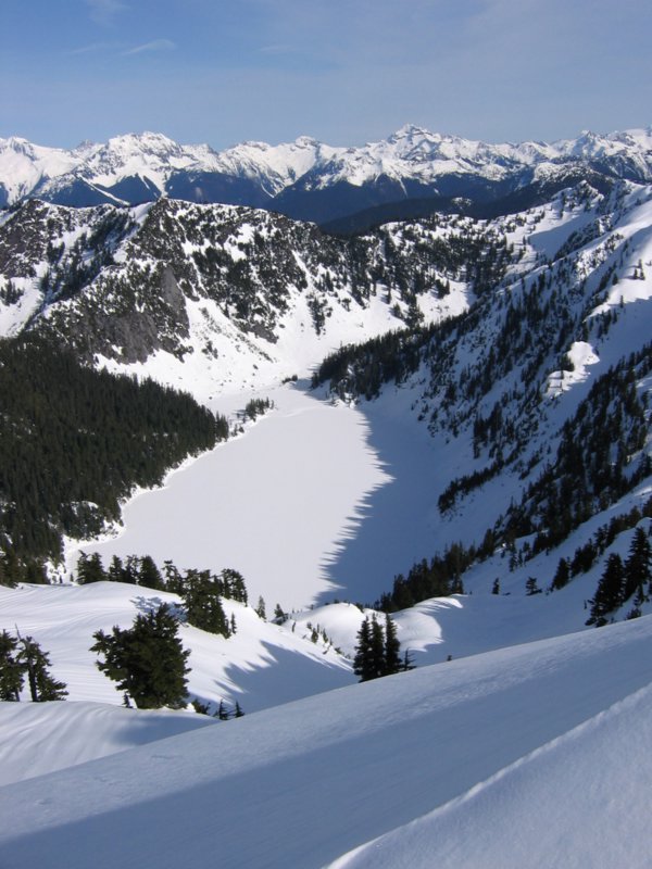
End of the Road The road continued all the way to the re-crossing of Boulder Creek at about 4000 feet, below Granite lake #1. There we found the other party’s overnight gear, where they had departed to ascend Razorback. The creek was a jumble of open water and steep snow-piles on rocks, so we continued upstream and crossed at the outlet of the lake. |
|
||||||||||||||||||||||||||||||||||||||||||||||||||||||||||||||||||||||||||||
|
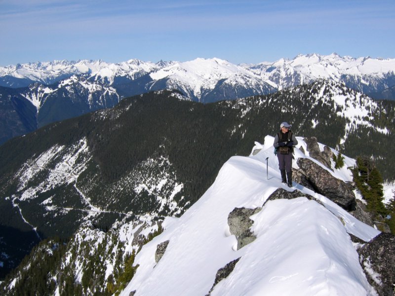
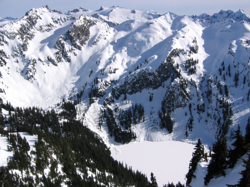
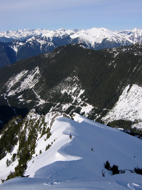
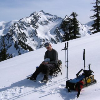
Ascending the NW Ridge of Boulder Peak We traversed up onto the ridge between Lakes #1 and #2 and followed the ridge south and then southwest upward for 2000 feet toward the summit of Boulder. Steeper snow required us to leave our snowshoes off most of the time, but a crust provided pretty good footing most of the time, with occasional post-holing. The views just kept getting better and better. At a break lower on the ridge, we could see Upper Granite Lake with Mt. Tommy Thompson for background. Higher on the ridge, we could whole ranges of peaks to the east. |
 |
||||||||||||||||||||||||||||||||||||||||||||||||||||||||||||||||||||||||||||
|
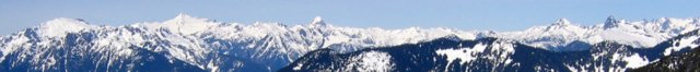
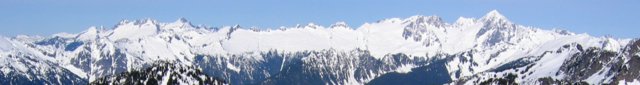
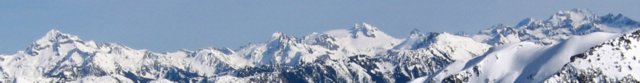
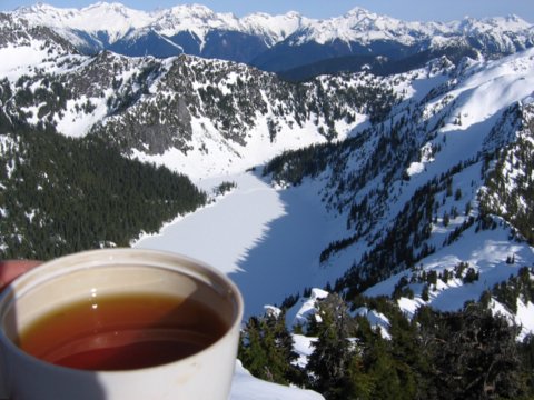
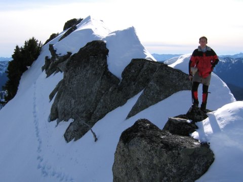
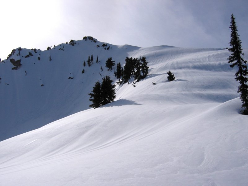
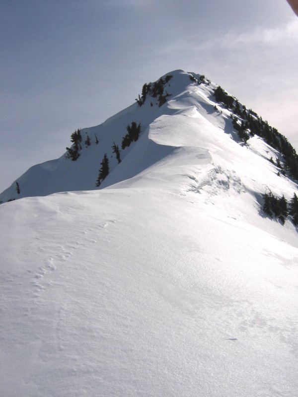
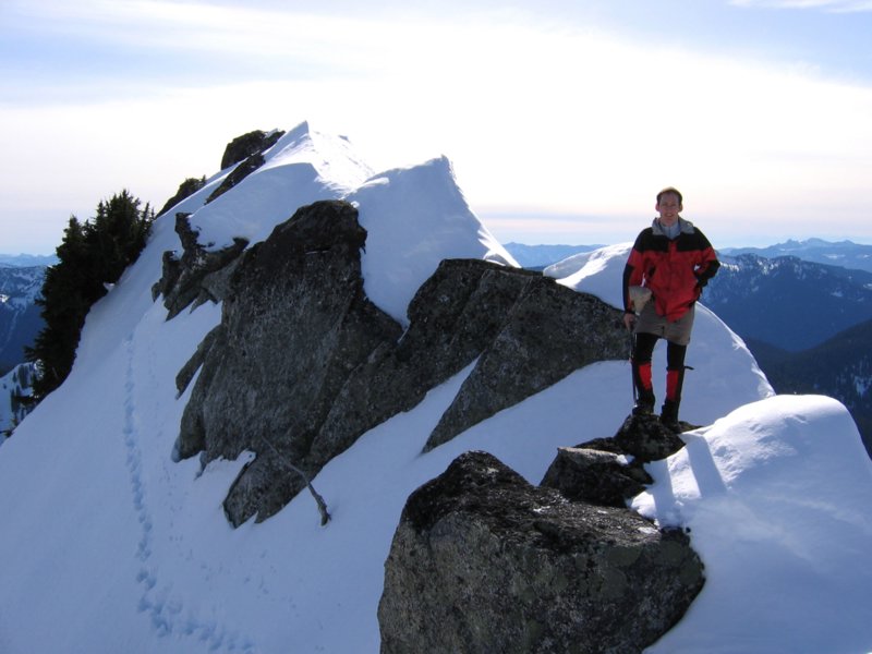
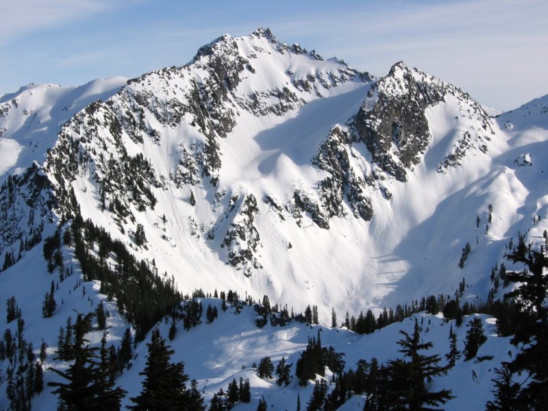
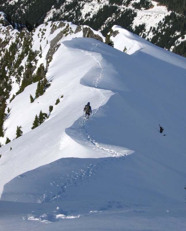
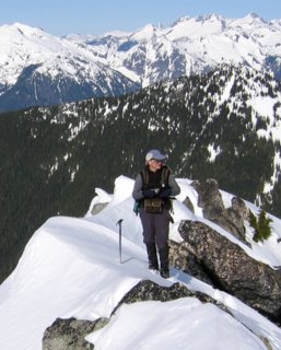
The Summit Higher up, the ridge had a dramatic windswept appearance. Near the summit, we ascended a picturesque row of alternating cornices. At the top, we had to briefly make a steep side-hill traverse around several steep rocks. The summit itself was an uncomfortable exposed rock, so we tagged it and then retreated back to the top of the cornices for lunch, tea, and panoramic pictures in the sunshine. From north through east to south, we could see the Mystery Ridge Traverse, the Pickets, the Backbone-Eldorado Traverse, the Cascade Pass Peaks, the Ptarmigan Traverse, and the Snowking-Chaval area. |
 |
||||||||||||||||||||||||||||||||||||||||||||||||||||||||||||||||||||||||||||
|
|
|||||||||||||||||||||||||||||||||||||||||||||||||||||||||||||||||||||||||||||
|
The Descent On our descent, we dropped several hundred feet and then descended west into the basin northwest of the summit, where we had more open snow for glissading. The key here was to keep traversing further northwest till we were past the cliffs at about 4800 feet, and then turn back to descend to Lake #2. Our glissades turned out to be limited because of the need to traverse and because of old avalanche debris that made the slopes hard and bumpy. We went around the east side of Lake #2 and found a road branch that took us back to the main road at the 4000-foot crossing. |
 |
||||||||||||||||||||||||||||||||||||||||||||||||||||||||||||||||||||||||||||
|
The Return There we met the other party, who were just arriving back at their packs. While we did Boulder, they had climbed Razorback, traversed east to the Whale, and returned via Lower Granite Lake (which is the higher lake) and Upper Granite Lake (which is the lower lake). The next day, they climbed Boulder in a blizzard. We bid them farewell, and headed down the road. We stayed on the road the whole way for the return, but I was glad we bypassed the switchback going up, because it was a lot longer. |
 |
||||||||||||||||||||||||||||||||||||||||||||||||||||||||||||||||||||||||||||
|
Statistics: 13 miles round trip, Net gain 5277. Cumulative gain 5600, including circa 150 loss each way. Berm to summit 7:20, time at summit 0:35, summit to cars 3:30. Total time 11:25. Drive time 2:00 from Lynnwood to berm. Other
Route Info: The gate on the Boulder Creek Road requires a key from Crown Pacific in Hamilton. Click here for Stefan’s description of how to get the key. Panoramic Views: I have created a separate page with seven panoramic views, including peak annotions.
To see them, click here: Panoramic Views from Boulder Peak.
Pictures
& Map:
|
|||||||||||||||||||||||||||||||||||||||||||||||||||||||||||||||||||||||||||||
|
|
|||||||||||||||||||||||||||||||||||||||||||||||||||||||||||||||||||||||||||||