|
|
||||||||||||||||||||||||||||||||||||||||||||||||||||||||||||||||||||
|
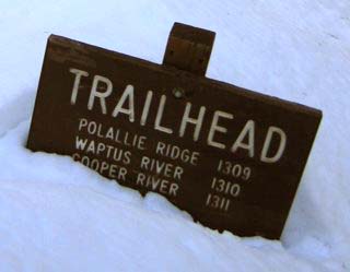
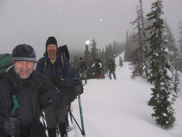
Polallie Ridge 5590 (USGS Polallie Ridge) 2/28/04 Party: Mountaineers Winter Scramble: Mike Torok (leader), Matt Burton, David Suhr, Jim Dobrick, Ike Eichenberger, Tord Kurthy, Terry Schwartz, Juliane Endres, Lynn Graf, Richard Burt, Sally Pfeiffer, Bonnie Reay, Celia Smith.
Highlights: |
||||||||||||||||||||||||||||||||||||||||||||||||||||||||||||||||||||
|
Polallie Ridge forms a long crest stretching from
Salmon La Sac northwest toward the Snoqualmie Crest peaks. The ridge made a
good continuous route without any major breaks, but its further half had
many bumps going up and down (700 feet of extra gain). The bumps provided
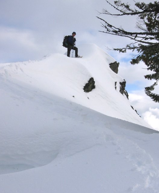
nice open viewpoints above the trees, but went there were an awful lot of
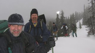
them before we finally got to the summit. We began in warm sunshine,
proceeded into clouds as the summit receded further and further away, and
then enjoyed views through breaking clouds on the return. Unfortunately,
all the bumps were still there to climb up and down for the return. |
|
|||||||||||||||||||||||||||||||||||||||||||||||||||||||||||||||||||
|
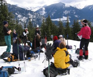
Details: Mike introduced the trip by stating that we probably wouldn't have time to make it all the way to the summit, which of course motivated everyone to keep up their pace and try to make it.
|
||||||||||||||||||||||||||||||||||||||||||||||||||||||||||||||||||||
|
|
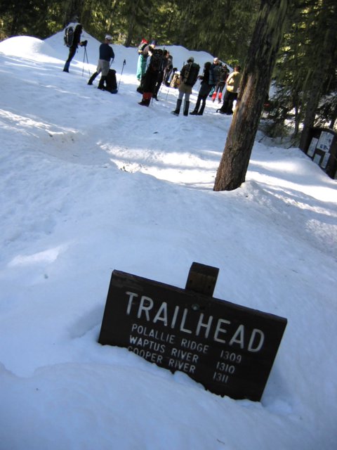
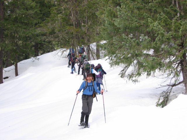
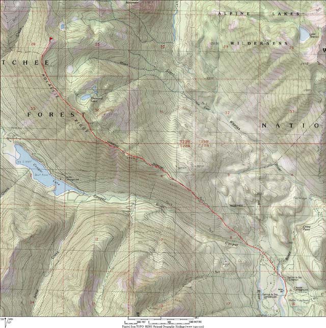
We parked at the winter road end just south of the Salmon La Sac guard station, 2300 feet. To reach the the summer trailhead, we walked pavement to the turn-around and followed snow-covered road to the trailhead. We had shirt-sleeve warm weather and blue skies above the trees. We immediately had to put on snowshoes due to a breakable crust, but the otherwise we had good spring snow conditions all day.
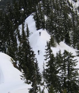
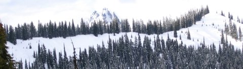
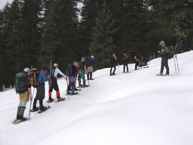
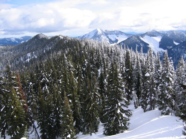
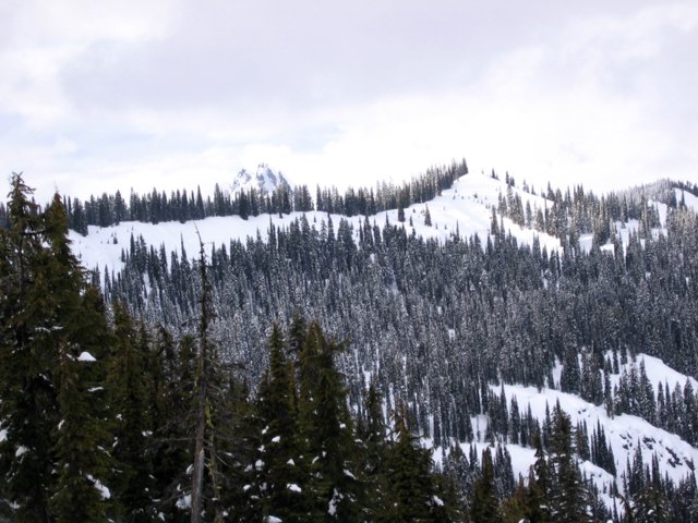
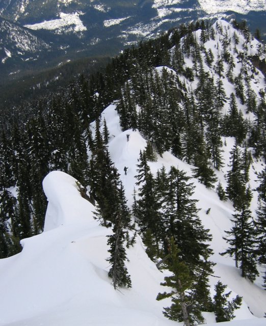
We followed the trail for awhile and then proceeded on the ridge crest for the rest of the way.The tree-covered ridge gained elevation steadily, with occasional open slopes that gave us views of Red Mountain to the west and other peaks to the east. Above 4600 feet, we encountered many bumps where the ridge would climb steeply up an open snow slope to a closed contour and then drop back down into trees on the far side. |
|||||||||||||||||||||||||||||||||||||||||||||||||||||||||||||||||||
|
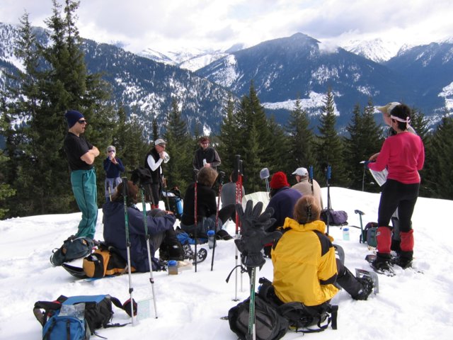
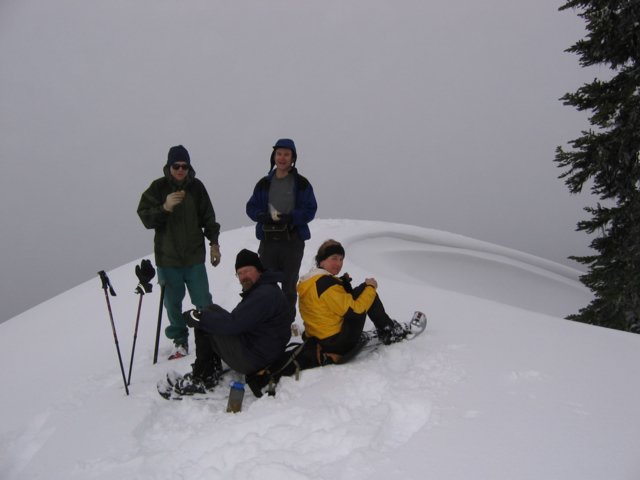
With the clouds closing in around us and the trees and bumps hiding the ridge ahead, it was difficult to tell exactly how far we were on the ridge. We kept pushing onward, hoping that each bump would be one of the final closed contours. Then we caught sight of Diamond Lake below us on the right, and realized that we were still at least a mile from the summit. Some people decided to stop for a longer rest while others continued into the cold grey fog, climbing up and down over more bumps that all seemed to be about the same elevation. |
|
|||||||||||||||||||||||||||||||||||||||||||||||||||||||||||||||||||
|
|
||||||||||||||||||||||||||||||||||||||||||||||||||||||||||||||||||||
|
|
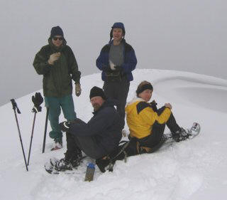
Later on Celia, Richard, Mike and Tord arrived, and then David arrived as we were leaving.
Since the rest of the party was waiting somewhere back on the ridge, we soon had to leave and hurry back down the ridge. There were just as many bumps on the way down, each adding an extra ascent and descent. |
|
||||||||||||||||||||||||||||||||||||||||||||||||||||||||||||||||||
|
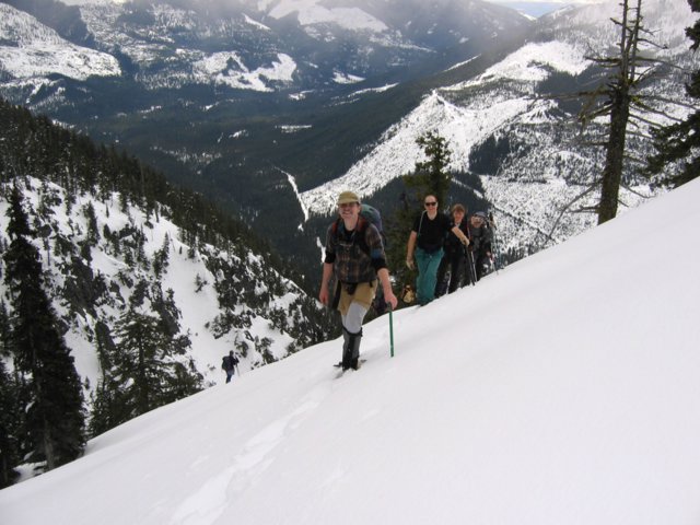
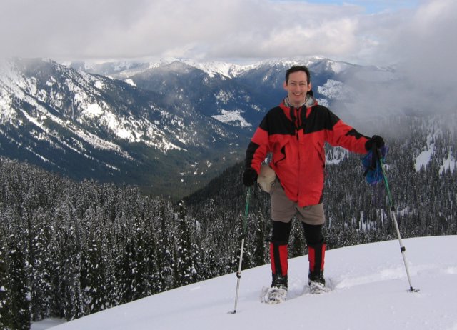
This time, however, each bump provided more views, because the clouds were breaking up. We could see the ridge itself, alternating bumps of snow or trees stretching back to the summit and ahead to the cars. Chimney Rock was visible behind the summit. |
|
|||||||||||||||||||||||||||||||||||||||||||||||||||||||||||||||||||
|
|
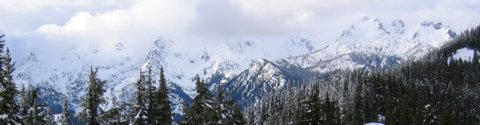
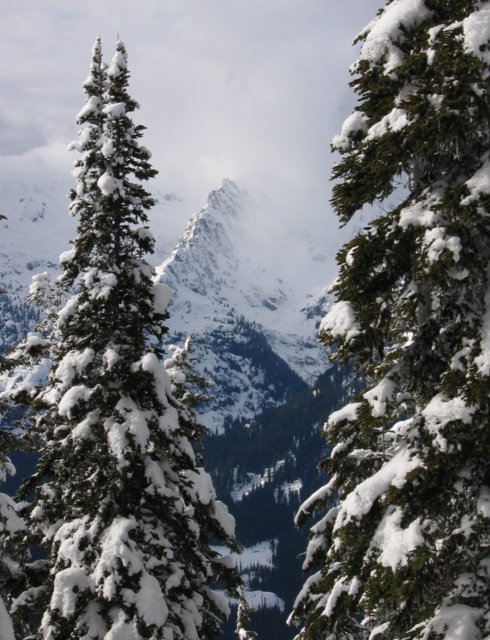
And we could see bits and pieces of the surrounding peaks - a ridge here, a summit there, parts of a crest in the distance. The views helped carry me over the bumps, and then down the long slope back down to the road. |
|||||||||||||||||||||||||||||||||||||||||||||||||||||||||||||||||||
|
Statistics: 12.5 miles round trip. 3300 feet net gain, 4740 cumulative gain (720 feet of ups and downs on the ridge each way). Cars to summit 6:00, time at summit 0:25, summit to cars 3:55. Drive time 1:40 from Issaquah P&R.
This route requires good consolidated snow conditions,
due to its length and to some potentially hazardous open slopes going over
some of the bumps. |
||||||||||||||||||||||||||||||||||||||||||||||||||||||||||||||||||||
|
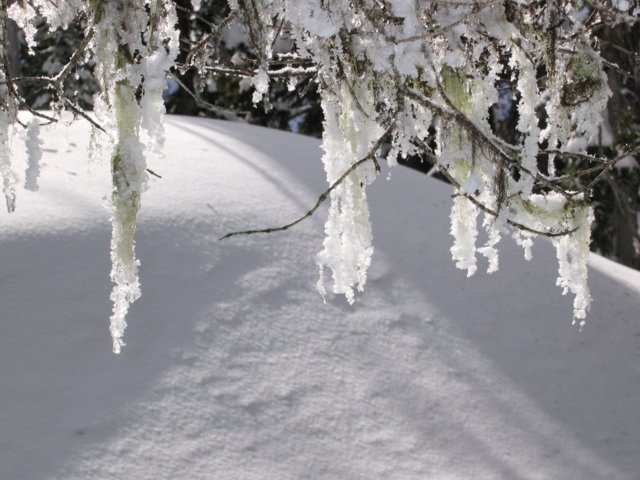
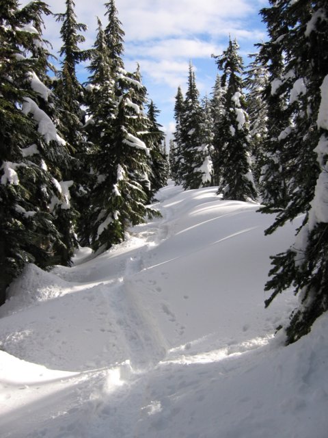
Pictures & Maps:
|
||||||||||||||||||||||||||||||||||||||||||||||||||||||||||||||||||||