|
|
|||||||||||||||||||||||||||||||||||||||||||||||||||||||||||||||||||||||||||||||||||||
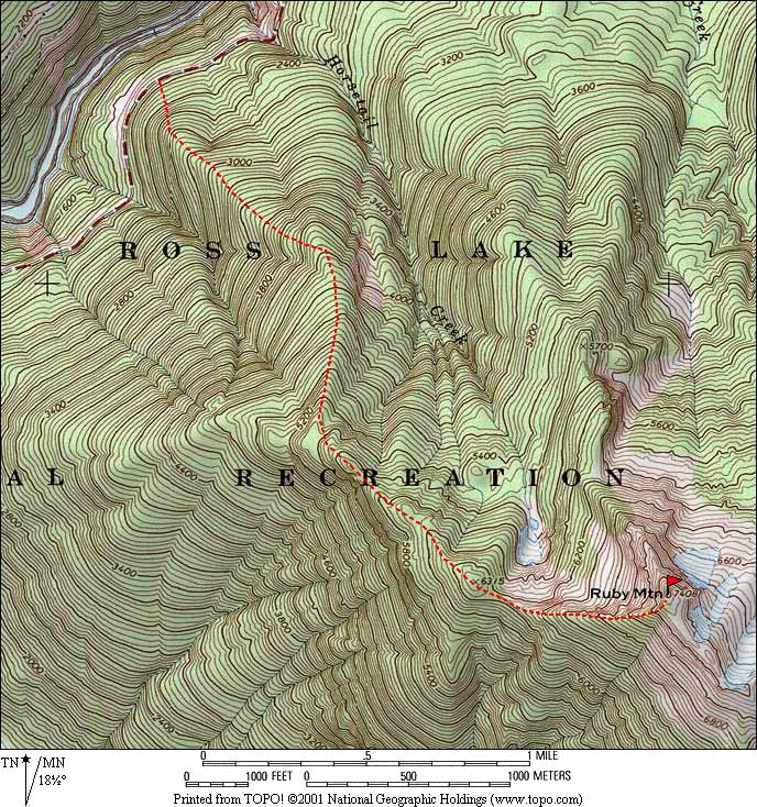
Ruby Mtn 7408
(USGS Ross Dam)4-25-04 |
|||||||||||||||||||||||||||||||||||||||||||||||||||||||||||||||||||||||||||||||||||||
|
Party: Mountaineers Scramble: Matt Burton, Jack Stowe, Eric Johnson, Richard Burt, Lynn Graf, Tord Kurthy, Jerry Chang, Brain Massey. |
|||||||||||||||||||||||||||||||||||||||||||||||||||||||||||||||||||||||||||||||||||||
|
Highlights: Sometime back in the mid-1990’s, as I was riding in the Matoi’s car on the North Cascades Highway above Diablo Lake, Sara pointed out the window and said, “See that talus slope. You can do Ruby Mountain by going straight up to the summit from there. It’s the best route to use in spring when you can travel on snow.” And that’s pretty much exactly how it went. I’ve long wanted to do Ruby Mountain, because I thought it would be a great viewpoint for other trips I’ve done in the vicinity of Thunder Creek, especially the Colonial-Snowfield group right next door, and also the beginning of the Klawatti-Inspiration Traverse and the Ragged Ridge Peaks. At Point 6315 along the way, I looked around and identified 39 peaks I’ve climbed without even thinking too hard about it.
Tricouni, Primus, Austera, Dorado Needle, Snowfield, Colonial, Paul Bunyan's Stump, Pinnacle, & Pyramid
For today’s trip, we had clear sunny weather, well-consolidated snow, a strong party, and a good route description from Mike Torok. The trip went smoothly all the way, with one exception where we failed to follow the route description and Ian was injured by a rock. |
|||||||||||||||||||||||||||||||||||||||||||||||||||||||||||||||||||||||||||||||||||||
|
Details: We met at Colonial Creek campground, where the devastation of last October’s floods was still evident. The campground entrance was surrounded by piles of rocks and debris that had been plowed off the road. The trailhead for the Thunder Creek trail was closed off, because parts of the trail washed away and the bridge was washed down in to Thunder Arm. The northern campground was closed. From higher on the road, we could see a big fan of debris in the lake where the creek ran through the campground. |
|||||||||||||||||||||||||||||||||||||||||||||||||||||||||||||||||||||||||||||||||||||
|
|
|
||||||||||||||||||||||||||||||||||||||||||||||||||||||||||||||||||||||||||||||||||||
|
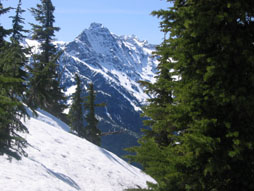
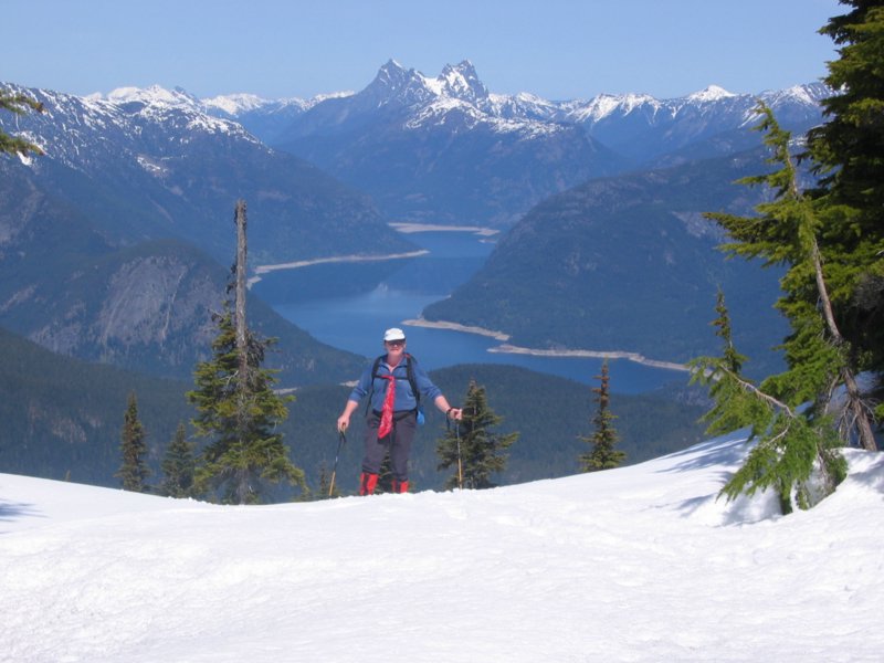
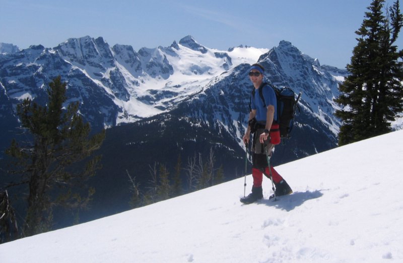
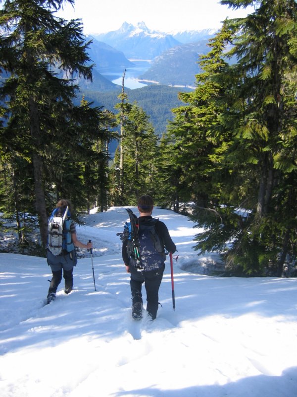
Colonial while ascending |
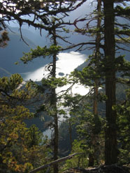
Ian, Ross Lake,
& Hozomeen while ascending |
||||||||||||||||||||||||||||||||||||||||||||||||||||||||||||||||||||||||||||||||||||
|
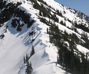
We used Mike Torok’s route description (included below) and it was completely accurate. We parked on the highway near the boulder field, at about 1900 feet, and headed uphill left of the boulders. The ridge was generally a steep forested slope with lots of small rock bands. The rock bands required some caution, because they were booby-trapped with loose rocks hidden among deep moss. Our only mishap occurred when we tried to go through one rock band rather than left of it, and a tumbling rock injured Ian’s shin. The key is to stay left of the rock bands for the first thousand feet. After that you can go around whatever side looks easiest. |
|||||||||||||||||||||||||||||||||||||||||||||||||||||||||||||||||||||||||||||||||||||
|
|
|
||||||||||||||||||||||||||||||||||||||||||||||||||||||||||||||||||||||||||||||||||||
|
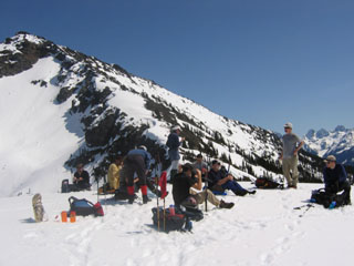
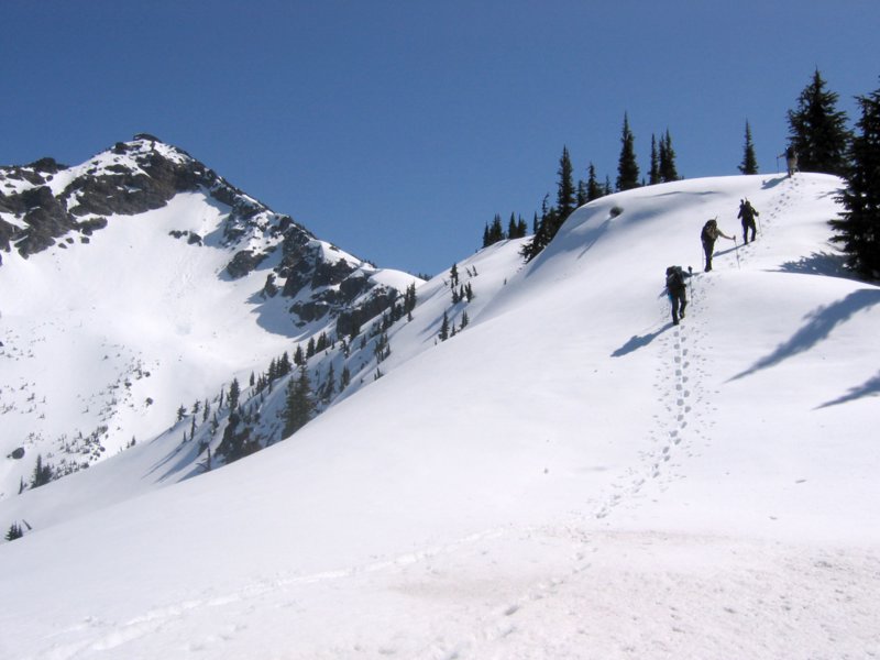
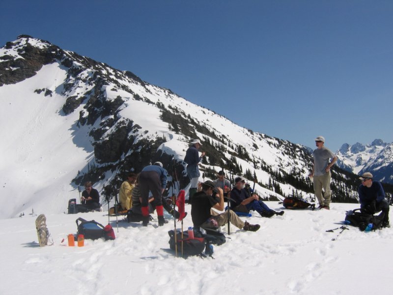
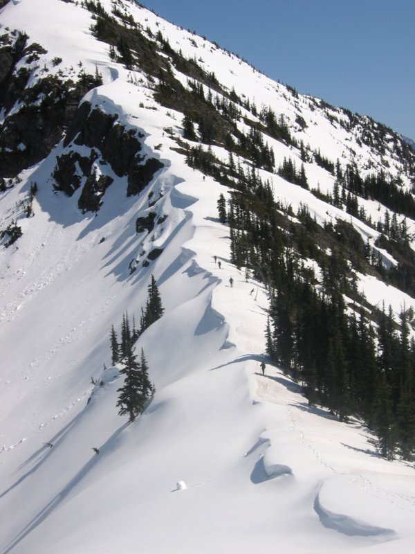
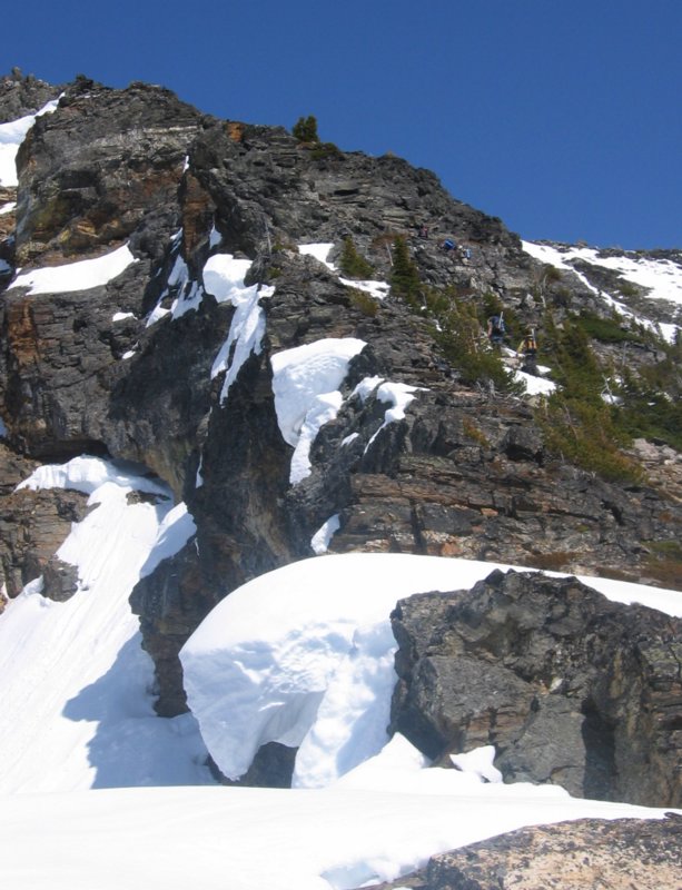
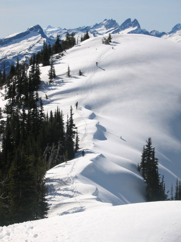
Point 6315, with summit on left & Ragged Ridge on right |
Heading up the summit ridge |
||||||||||||||||||||||||||||||||||||||||||||||||||||||||||||||||||||||||||||||||||||
|
At about 4000 feet we reached snow cover, and the travel was easier from then on. We had brought snowshoes, but never needed to use them. At Point 6315, we took a longer break and left our snowshoes behind, standing like a mini-Stonehenge on the snow-covered point. . The ridge to the summit was mostly melted out, so we got to do some rock scrambling for the last five hundred feet. |
|||||||||||||||||||||||||||||||||||||||||||||||||||||||||||||||||||||||||||||||||||||
|
|
|
|
|||||||||||||||||||||||||||||||||||||||||||||||||||||||||||||||||||||||||||||||||||
|
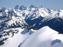
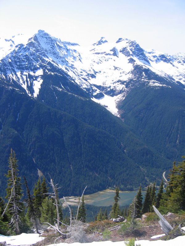
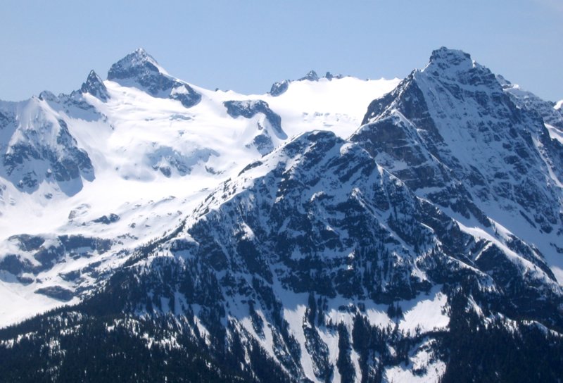
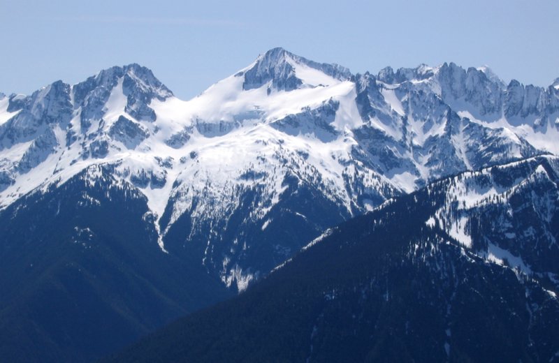
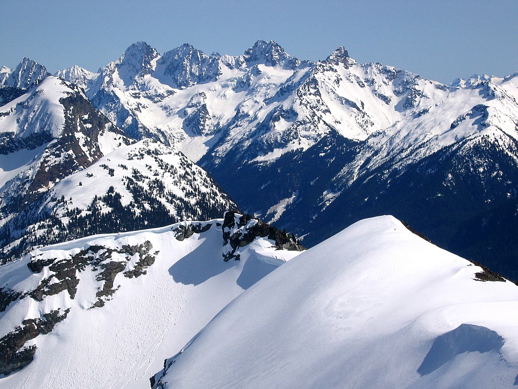
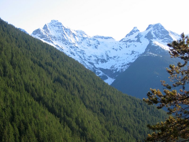
Snowfield & Colonial |
Diablo Lake, Pickets, etc |
Ragged Ridge |
|||||||||||||||||||||||||||||||||||||||||||||||||||||||||||||||||||||||||||||||||||
|
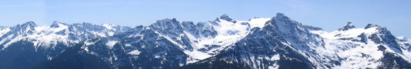
As we scrambled upward, the views got better and better. Going up the lower ridge, we had ever-growing views westward to the Colonial-Snowfield group on our right and northward to all the peaks beyond Diablo & Ross Lakes. When we turned the corner at Point 6315, our view added another 90 degrees to include Ragged Ridge and the Cascade Pass area to the south. The summit completed the panorama with views of Jack Mountain and all the eastern North Cascades. |
|||||||||||||||||||||||||||||||||||||||||||||||||||||||||||||||||||||||||||||||||||||
|
|
|
||||||||||||||||||||||||||||||||||||||||||||||||||||||||||||||||||||||||||||||||||||
|
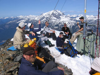
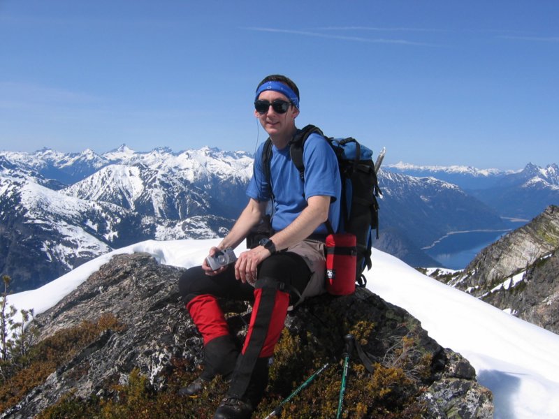
Group on Summit, with Jack Mtn |
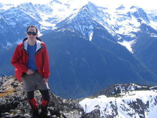
Matt on Summit,
with ascent ridge & Colonial group. |
||||||||||||||||||||||||||||||||||||||||||||||||||||||||||||||||||||||||||||||||||||
|
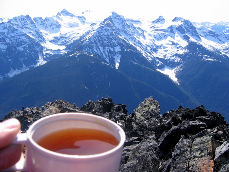
The summit itself, I have to admit, was somewhat annoying for me, because it was dominated by a large radio antenna and guy wires. So I didn’t like the view of the summit itself, but the views outward were fine, so we spent our lunch identifying peaks. |
|||||||||||||||||||||||||||||||||||||||||||||||||||||||||||||||||||||||||||||||||||||
|
Returning to Point 6315 |
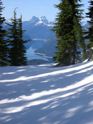
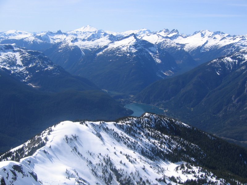
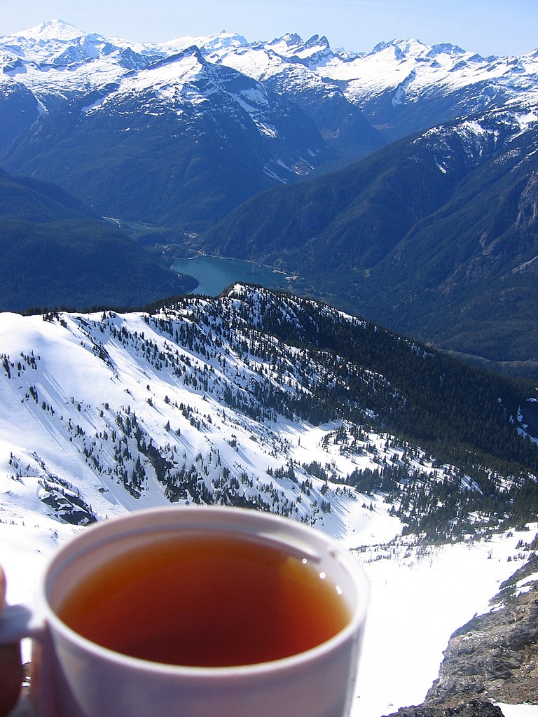
Ross Lake While Descending |
Diablo Lake While Descending |
|||||||||||||||||||||||||||||||||||||||||||||||||||||||||||||||||||||||||||||||||||
|
Then we headed back down for a smooth descent
to the road. We remembered to stay
right of the cliffs on the bottom thousand feet, and came out a little creek
bed just west of our cars. |
|||||||||||||||||||||||||||||||||||||||||||||||||||||||||||||||||||||||||||||||||||||
|
Statistics: Round trip 7 miles. TH 1900. Summit 7408. Net gain 5500. Metered cumulative gain 5590. Ascent 6:55, summit break 0:45, descent 3:45. Drive from Lynnwood to Colonial Creek CG, 2:15. Route
Description: Drive the Hwy 20 (North Cascades) to Colonial Creek CG and then continue 2.8 miles and park at the far end of the turn-out (about .4 miles west of Horsetail Creek) across from a boulder field. (elevation 1950') Head up the hill to the left side of the boulder field. Continue straight up for 450' then go slightly left for 200' and gain the ridge. Follow the ridge as it "S" turns around going over pt. 6315' to the summit. The final 300' is a rock scramble, stay on the left side for the final 100'. Pictures
& Maps:
|
|||||||||||||||||||||||||||||||||||||||||||||||||||||||||||||||||||||||||||||||||||||
|
|
|||||||||||||||||||||||||||||||||||||||||||||||||||||||||||||||||||||||||||||||||||||