|
|
|||||||||||||||||||||||||||||||||||||||||||||||||||||||||||||||||||||||||||||||||||||||||||||||||||||||||||
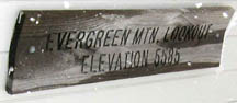
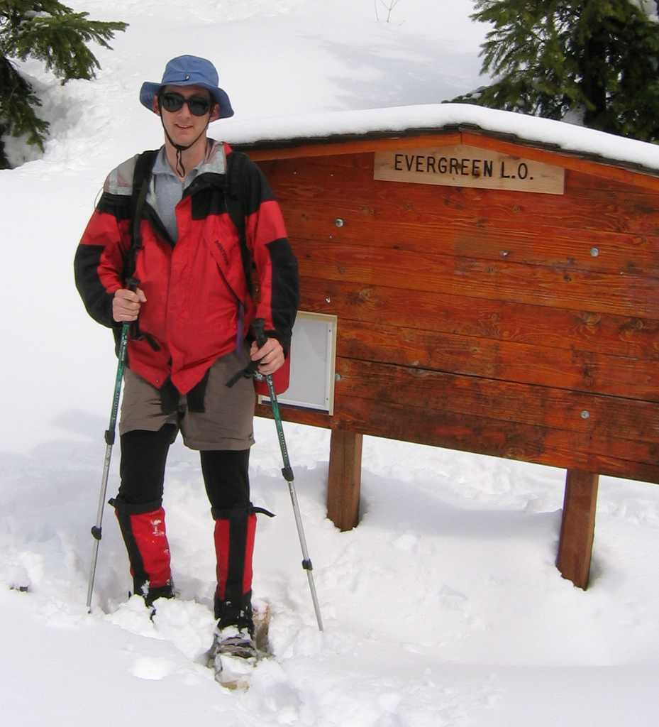
Evergreen Mountain 5587
(USGS Evergreen Mtn.)4/2/05 |
|||||||||||||||||||||||||||||||||||||||||||||||||||||||||||||||||||||||||||||||||||||||||||||||||||||||||||
|
|
|||||||||||||||||||||||||||||||||||||||||||||||||||||||||||||||||||||||||||||||||||||||||||||||||||||||||||
|
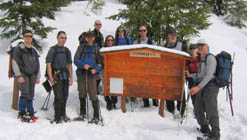
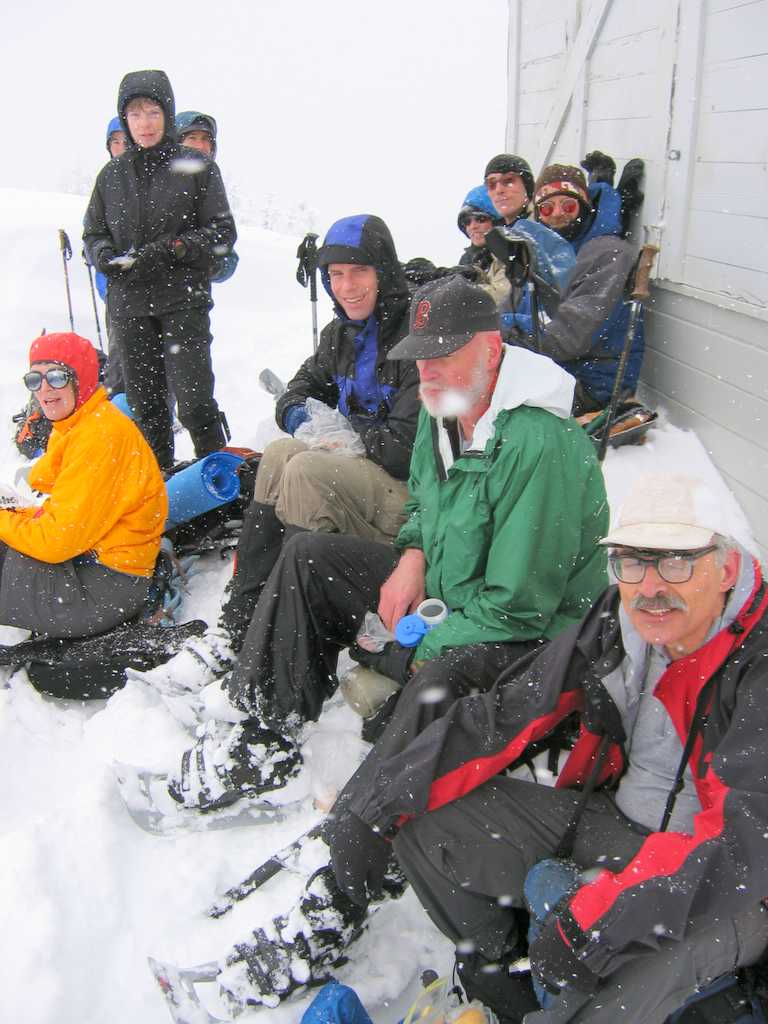
Party: Mountaineers Winter Scramble Led by Richard
Burt & Lynn Graf Highlights: This was my first snowshoe trip this year where there was
actually fresh snow. From January through mid-March the weather stayed mostly dry and
clear, with occasional bouts of warm rain, neither of which left any snow on
the mountains. Now that spring is
here, it has been snowing steadily for the past month. |
|
||||||||||||||||||||||||||||||||||||||||||||||||||||||||||||||||||||||||||||||||||||||||||||||||||||||||||
|
|
|||||||||||||||||||||||||||||||||||||||||||||||||||||||||||||||||||||||||||||||||||||||||||||||||||||||||||
|
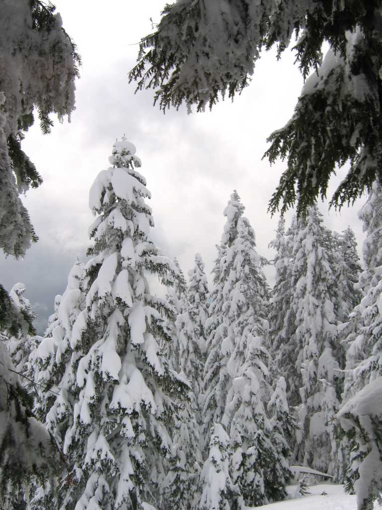
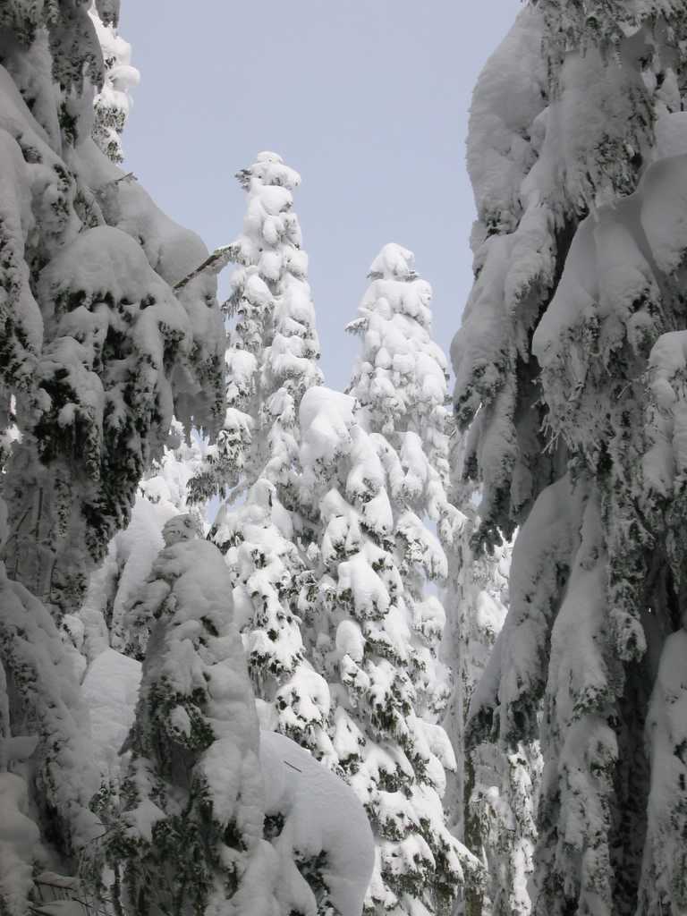
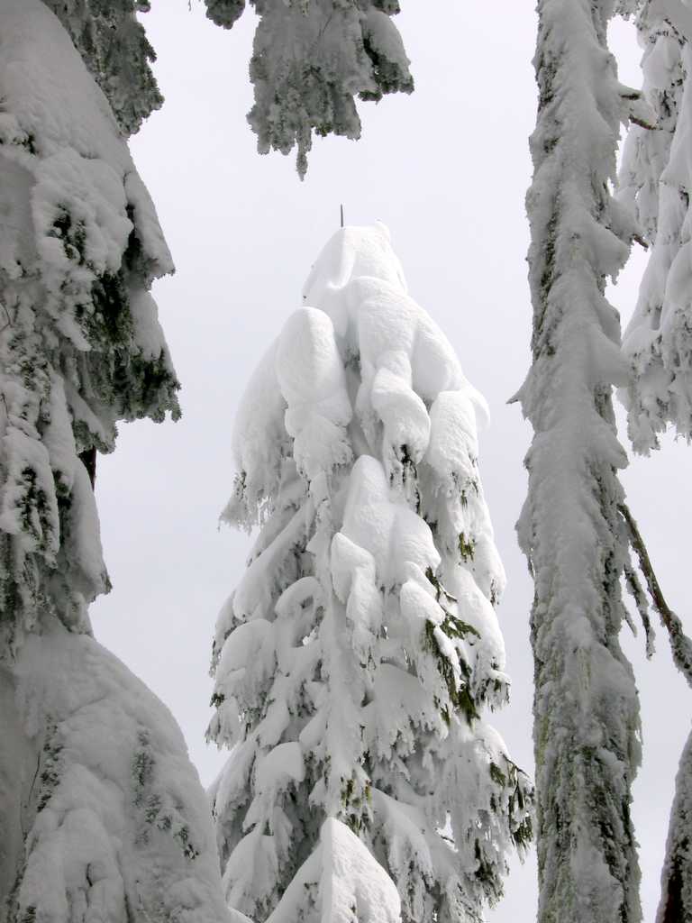
Today’s trip was marked by fresh
snow all the way:
|
|
||||||||||||||||||||||||||||||||||||||||||||||||||||||||||||||||||||||||||||||||||||||||||||||||||||||||||
|
|
|||||||||||||||||||||||||||||||||||||||||||||||||||||||||||||||||||||||||||||||||||||||||||||||||||||||||||
|
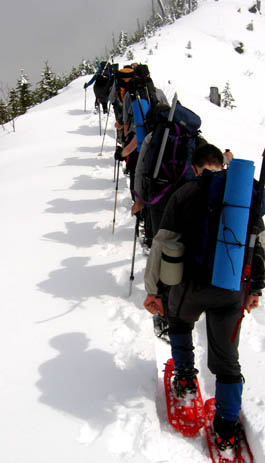
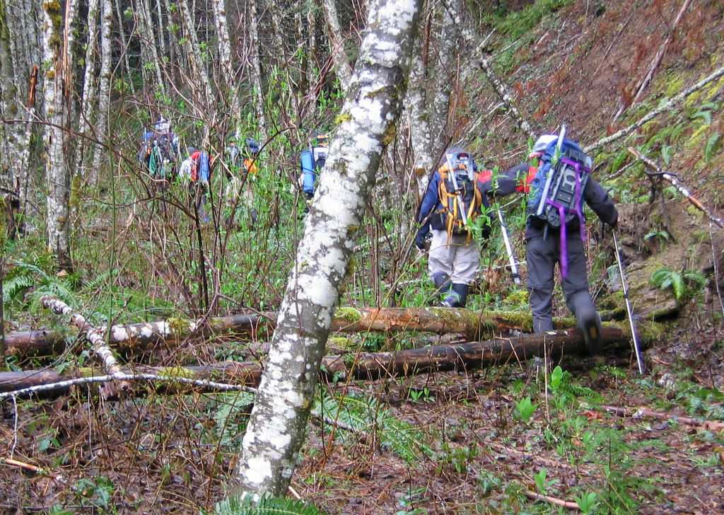
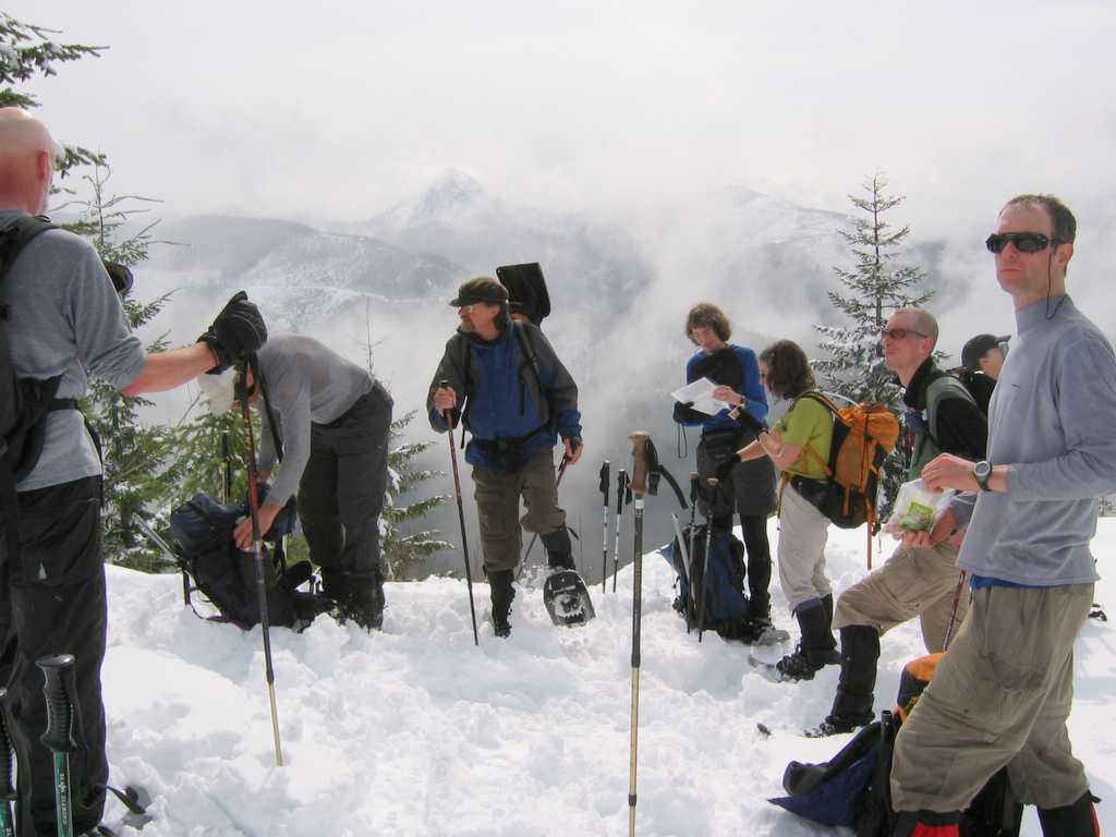
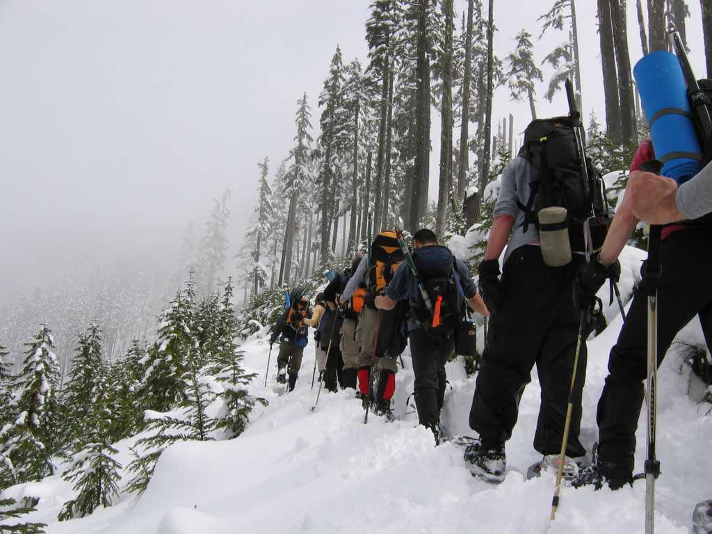
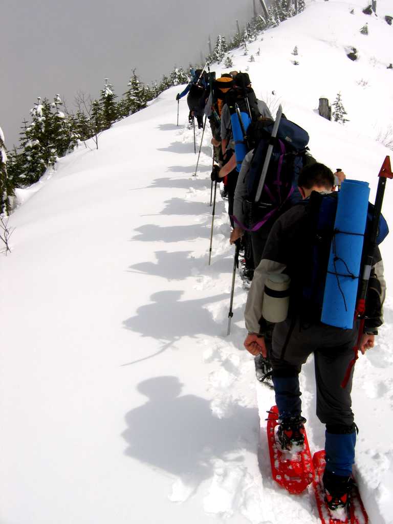
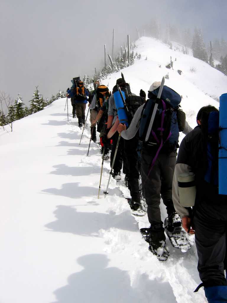
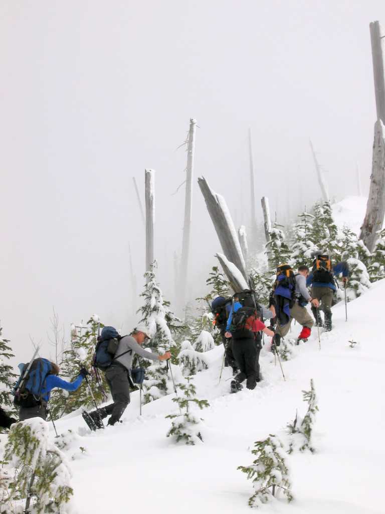
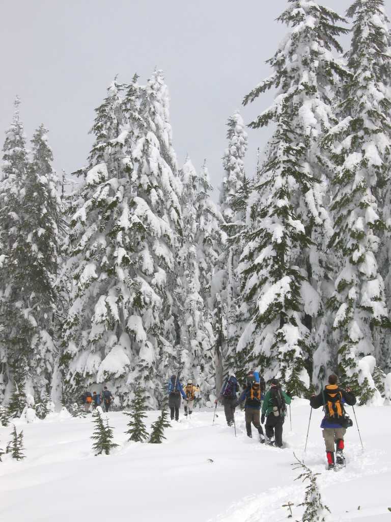
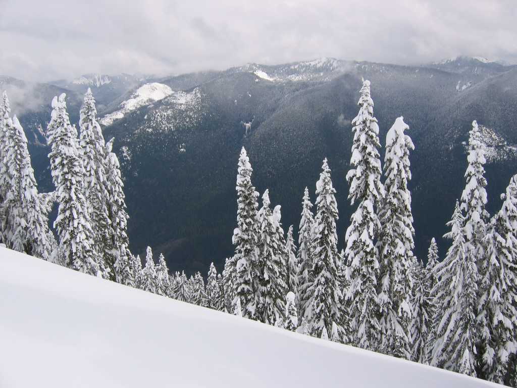
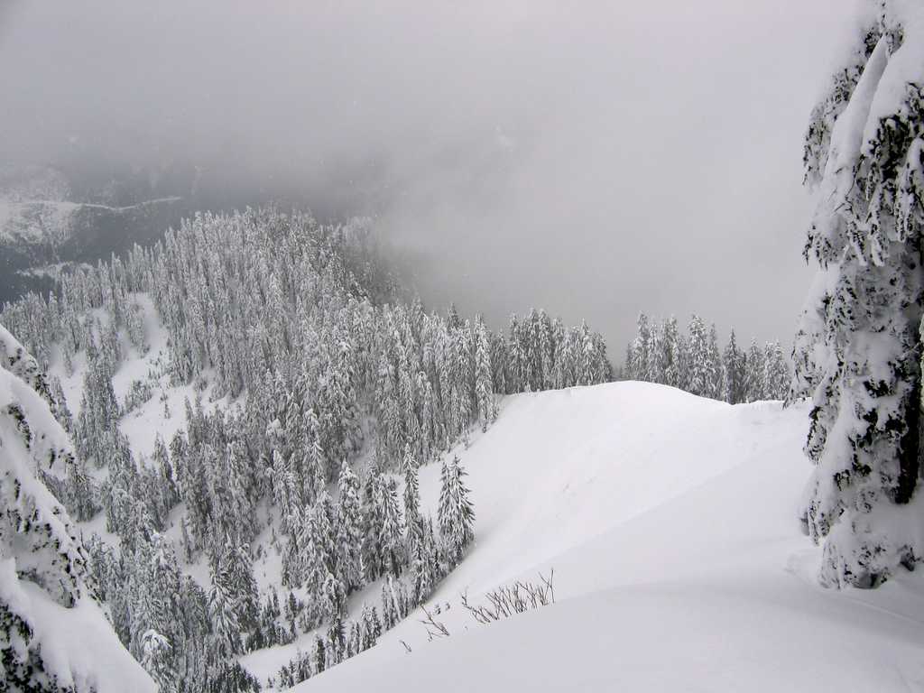
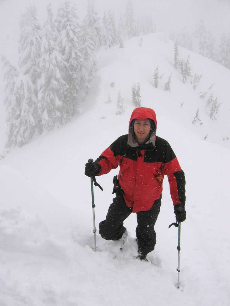
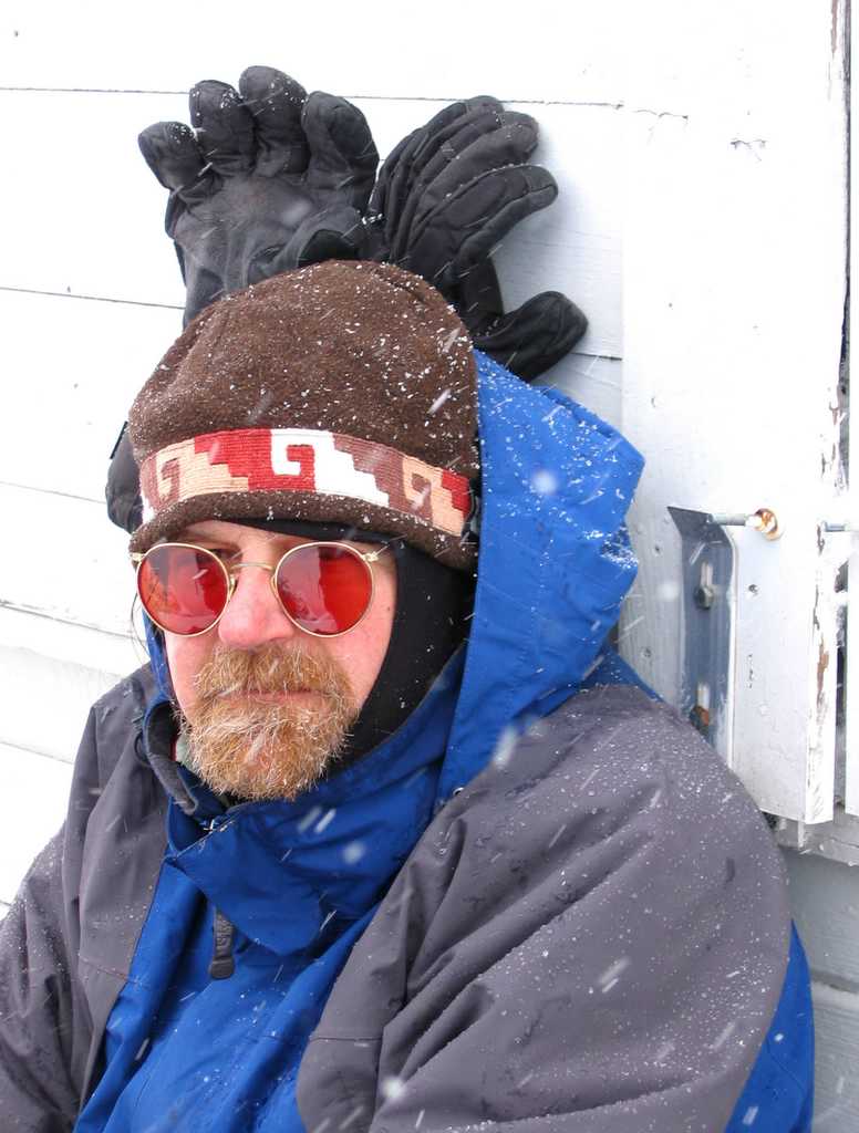
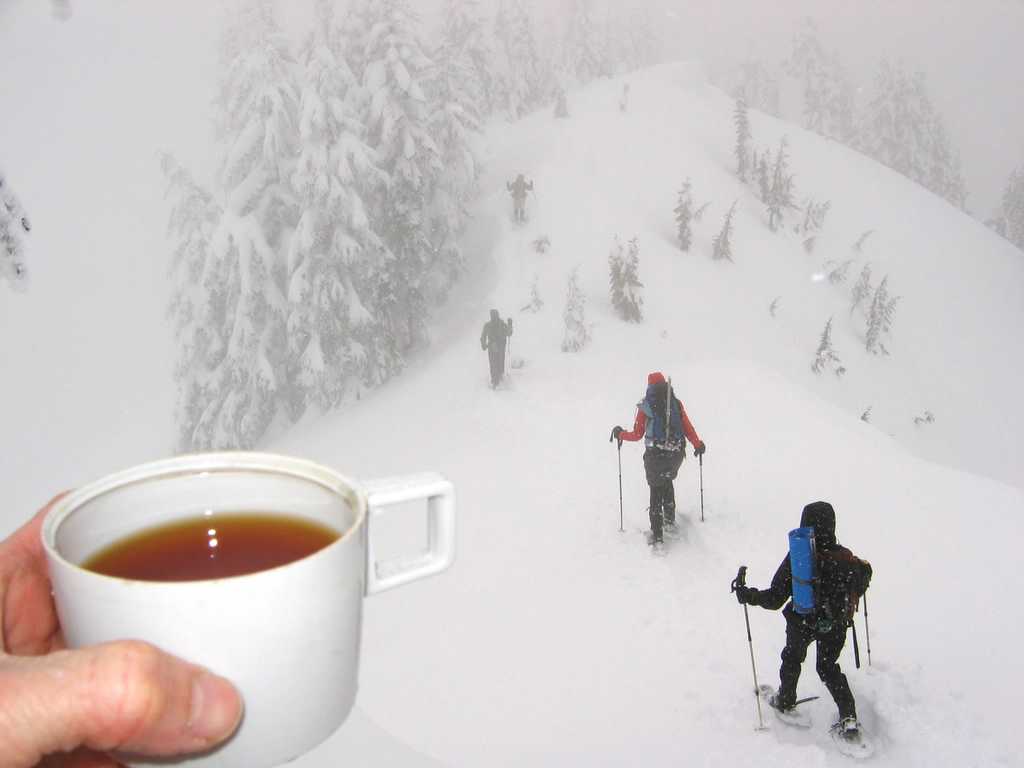
Details: Snow problems governed Richard’s choice of Evergreen Mountain for today’s trip. The route provided a starting point below snow level and it followed forested roads and a well-defined ridge crest to avoid avalanche danger. We began at 1500 on the Beckler River Road and followed ever-fainter old logging roads upward. The lowest road was well-defined but somewhat brushy at the start. We followed long switchbacks on the deteriorating road until we reached the broad crest of Evergreen’s south ridge, where we continued up the center of the ridge on the lower section of the summer trail. The route seemed to jump back and forth between several generations of old logging roads. Someone had marked the criss-crossing junctions with a multitude of pink tape flags. For the first couple hours, the trees rained on us continually. It looked like a steady rain shower from the gray overcast hanging overhead, but it was actually just fresh snow melting off the trees in the warm weather. Circa 3000 feet, the snow was deep enough that we had to use snowshoes. It’s been such a weird winter. On the Sourdough trip, we didn’t need snowshoes till over 5000 feet. Here we were, a month later, 65 miles further south, and we need the snowshoes when we were 2000 feet lower down. After following the flags up more old roads and paths, we reached the current road and summer trailhead marked by a big sign at 4200 feet. The next leg of the trip ascended WNW up a steeper, more well-defined ridge that had been clearcut. In the deep open snow, we were glad to have a train of ten people breaking trail. We had brief sunshine and views of some of the peaks south of Evergreen. |
|
||||||||||||||||||||||||||||||||||||||||||||||||||||||||||||||||||||||||||||||||||||||||||||||||||||||||||
|
|
|||||||||||||||||||||||||||||||||||||||||||||||||||||||||||||||||||||||||||||||||||||||||||||||||||||||||||
|
|
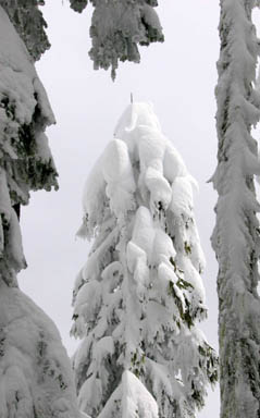
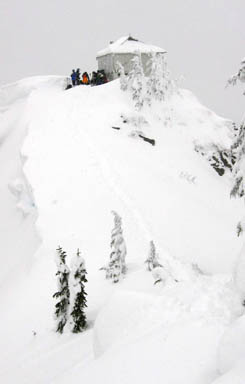
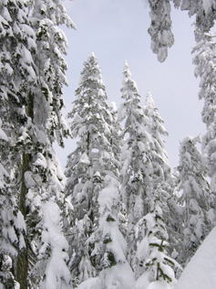
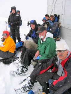
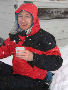
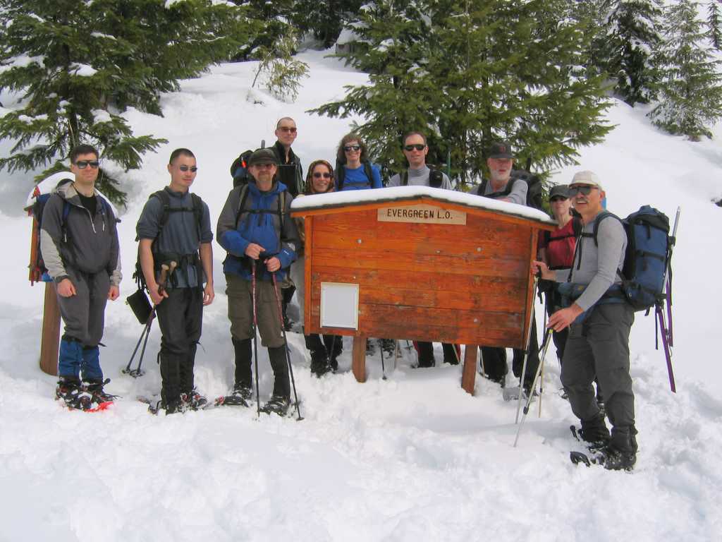
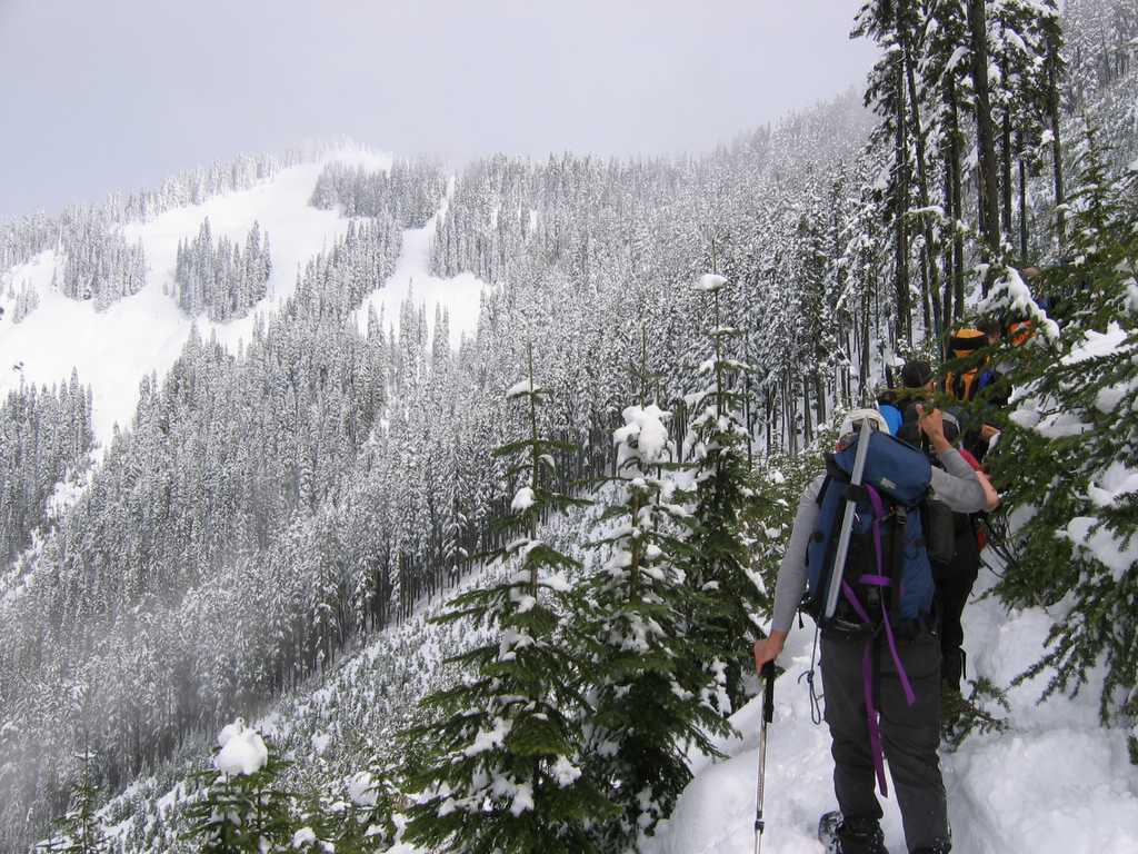
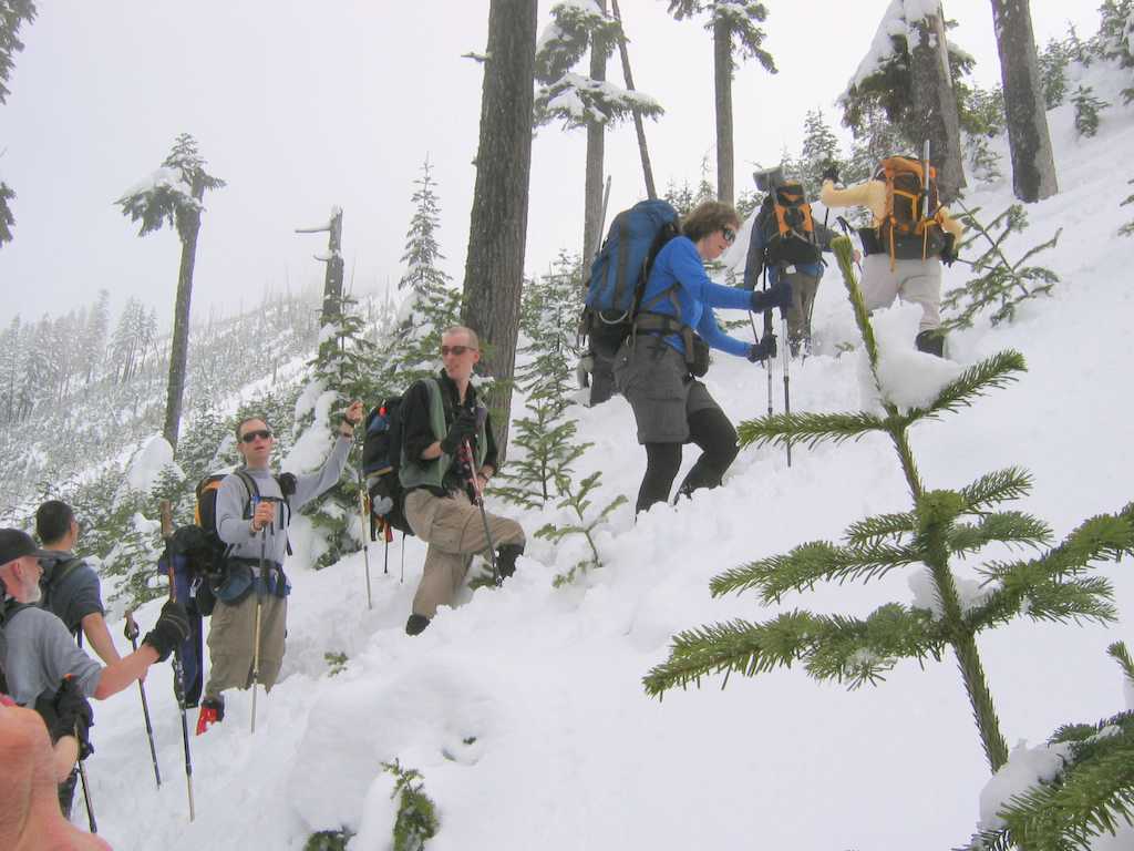
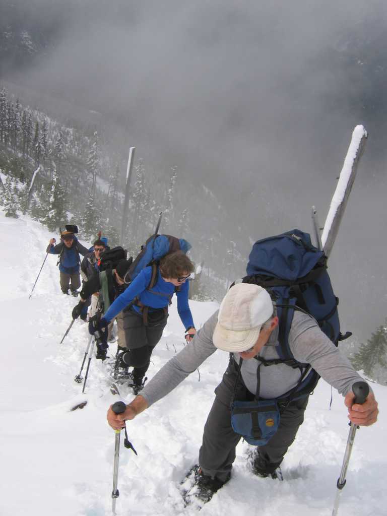
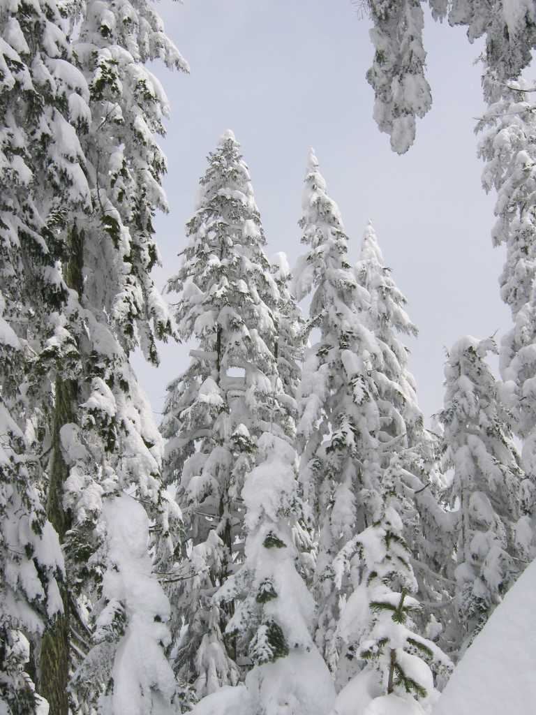
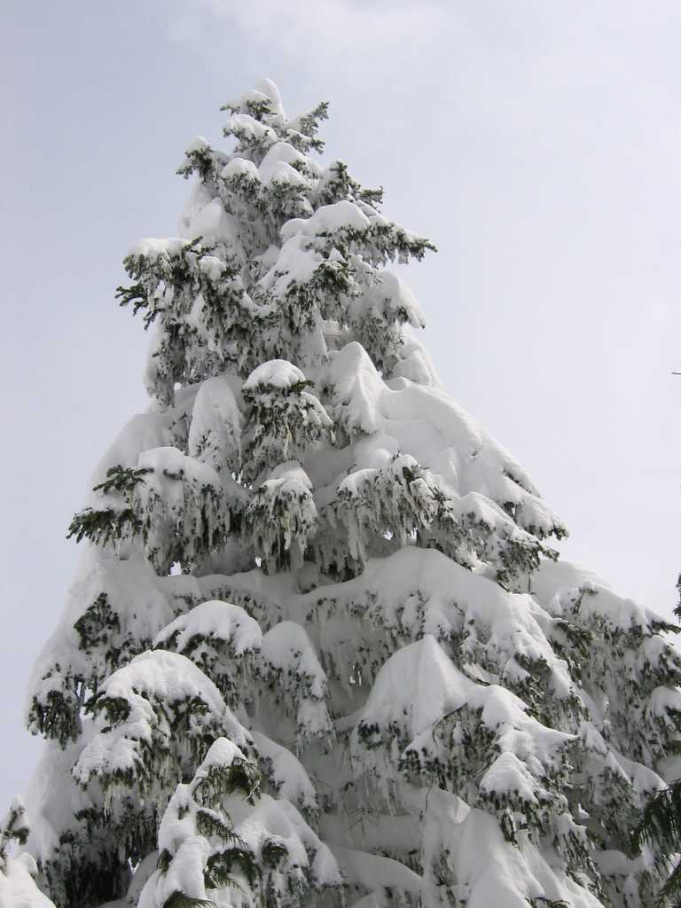
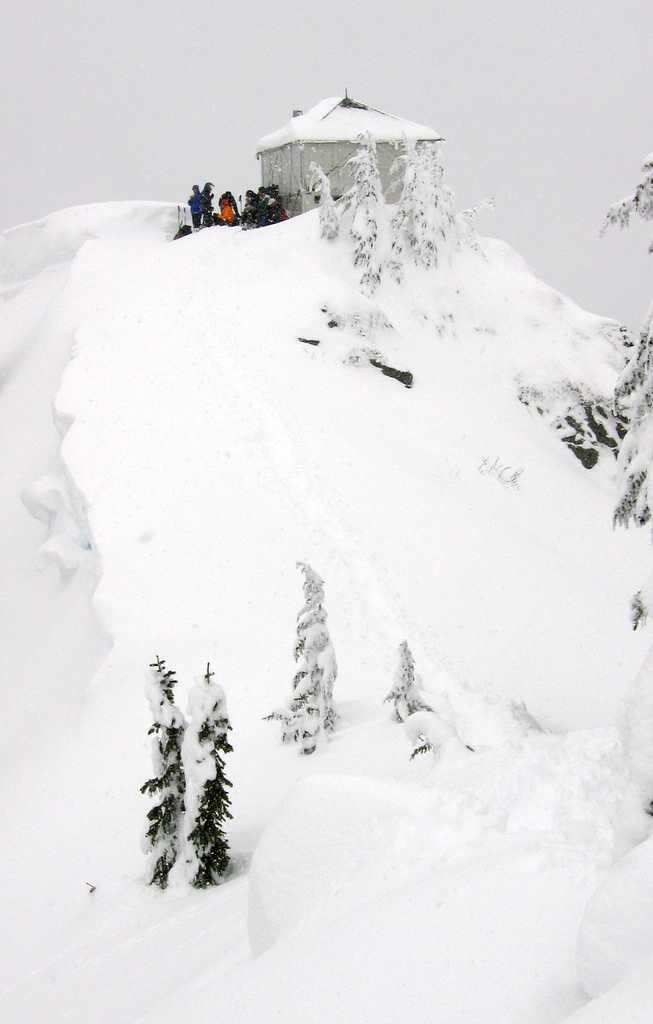
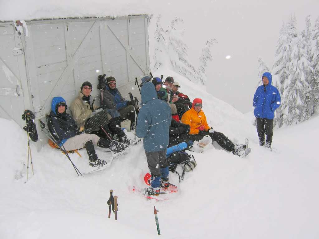
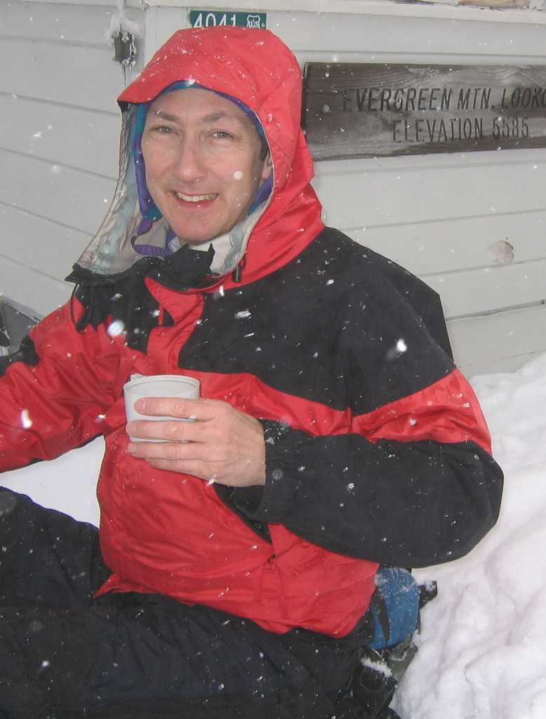
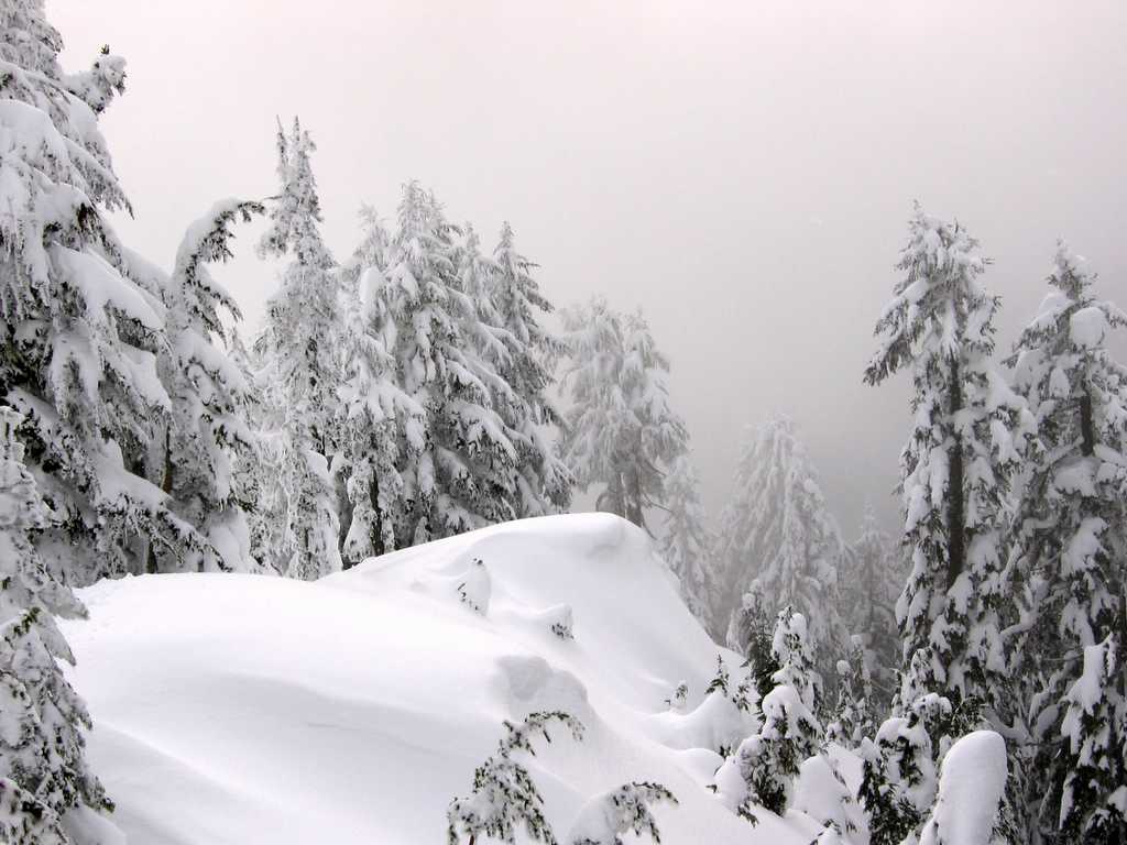
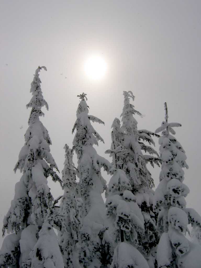
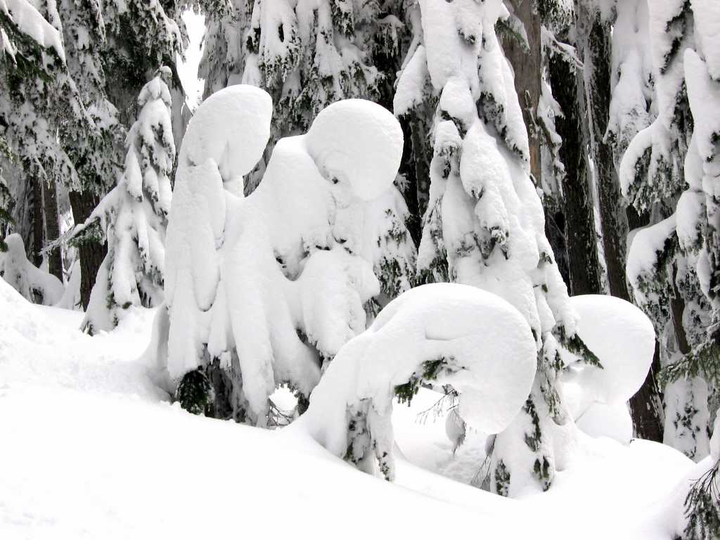
Circa 5000 feet the ridge turned north and leveled off among large trees. The group made a good pace, except a few times when someone would sink waist deep into a hole. My own pace slowed down so that I could take snowy tree pictures. There wasn’t much sun or blue sky, but the snow was spread in broad strokes on the wide boughs, and the tall trees neatly framed views of their neighbors. The last leg of the trip turned west, entered the clouds that had been hovering against the north side of the mountain, and climbed up to the summit lookout. Light snowfall sprinkled down on us, and everyone huddled against the side of the lookout to avoid the summit breeze. The descent went easily. Out trail was well packed into the high snow, our earlier tracks marked the road junctions, and the lower trees had dried out overhead. |
|
|||||||||||||||||||||||||||||||||||||||||||||||||||||||||||||||||||||||||||||||||||||||||||||||||||||||||
|
|
|
||||||||||||||||||||||||||||||||||||||||||||||||||||||||||||||||||||||||||||||||||||||||||||||||||||||||||
|
|
|||||||||||||||||||||||||||||||||||||||||||||||||||||||||||||||||||||||||||||||||||||||||||||||||||||||||||
|
|
|
|
|||||||||||||||||||||||||||||||||||||||||||||||||||||||||||||||||||||||||||||||||||||||||||||||||||||||||
|
Statistics: Round trip 11 miles. Parked at 1500. Summer trailhead 4200. Summit 5587. Net gain 4087. Cumulative gain 4320. Up 4:45, 0:30, down 3:15. Route
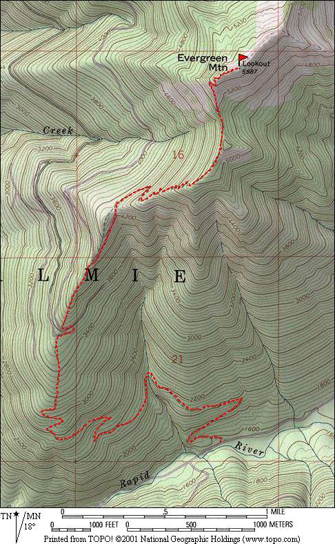
Info: Drive the Beckler River Road #65 seven miles north to Rapid River Road #6530. Drive Rapid River Road to just after it crosses the river for the second time. Park at a small parking lot by an old quarry on the north side of the road, 1500. Hike uphill 50 feet to the abandoned logging road. The road switchbacks uphill, travels west to cross a major creek at 2400, and continues further northwest with occasional switchbacks till it attains the ridge crest circa 2800. Follow the ridge (or sections of road where convenient) northward up the ridge to the summer road and trailhead at 4200. Do not follow the long NNW switchbacks of the summer road, circa 3600, which add unnecessary distance. Then follow the trail route up the ridge crest ENE to point 5200, N down and up to the summit ridge, and ENE to the summit. Pictures
& Maps:
|
|||||||||||||||||||||||||||||||||||||||||||||||||||||||||||||||||||||||||||||||||||||||||||||||||||||||||||
|
|
|||||||||||||||||||||||||||||||||||||||||||||||||||||||||||||||||||||||||||||||||||||||||||||||||||||||||||