|
|
||||||||||||||||||||||||||||||||||||||||||||||||||||||||||||||||||
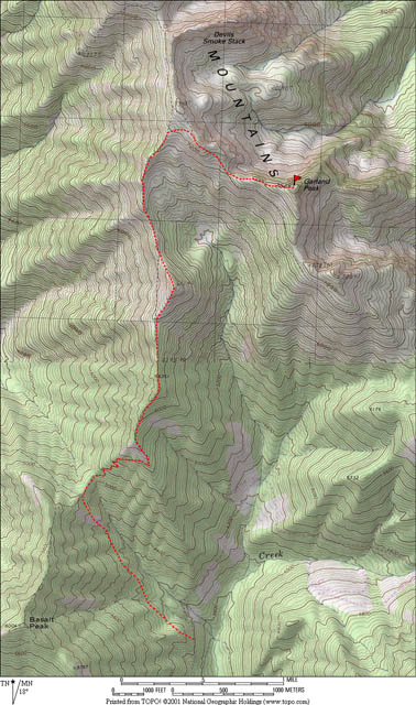
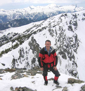
Garland Peak 7525(USGS Saska Peak)4/23/05 |
||||||||||||||||||||||||||||||||||||||||||||||||||||||||||||||||||
|
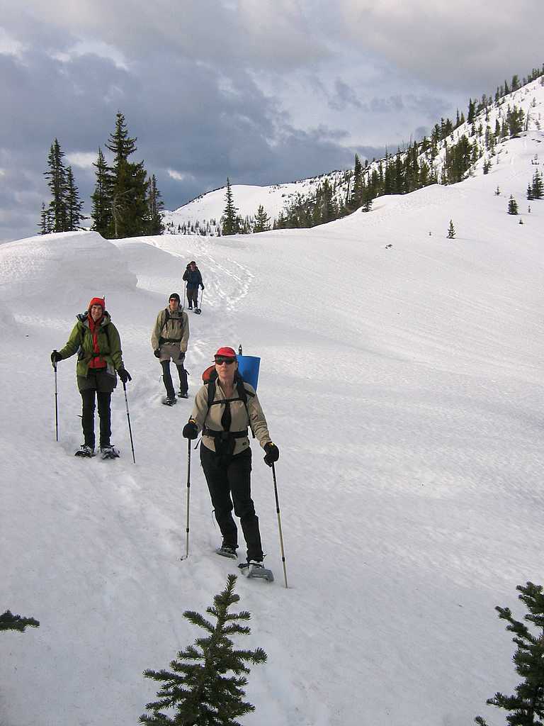
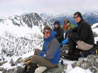
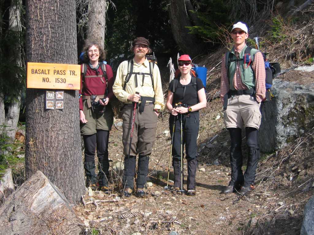
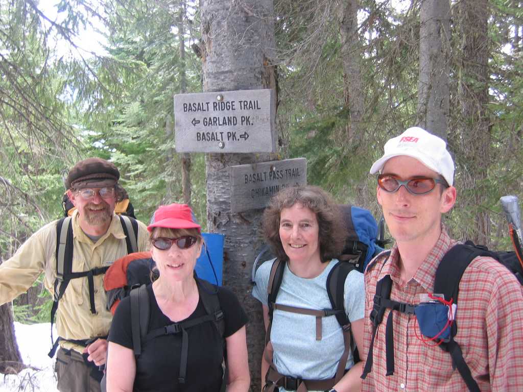
Party: Richard Burt, Lynn Graf, Kathleen Whalen-Burns, Gabriel Deal, Matt Burton Highlights: Richard described the shape of the route as a
fishhook. We took the trail up to
Basalt Pass, and then made the fishhook by following the ridge crest north on
the Basalt Ridge trail
to intercept the Garland trail, and then hooking southeast back down to
Garland. Garland gave panoramic views of the high end of both the Chiwawa & Entiat drainages. I had hoped to get a view of the Saska group of peaks that I scrambled last fall, but the view actually covered a wide sweep up the Chiwawa valley and back down the Entiat Valley The skies stayed mostly overcast, but cleared up just enough provide occasional light on each peak.
|
||||||||||||||||||||||||||||||||||||||||||||||||||||||||||||||||||
|
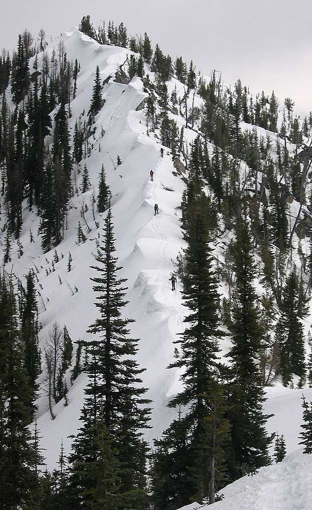
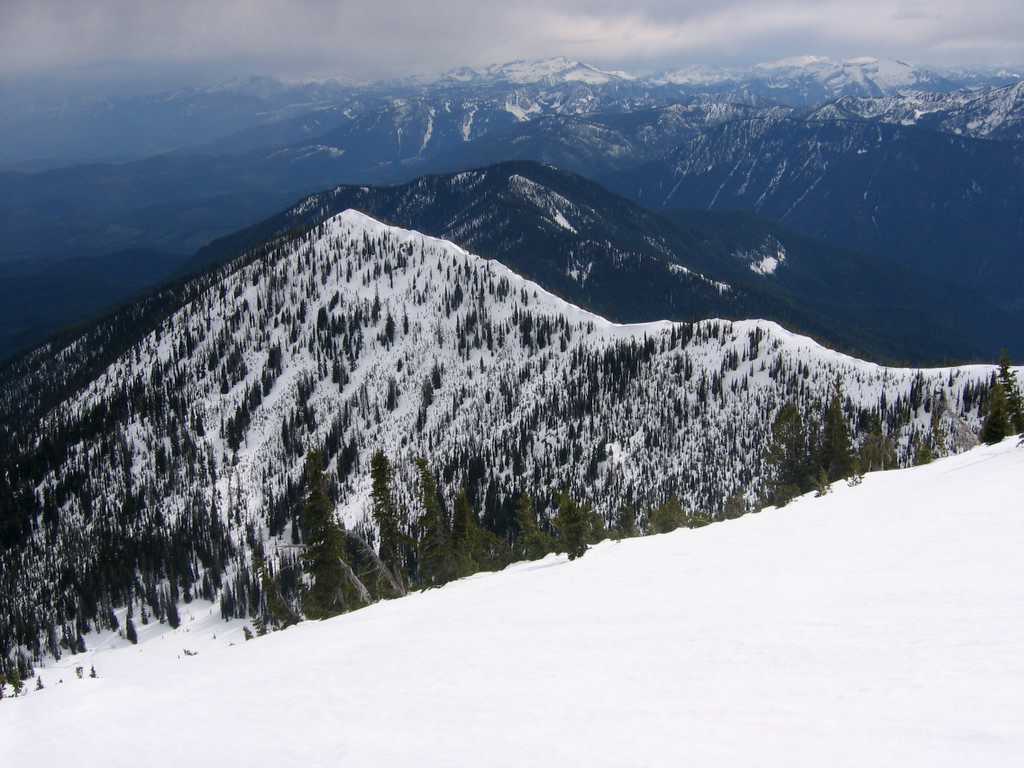
The Fishhook (from 5800 to summit) |
Details: Garland was an orphan from the Larch Lakes trip that I did with Mike Torok in 2000. On that trip, we started from the Entiat valley and traveled south over Rampart & Devils smokestack toward Garland. However, I was enthralled by the rich colors of the larch meadows between Devils and Garland, so I left Garland an orphan and went down to the meadow while Mike traversed across to Garland. Today I picked up the orphan from the opposite direction, starting from the Chiwawa valley and traveling north to the peak. The snow had melted enough that we could drive to within ¼
mile of the trailhead circa 3800. We
needed snowshoes beginning about 4500.
The trail was in deep forest to Basalt Pass (5150), in partial forest
to the ridge crest at 5800, and open ridge-top for the entire fishhook. There was a 300-foot drop going over Point
6754 midway up the shaft of the hook, and another 300-foot drop approaching
Point 7348 at the bend of the hook.
Most of the open snow packed down well under the snowshoes, so the
distance was tiring, but not overwhelming. |
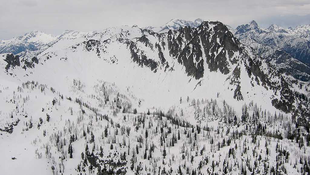
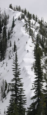
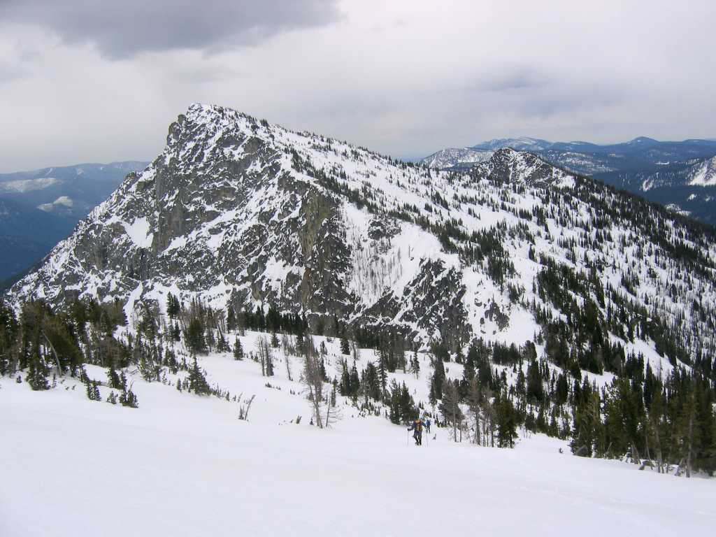
Point 6754 |
||||||||||||||||||||||||||||||||||||||||||||||||||||||||||||||||
|
|
||||||||||||||||||||||||||||||||||||||||||||||||||||||||||||||||||
|
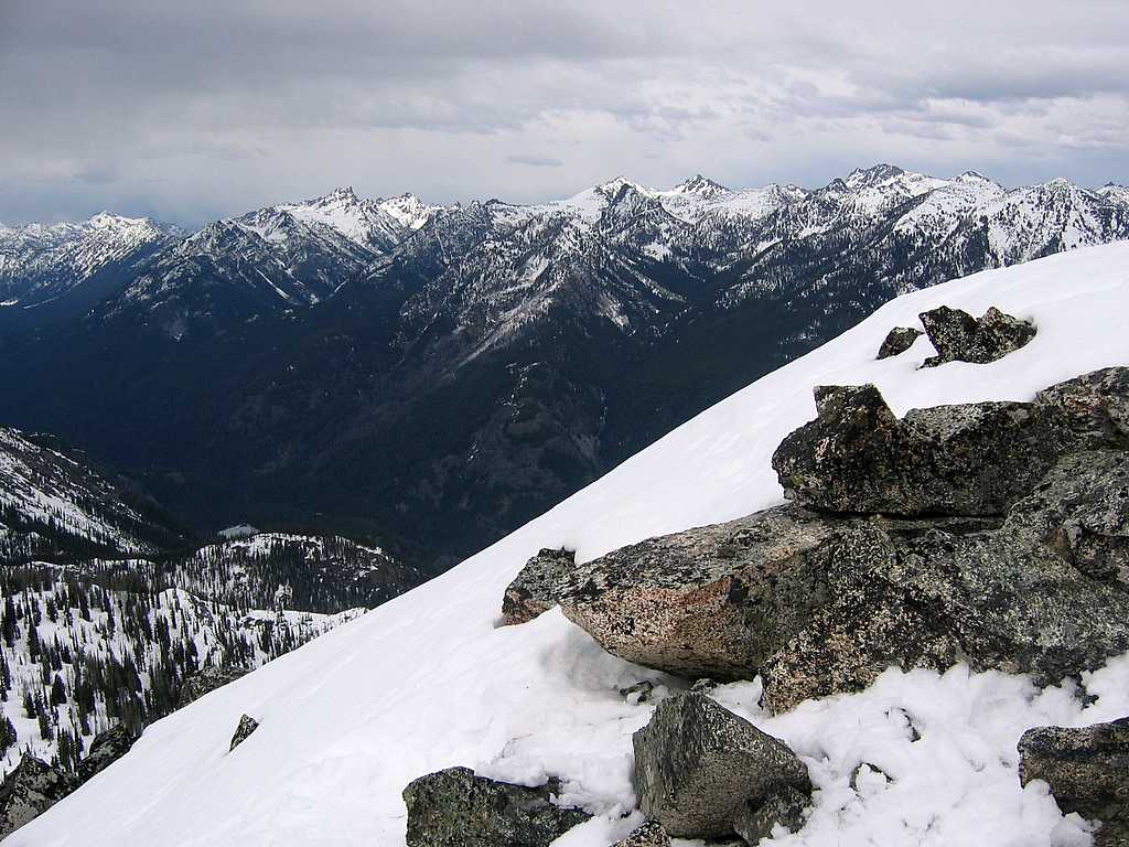
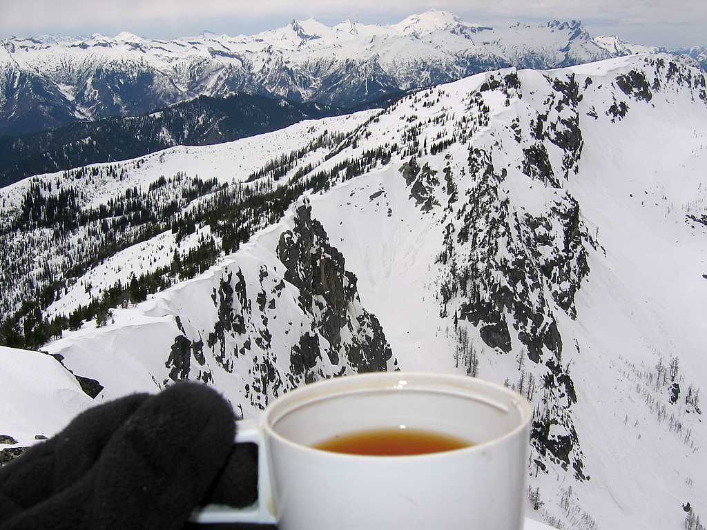
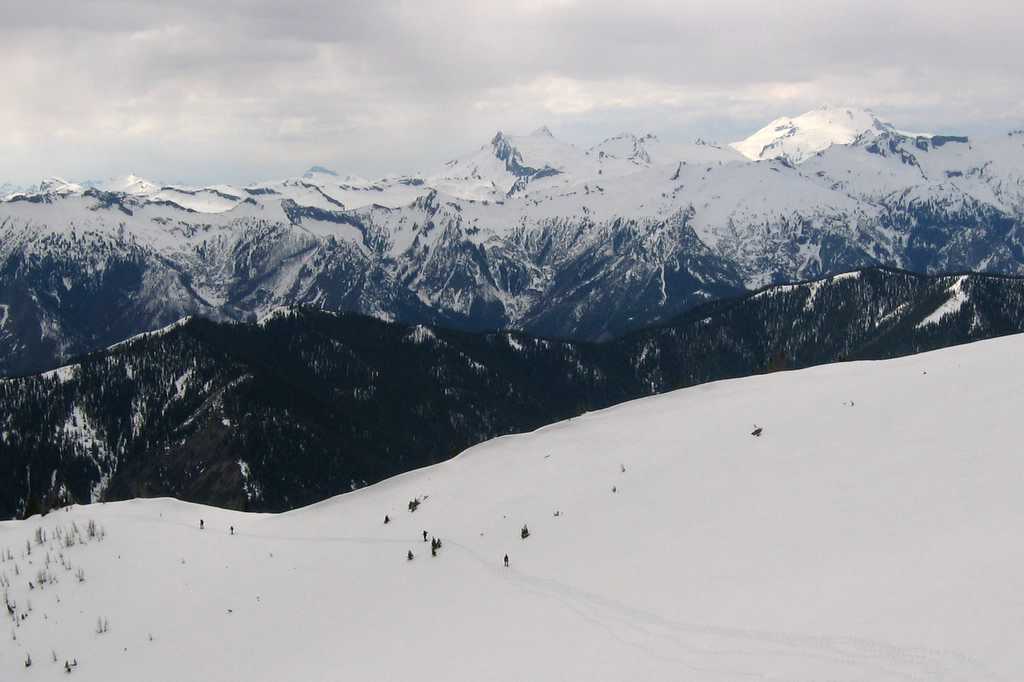
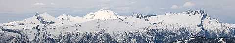
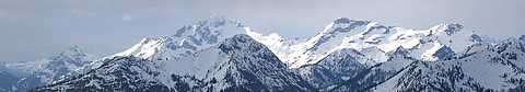
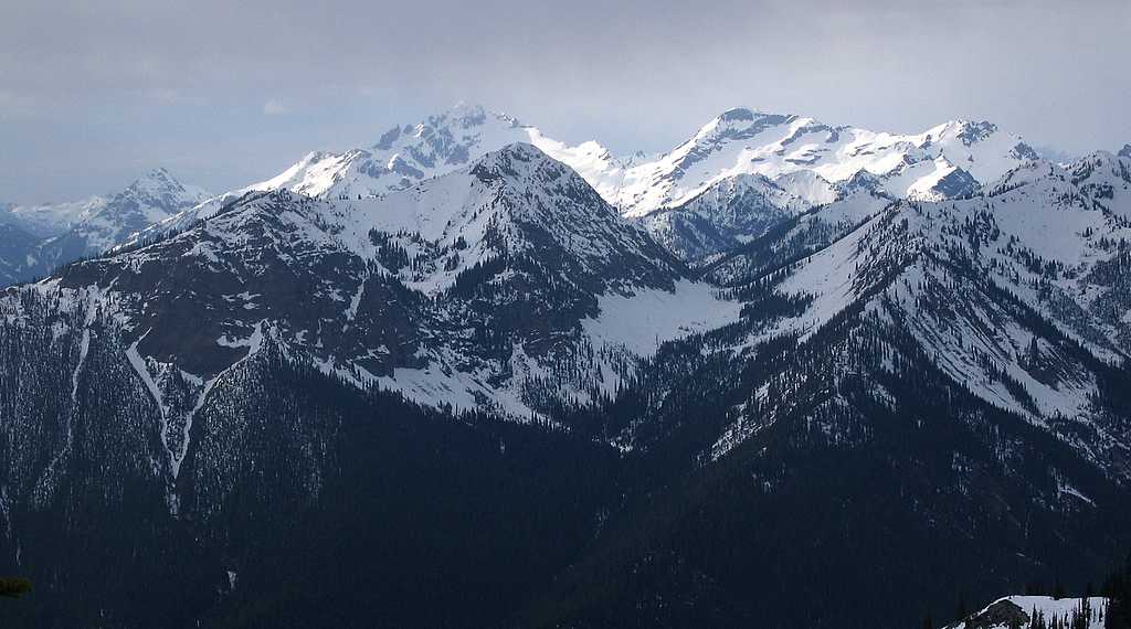
Two views dominated most of the trip along the ridge. To the northwest, Glacier Peak was framed neatly between Clark & Buck. To the northeast, Garland taunted us on the far side of the valley, waiting for us to make the long curve up and back to reach it. On the way up the hook, we could also see the peaks at the head of the Chiwawa valley (Fortress, Chiwawa, Maude, Fernow) and then on the far side of the hook we could see the Entiat valley peaks (Rampart, Devil’s Smokestack, Spectacle Buttes, Pinnacle, Saska, Emerald, Cardinal). There were strong winds on the approach and especially at the low point just before the summit, but the summit itself was fairly comfortable. The wind had built moderate cornices along the approach ridge, and some really impressive cornices above the cliffs on the north side of Garland. |
Clark, Glacier, Buck
Fortress & Chiwawa
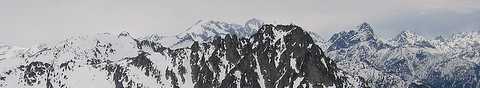
Devils
Smokestack (foreground) Rampart, Maude,
Fernow, Spectacle Buttes (background)
Pinnacle, Saska,
Emerald, Cardinal |
|||||||||||||||||||||||||||||||||||||||||||||||||||||||||||||||||
|
|
||||||||||||||||||||||||||||||||||||||||||||||||||||||||||||||||||
|
Group on Summit with Devils Smokestack |
Matt on the summit,
with the top of the hook and Glacier Peak behind. |
|||||||||||||||||||||||||||||||||||||||||||||||||||||||||||||||||
|
|
||||||||||||||||||||||||||||||||||||||||||||||||||||||||||||||||||
|
The clouds threatened all day, but allowed us views of all the peaks. The rain gave us just a few spatters on the return, but kindly waited until we were standing at the car before turning to continuous showers. Statistics: Drive 2:30 from Mountlake Terrace. Round trip 12 miles. Parked at 3750. Basalt Pass TH 3800. Basalt Pass 5150. Lost 810 feet on ridge (mostly at Point 6754 & Point 7348). Summit 7535. Net gain 3785. Cumulative gain 5400. Up 6:00, summit 0:30, down 3:45. Other
Route Info: The trip would be mostly a trail hike in summer. Most years the road would not be open till later in spring. Related
Trips: Schaefer Point (Bandit Attempt) (6/5/04) - west of Garland on the opposite side of the Chiwawa valley. Larch Lakes (10/7 - 10/9/00), directly north of Garland, the trip that left Garland an orphan.
Entiat Crest
(10/9 - 10/12/04),
northeast of Garland on the opposite side of the Entiat valley. Pictures
& Maps:
|
||||||||||||||||||||||||||||||||||||||||||||||||||||||||||||||||||
|
|
||||||||||||||||||||||||||||||||||||||||||||||||||||||||||||||||||
.jpg)
.jpg)
.jpg)