|
Details:
Saturday
North Fork Sauk Trail (Trailhead to White Pass)
The North Fork Sauk trail seems to have only two grades:
flat by the river or steep up the ridge.
The first six miles gained less than a thousand feet following the
river through old-growth forest from the 2100-foot trailhead to the Mackinaw
Shelter (3000 feet). Then it climbed
3000 feet in the next 2.7 miles, in switchbacks hacked out of the brush of
avalanche slopes. The soil was
broiling and the black flies hounded us.
My skin felt like an unhappy stew of heat, coated with sunscreen and
insect repellent, with sweat running down me, and flies bouncing off me.
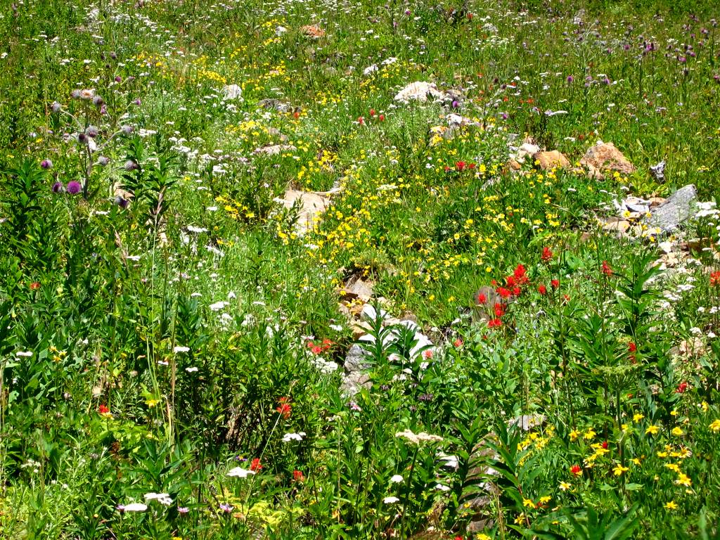
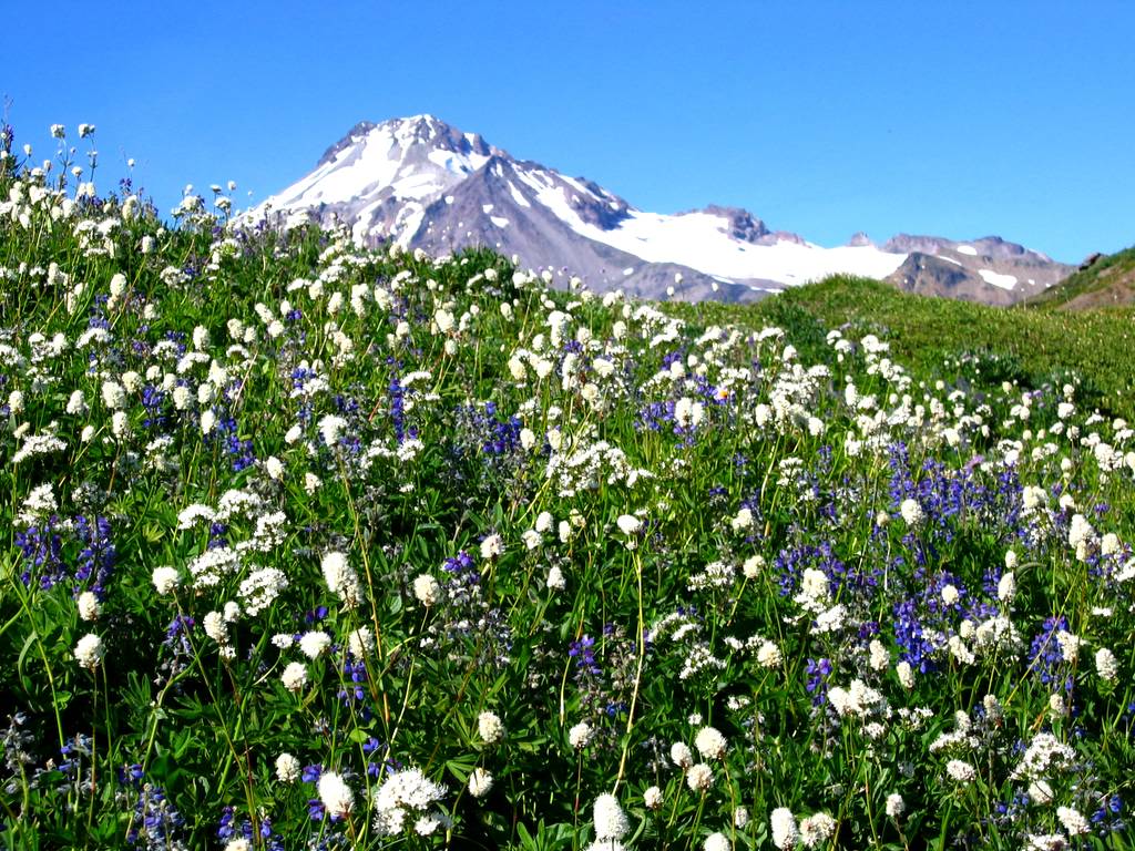
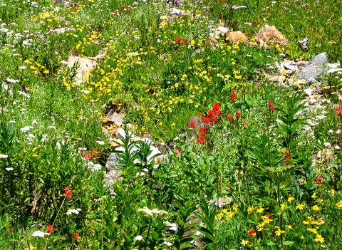
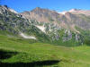
The reward came in the meadows above 5000 feet. We gained a breeze to cool us off and keep
the flies away. Anywhere a small
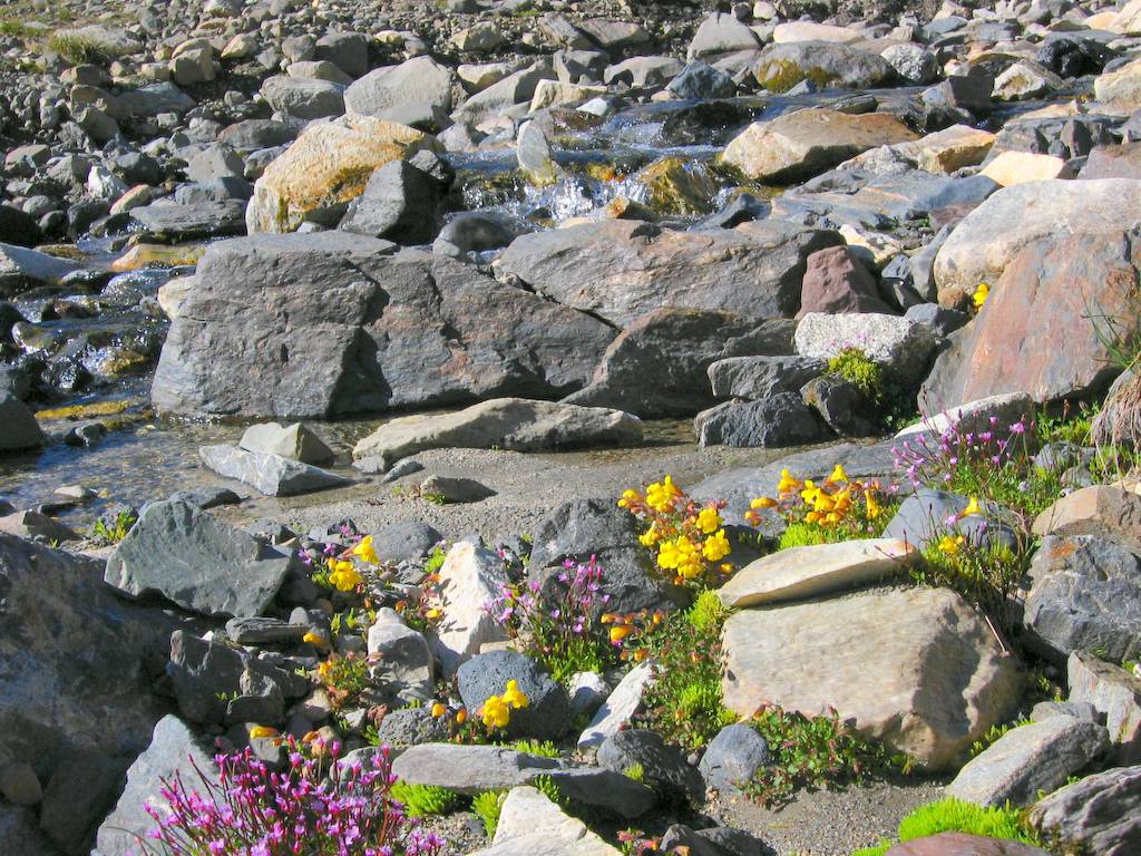
stream trickled down, the meadows were filled with flowers. We stopped to pump water at a little
stream that had only a trickle of flow, but all around it were big bunches of
flowers. You’d have pay a fortune to
create this kind of water garden in town, but here it spread naturally for
hundreds of feet above and below the trail.
Higher up, there were wide swaths of purple and white flowers stretching
up to the ridge crest. Behind us,
Sloan and the Monte Cristos came into view, and ahead we could see Indianhead
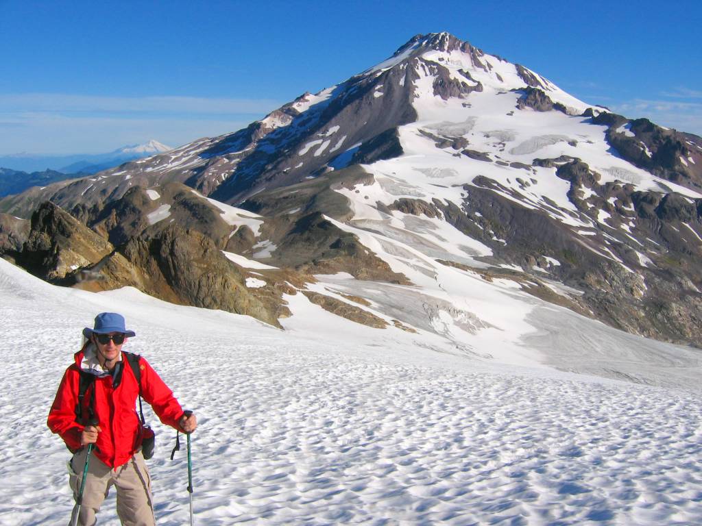
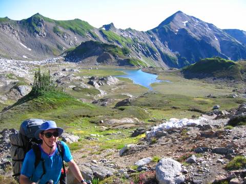
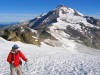
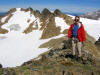
Peak rising above the bright green meadows of White Pass (6000 feet).
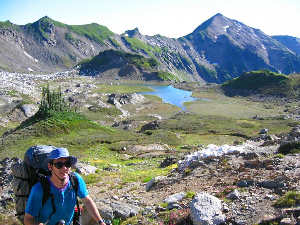
Lighting Creek High Route (White Pass to Camp)
At White Pass, we turned onto the Lighting Creek high
route, which was a very well beaten trail traversing northeast past the flank
of White Mountain. At about 6250
feet, we turned uphill to hike up to the ridge crest just before (west) of a
distinct rock outcrop. We back side
was steep, so we went a little further east on the crest and then dropped
down loose rock and steep meadow a couple hundred feet into the glacial
basin.
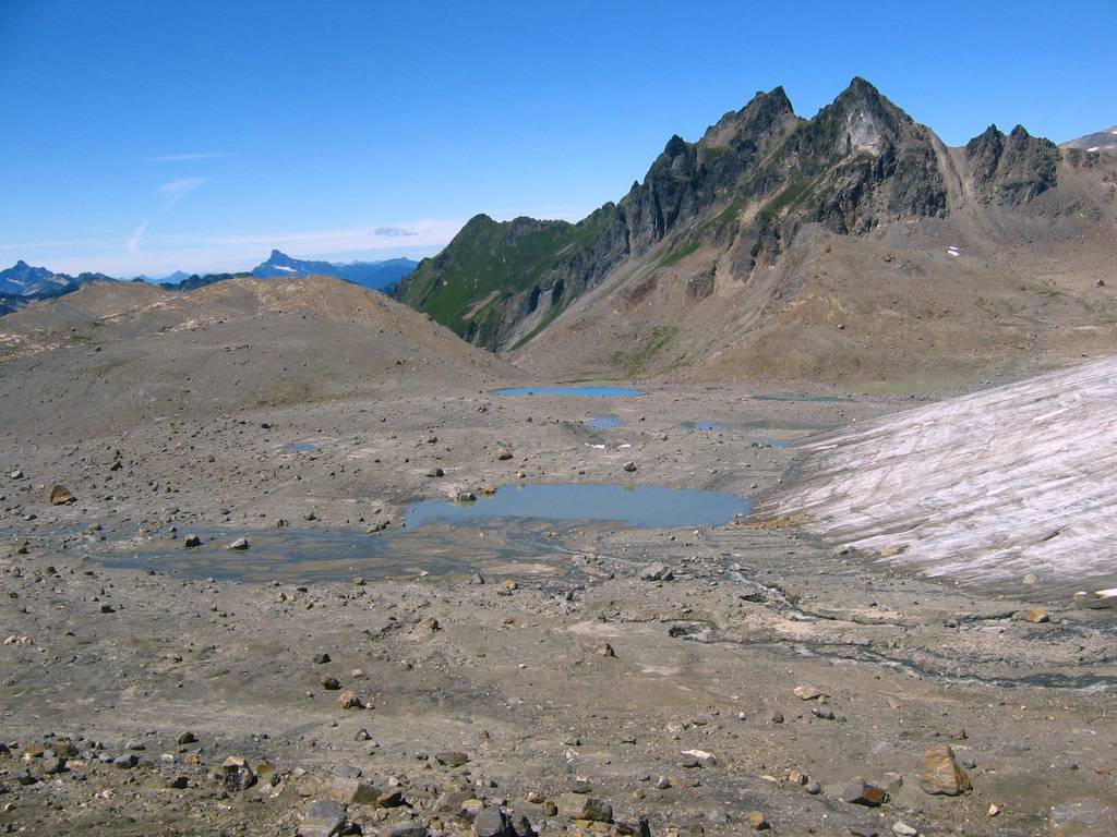
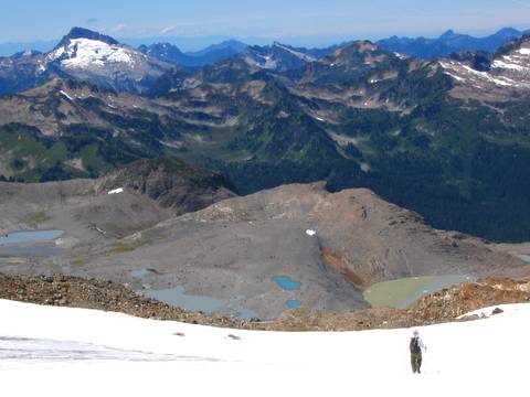
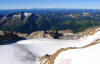
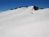
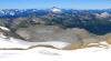
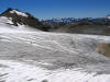
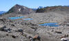
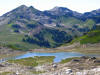
From the ridge crest, we could look down see miles of dirt
and rock piled up across a low-angled basin left behind by the retreating
glacier. We headed northeast to cross
the low point of the basin and then northeast toward the glacier, which was
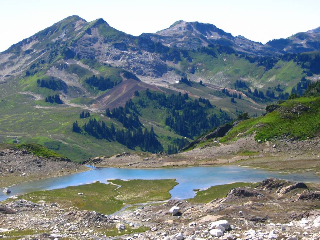
hidden behind successive piles of rocks and moraines. Below us was a pretty lake with White
Mountain behind us. Across the
valley, I could see the White Chuck Cinder Cone, where I had camped on the
first three-day trip I ever made in the Cascades, as a hiker on the White
Chuck trail back in 1987,
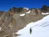
The basin was filled with rock piles, separated by
stretches of sand or pumice, and watered by occasional streams and
snow-patches. We followed the basin
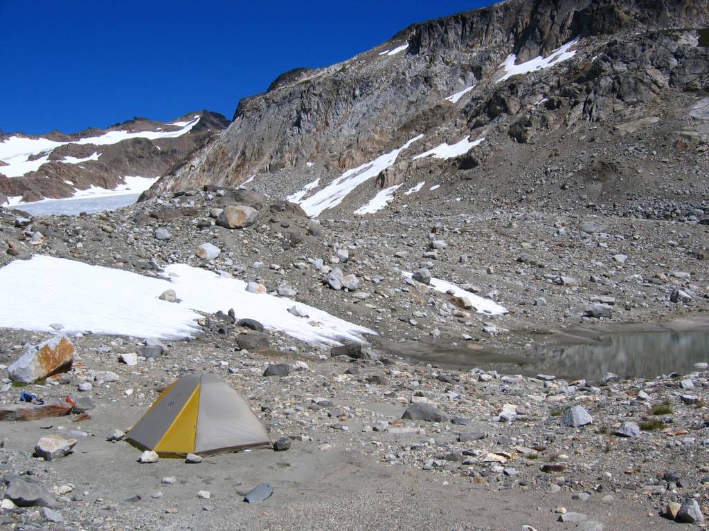
up to a crest at 6600 feet, not far from the southwest corner of the glacier,
separating the previous older basin from a newer basin even more barren from
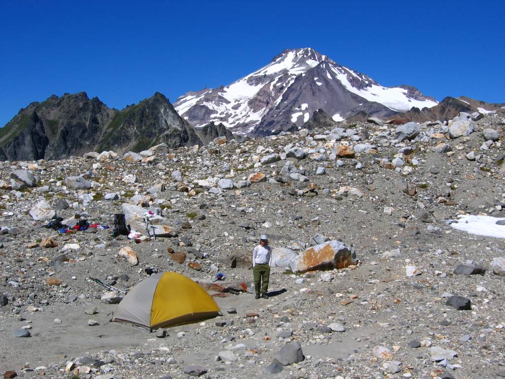
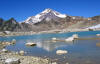
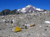
the glacier’s recent retreat. We put
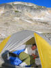
our camp there on a very comfortable flat patch of sand, with two small tarns
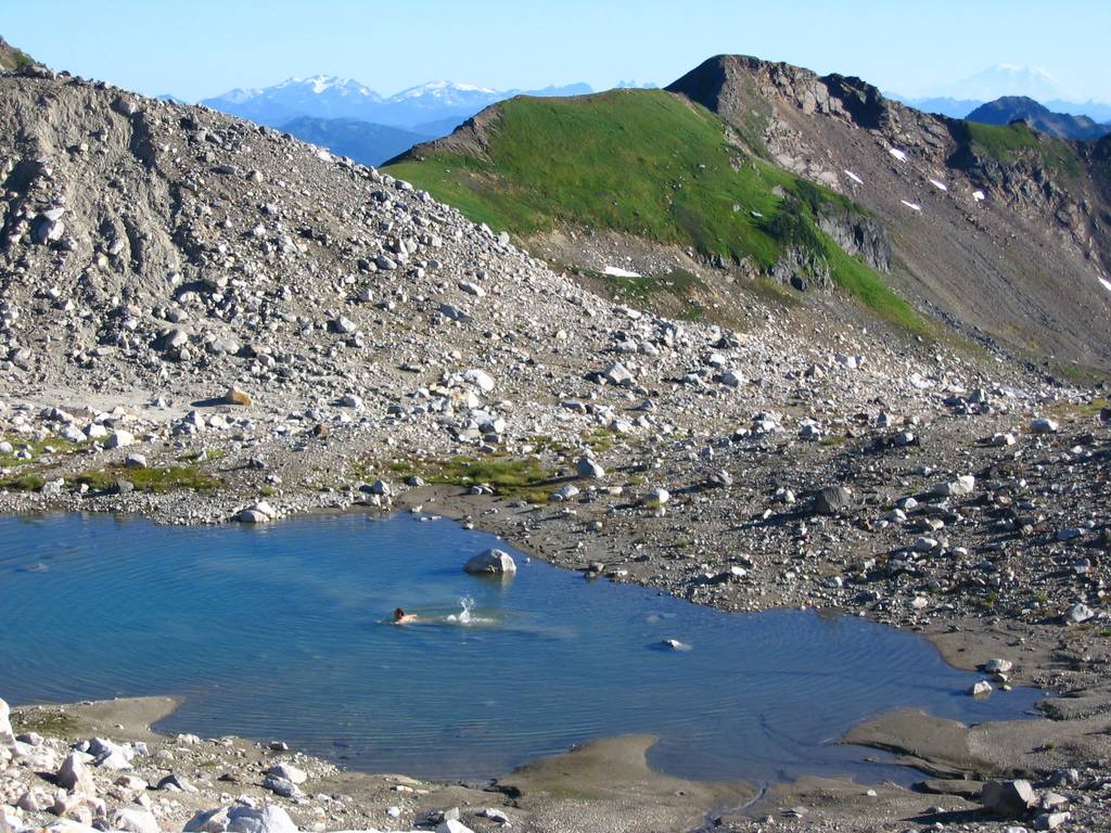
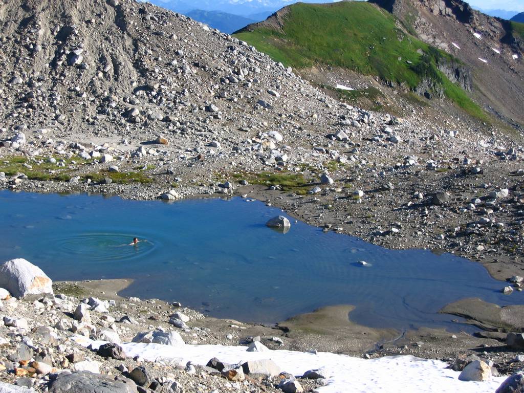
nearby, and a view of Glacier Peak on the rise above us. I went swimming in the nearest tarn, which
made a great swimming pool. It was a
couple hundred feet long but only about four feet deep, with a soft sandy
bottom and refreshing warm-cool water.
Sunday
Up the White Chuck Glacier
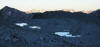
We left camp at 5:45 in the morning and walked uphill to
reach the toe of the glacier at about 6800, discovering multiple additional
small lakes along the way. The lower
glacier was bare ice and frozen solid during the night, so we cramponed
easily up the slope. The bare ice
showed lots of small crevasses, but nothing that was a serious obstacle. Below us, we could see at least more and
more ponds reflecting the morning light like silvery cut-outs in the shadowed
basin. As we ascended, we crossed
into sunlight and white snow higher on the glacier, and the ponds turned
bright blue reflecting the early sky.
From here we could see that there were at least a dozen ponds, with
several larger lakes that had been hidden at lower elevations.
First Route-Finding Error
We headed up the glacier a little too easily and never
stopped to check that out route should have traversed north to get to the
permanent snow/ice filed above a ridge at the northeast corer of the
glacier. Instead we ended at a
7600-foot foot col, looking down several hundred feet at the stagnant lower
lobe of the White River Glacier. The
bottom lobe of the glacier was melting back into the hollow, covered in black
dirt and surrounded by meltwater ponds.
Actually, we could have made a loop trip at this point, by following
the ridge north to the 7200-foot col, then dropping east onto the middle of
the White River Glacier, then ascending back up northeast to the east summit
of Kololo. Instead we retraced our
steps downhill a few hundred feet and across to the north edge of the
glacier, where we climbed to the higher snow near a stream gully and then
followed snow and rock to a col at 7800 feet on the minor ridge between White
Chuck and Suiattle glaciers. (This
was our first route-finding error of the day, which cost us about 45
minutes.)
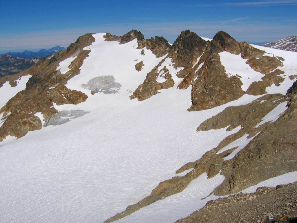
Across the Suiattle Glacier
From here, we had wide-open views of the south face of
Glacier Peak, and the wide expanse of glaciers and glacier-cut rock that
stretches between Glacier & Kololo.
The sun had warmed the snow cover up here, so we continued without
crampons. On the Suiattle Glacier, we
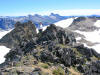
traversed summit ridge circa 8000 feet, where the ridge of Kololo had
multiple outcrops with deeply carved wind galleries between them. The summit turned out to be the first
point after the ridge crest, but we overshot it, so we decided to go on to
the east summit first and then get the main summit on our return.
Honeycomb Glacier, East Summit (8160), and West Summit
(8197)
An east-trending nose led us to the Honeycomb Glacier,
where we could see an easy line curving southeast and then southwest to the
summit. This glacier showed some
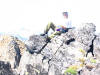
larger crevasses, so we roped up for the crossing. The east summit (8160) was a wide pumice covered ridge with a
few rock outcrops and superb views of the surrounding area. Tenpeak, Luahna, and Clark showed up
clearly. Mike had also wanted to do a
couple bonus summits (because they had 400-foot prominence) further east, but
we didn’t have time to go there.
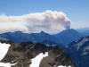
Further northeast, a new fire on Dirtyface Peak sent plumes of smoke
towering into the air. The wide
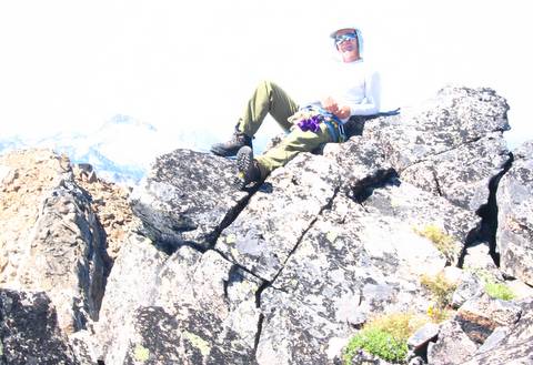
pumice field on the ridge was soft enough that I lay for a while on my back
just enjoying the view of the sky above the peaks at the periphery of my
vision. Then we retraced out path
back to the main summit, which had just a bit of a steep snow finger to get
to the top. We found a film-can
register left by Don Goodman in 83.
After more pictures and views, we headed back to camp.
Descending the Glacier (Ice-Melt Streams and Glacial
Ponds)
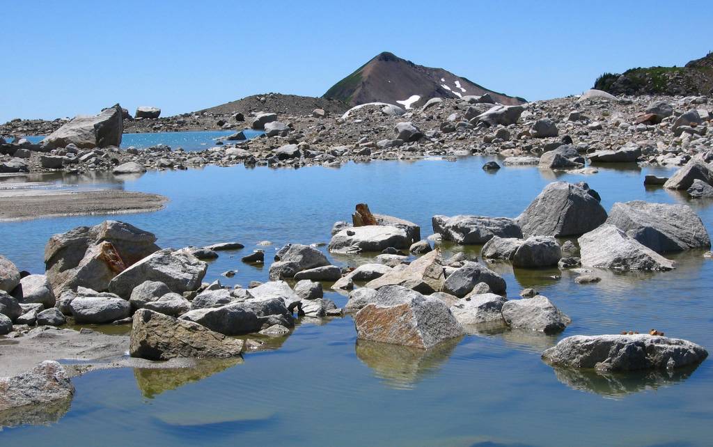
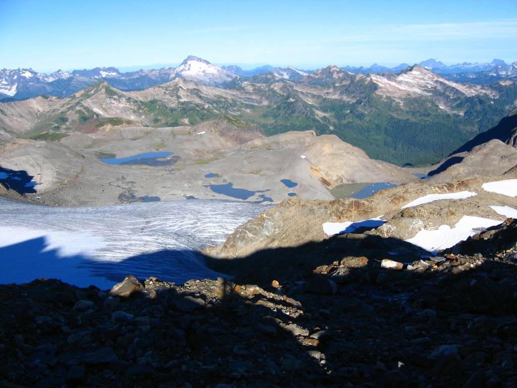
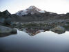
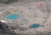
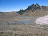
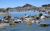
With full daylight, the lakes in the glacial basin made a
fascinating display of colors. The
clearest lake, near where we had camped, was a deep blue. Other snow-fed lakes up on the moraine
were blue-green, having picked up some glacial powder. Below the foot of the glacier, a series of
lakes and streams (the head of the White Chuck River) were a bright
grayish-green with the loads of silt washing down from the glacier. Further down, a large lake confined in a
basin with no surface outlet was a deep yellow-green from the build-up of
silt.
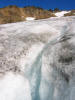
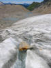
In the warm sunshine, the toe of the glacier was alive
with water. At edge of the glacier,
we crossed alternating stripes of black and white, black being the dark
surface of the glacial ice, and white being the fresh snow filling the lines
of crevasses. In the flat center, the
surface was covered with little streams of clear water running down the
glacier. Occasionally the water would
splash and gurgle into small crevasses, where we could see it making little
waterfalls inside the crevasse and could hear it running in streams far
below. Farther down, we could hear
the louder rush of multiple streams running out of the glacier onto the plain
of ground dirt and little lakes below the glacier. Where we exited the glacier (a couple hundred feet higher at
its southwest corner) there was a series of three beautiful little lakes
among the rocky moraines. (These
would be an ideal camp area.)
Exit (and Second Route-Finding Error)
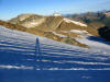
We packed up our camp and headed out at about 3pm. Then we made our second route-finding
mistake. We headed to the nearest col
that would take us over the ridge separating our basin from Foam Creek,
crossing the second col to the east of Point 6770. A report from a previous traveler had led Mike to believe that
the Lightning High Route passed through Foam Basin, so we dropped into the
basin, which was a very steep descent that cost us an elevation drop down to
5900 feet. We didn’t find the trail,
and we spent a long time getting around the shoulder of 6770. Finally we found the trail back up at
about 6350 feet a little west of the shoulder. My guess is that the trail doesn’t drop down, but rather
traverses high on the shoulder to reach one of the cols nearby. Anyway, this detour cost us another hour.
Back on the high route trail, we made good time to White
Pass and down to the river. However,
we had lost too much time and energy, and we couldn’t get close to getting
out before dark. I ended up hiking
the last two hours by headlamp. Deep
under the trees on a moonless night, it was surprisingly dark. When I’d turn my light off for a break, I
couldn’t see even a trace of the trail route, just a few stars glinting
between the treetops above. Very
weary, I finally trudged into the parking lot at 11:15pm. During the tired day at work on Monday, I
kept myself going by remembering the high peaks, the green meadows, and the
rough beauty of the glacier-plowed basins.
Statistics:
TH to White Pass, 7 hours,
8.5 miles miles, 4300 gain
White Pass to Camp, 3
hours, 2.4 miles, 930 gain.
Summits: 8.5 hours, 6.6
miles, 2740 gain (includes 300 loss from route error)
Camp to TH: 8.25 hours,
11.5 miles, 1040 gain (includes 500 loss to Foam Basin)
Total: 29 miles, 9010
gain.
Related
Trips:
White Pass (Kololo Attempt), 8/27 - 8/28/04
|
Flowers below White Pass
Mike nearing White Pass
Crossing the lower glacial basin
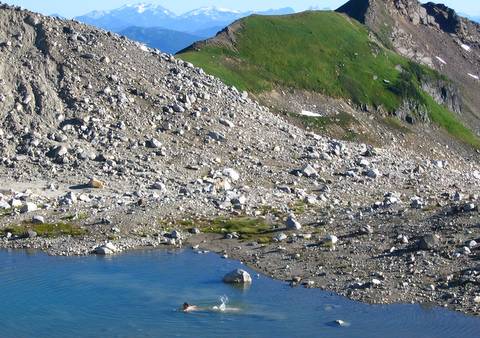
Swimming near Camp

Camp
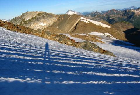
Morning shadows on White Chuck glacier

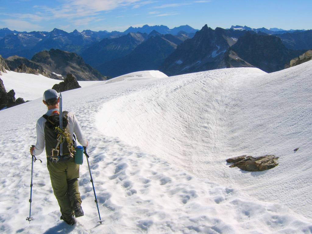
Mike on Suiattle Glacier

Matt on East Summit
Mike on Main (West) Summit
Mike Descending to Toe of Glacier
Ice-Melt Stream Falling into Crevasse

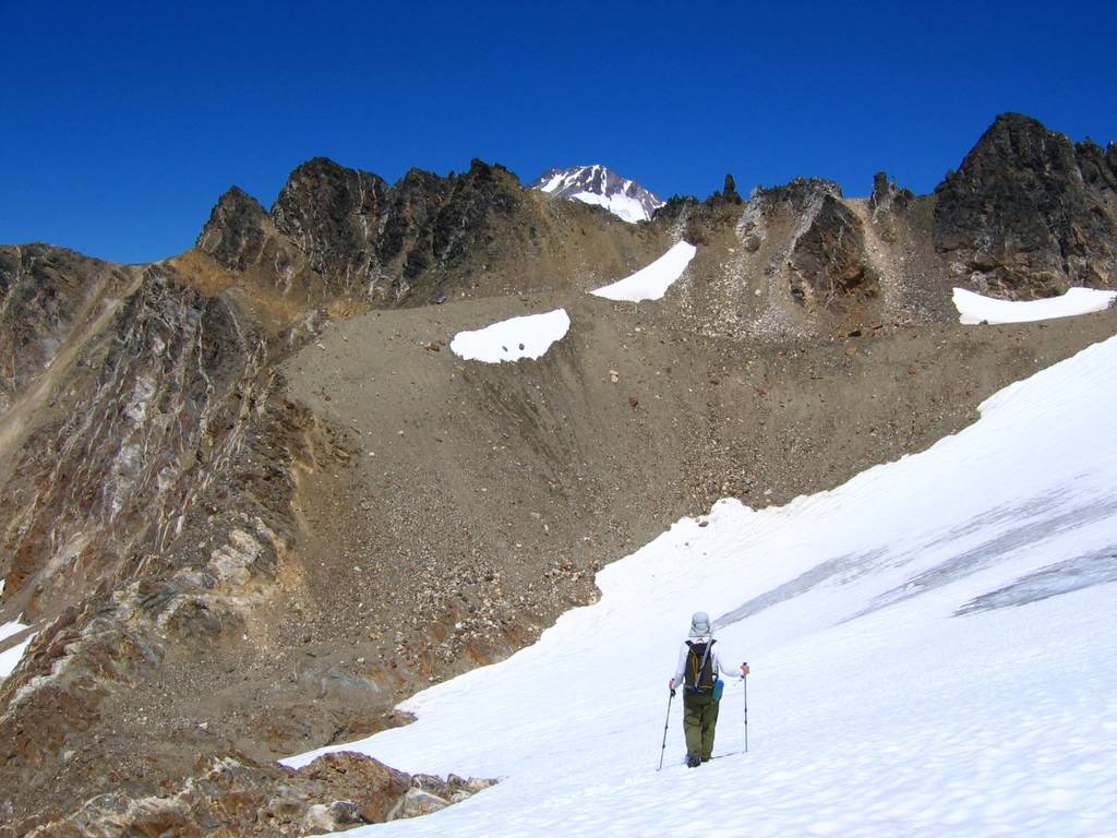
Lakes on return to camp.

|
|
Pictures
& Maps: (Click
any photo above or below to enlarge.)
|
[ MtnVista Home Page ] [ Family Home Page ] [ Mountaineering Home Page ] [ Recent Updates ]
  
|
Kololo Peaks
(USGS Glacier Peak East, GT Glacier
Peak)
July 30-31, 2005
|
|

|
|
|
|
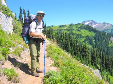
Party: Mike Torok,
Matt Burton
Introduction:
Kololo Peak is a rock crest surrounded by glaciers on the
south side of Glacier Peak, one of the Second 100 highest peaks. The trip had three stages: first hiking the North Fork Sauk trail to
beautiful meadows by White Pass, second crossing the glacial wasteland of
rock piles and scattered ponds gouged out by the Whitechuck Glacier before it
retreated, and third crossing successive glaciers (Whitechuck, Suiattle, and
Honeycomb) to reach the peaks on the summit ridge.
Last year we had attempted Kololo as a three-day trip, but
rain prevented us from getting beyond White Pass. This weekend we only had two days, so we can up with a
deceptively simple plan: we would
just walk faster. Actually it was
more like a foolishly exhausting plan.
We didn’t actually move faster, we just kept moving longer, putting
two days worth of hiking (17½ hours) into the second day.

The most interesting part of the trip ended up
glacier-scoured terrain between the meadows and the glacier. It looked like it would just be barren
wasteland, but it was actually a fascinating jumble of rock piles, sand, and
water. There were little ponds hidden
all over among the rocks. The water
ranged from bright blue tarns fed by snowmelt, to deep green tarns fed by
powdery glacial water, to deeper muddy green tarns that accumulated silt
without any outlet. At the retreating
toe of the Whitechuck Glacier, we walked across streams of water that ran
over, under, and around the glacier and then spread out to fill ponds in the
barren basin from which the glacier had retreated.
|
|
|
|
Details:
Saturday
North Fork Sauk Trail (Trailhead to White Pass)
The North Fork Sauk trail seems to have only two grades:
flat by the river or steep up the ridge.
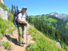
The first six miles gained less than a thousand feet following the
river through old-growth forest from the 2100-foot trailhead to the Mackinaw
Shelter (3000 feet). Then it climbed
3000 feet in the next 2.7 miles, in switchbacks hacked out of the brush of
avalanche slopes. The soil was
broiling and the black flies hounded us.
My skin felt like an unhappy stew of heat, coated with sunscreen and
insect repellent, with sweat running down me, and flies bouncing off me.
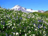
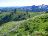
The reward came in the meadows above 5000 feet. We gained a breeze to cool us off and keep
the flies away. Anywhere a small
stream trickled down, the meadows were filled with flowers. We stopped to pump water at a little
stream that had only a trickle of flow, but all around it were big bunches of
flowers. You’d have pay a fortune to
create this kind of water garden in town, but here it spread naturally for
hundreds of feet above and below the trail.
Higher up, there were wide swaths of purple and white flowers stretching
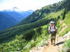
up to the ridge crest. Behind us,
Sloan and the Monte Cristos came into view, and ahead we could see Indianhead
Peak rising above the bright green meadows of White Pass (6000 feet).
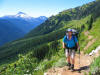
Lighting Creek High Route (White Pass to Camp)
At White Pass, we turned onto the Lighting Creek high
route, which was a very well beaten trail traversing northeast past the flank
of White Mountain. At about 6250
feet, we turned uphill to hike up to the ridge crest just before (west) of a
distinct rock outcrop. We back side
was steep, so we went a little further east on the crest and then dropped
down loose rock and steep meadow a couple hundred feet into the glacial
basin.
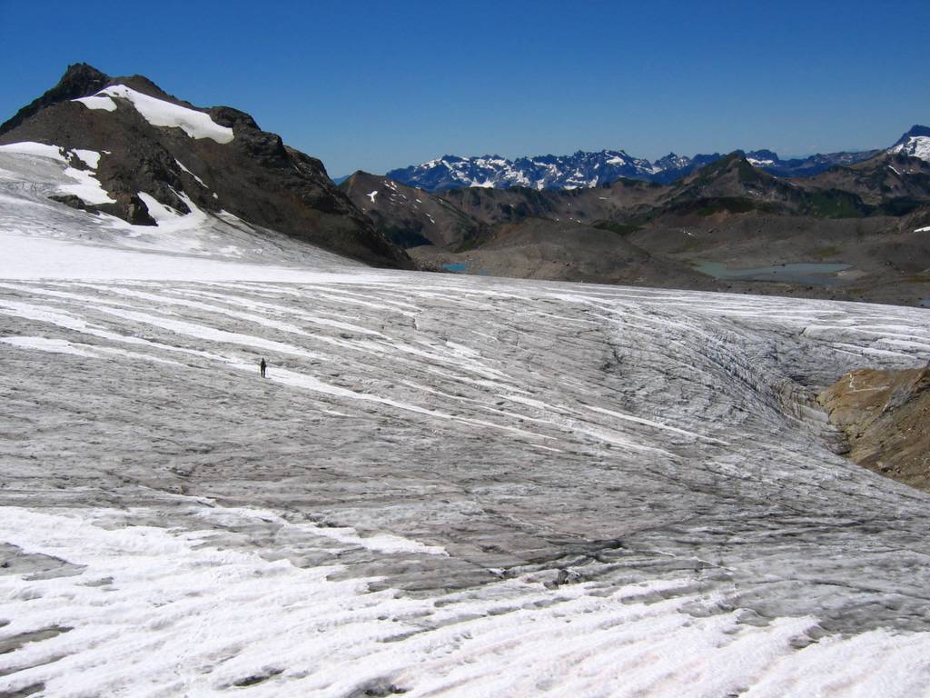
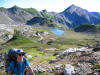
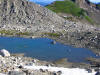
From the ridge crest, we could look down see miles of dirt
and rock piled up across a low-angled basin left behind by the retreating
glacier. We headed northeast to cross
the low point of the basin and then northeast toward the glacier, which was
hidden behind successive piles of rocks and moraines. Below us was a pretty lake with White
Mountain behind us. Across the
valley, I could see the White Chuck Cinder Cone, where I had camped on the
first three-day trip I ever made in the Cascades, as a hiker on the White
Chuck trail back in 1987,
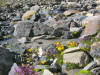
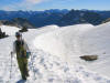
The basin was filled with rock piles, separated by
stretches of sand or pumice, and watered by occasional streams and
snow-patches. We followed the basin
up to a crest at 6600 feet, not far from the southwest corner of the glacier,
separating the previous older basin from a newer basin even more barren from
the glacier’s recent retreat. We put
our camp there on a very comfortable flat patch of sand, with two small tarns
nearby, and a view of Glacier Peak on the rise above us. I went swimming in the nearest tarn, which
made a great swimming pool. It was a
couple hundred feet long but only about four feet deep, with a soft sandy
bottom and refreshing warm-cool water.
Sunday
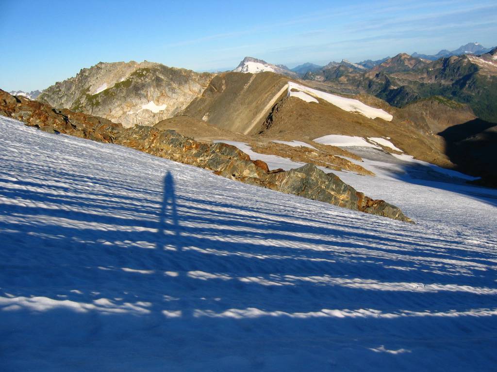
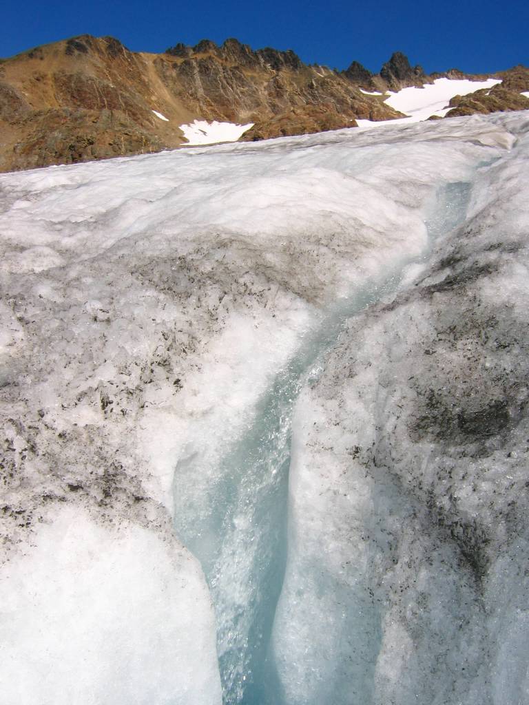
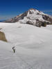
Up the White Chuck Glacier
We left camp at 5:45 in the morning and walked uphill to
reach the toe of the glacier at about 6800, discovering multiple additional
small lakes along the way. The lower
glacier was bare ice and frozen solid during the night, so we cramponed
easily up the slope. The bare ice
showed lots of small crevasses, but nothing that was a serious obstacle. Below us, we could see at least more and
more ponds reflecting the morning light like silvery cut-outs in the shadowed
basin. As we ascended, we crossed
into sunlight and white snow higher on the glacier, and the ponds turned
bright blue reflecting the early sky.
From here we could see that there were at least a dozen ponds, with
several larger lakes that had been hidden at lower elevations.
First Route-Finding Error
We headed up the glacier a little too easily and never
stopped to check that out route should have traversed north to get to the
permanent snow/ice filed above a ridge at the northeast corer of the
glacier. Instead we ended at a
7600-foot foot col, looking down several hundred feet at the stagnant lower
lobe of the White River Glacier. The
bottom lobe of the glacier was melting back into the hollow, covered in black
dirt and surrounded by meltwater ponds.
Actually, we could have made a loop trip at this point, by following
the ridge north to the 7200-foot col, then dropping east onto the middle of
the White River Glacier, then ascending back up northeast to the east summit
of Kololo. Instead we retraced our
steps downhill a few hundred feet and across to the north edge of the
glacier, where we climbed to the higher snow near a stream gully and then
followed snow and rock to a col at 7800 feet on the minor ridge between White
Chuck and Suiattle glaciers. (This
was our first route-finding error of the day, which cost us about 45
minutes.)
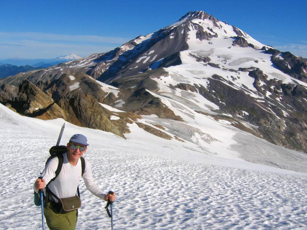
Across the Suiattle Glacier
From here, we had wide-open views of the south face of
Glacier Peak, and the wide expanse of glaciers and glacier-cut rock that
stretches between Glacier & Kololo.
The sun had warmed the snow cover up here, so we continued without
crampons. On the Suiattle Glacier, we
traversed summit ridge circa 8000 feet, where the ridge of Kololo had
multiple outcrops with deeply carved wind galleries between them. The summit turned out to be the first
point after the ridge crest, but we overshot it, so we decided to go on to
the east summit first and then get the main summit on our return.
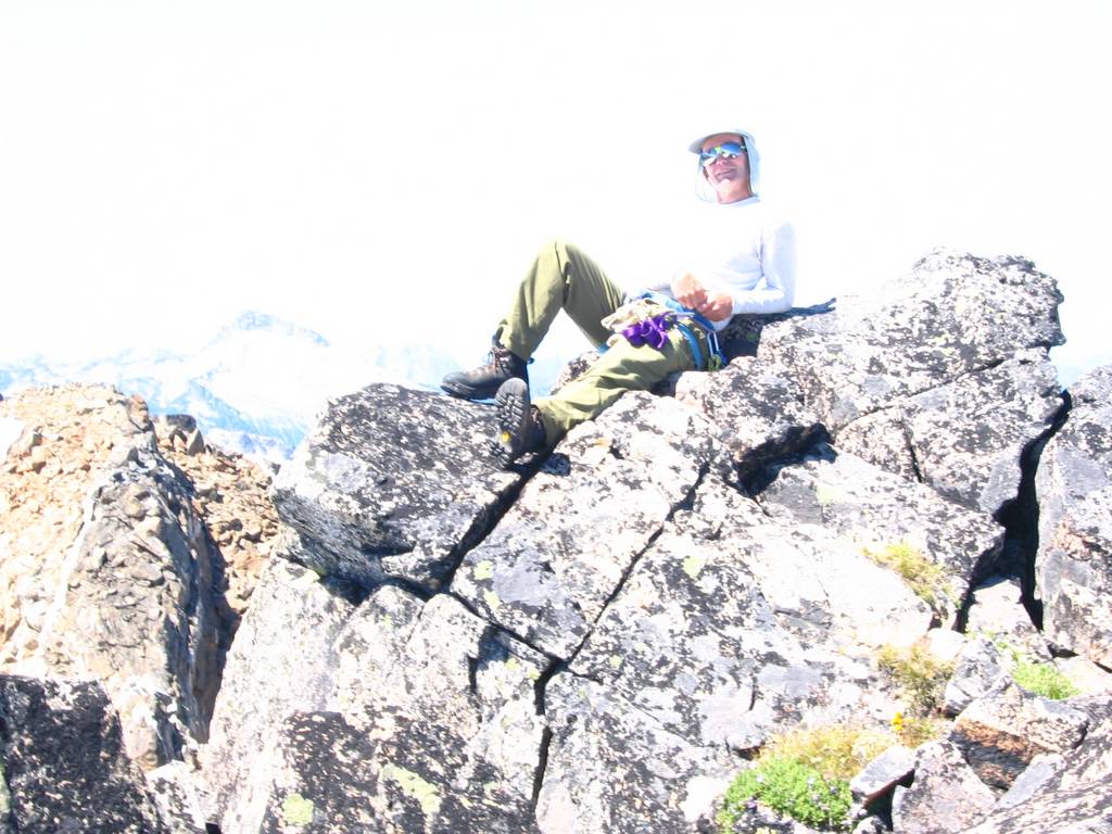
Honeycomb Glacier, East Summit (8160), and West Summit
(8197)
An east-trending nose led us to the Honeycomb Glacier,
where we could see an easy line curving southeast and then southwest to the
summit. This glacier showed some
larger crevasses, so we roped up for the crossing. The east summit (8160) was a wide pumice covered ridge with a
few rock outcrops and superb views of the surrounding area. Tenpeak, Luahna, and Clark showed up
clearly. Mike had also wanted to do a
couple bonus summits (because they had 400-foot prominence) further east, but
we didn’t have time to go there.
Further northeast, a new fire on Dirtyface Peak sent plumes of smoke
towering into the air. The wide
pumice field on the ridge was soft enough that I lay for a while on my back
just enjoying the view of the sky above the peaks at the periphery of my
vision. Then we retraced out path
back to the main summit, which had just a bit of a steep snow finger to get
to the top. We found a film-can
register left by Don Goodman in 83.
After more pictures and views, we headed back to camp.
Descending the Glacier (Ice-Melt Streams and Glacial
Ponds)
With full daylight, the lakes in the glacial basin made a
fascinating display of colors. The
clearest lake, near where we had camped, was a deep blue. Other snow-fed lakes up on the moraine
were blue-green, having picked up some glacial powder. Below the foot of the glacier, a series of
lakes and streams (the head of the White Chuck River) were a bright
grayish-green with the loads of silt washing down from the glacier. Further down, a large lake confined in a
basin with no surface outlet was a deep yellow-green from the build-up of
silt.
In the warm sunshine, the toe of the glacier was alive
with water. At edge of the glacier,
we crossed alternating stripes of black and white, black being the dark
surface of the glacial ice, and white being the fresh snow filling the lines
of crevasses. In the flat center, the
surface was covered with little streams of clear water running down the
glacier. Occasionally the water would
splash and gurgle into small crevasses, where we could see it making little
waterfalls inside the crevasse and could hear it running in streams far
below. Farther down, we could hear
the louder rush of multiple streams running out of the glacier onto the plain
of ground dirt and little lakes below the glacier. Where we exited the glacier (a couple hundred feet higher at
its southwest corner) there was a series of three beautiful little lakes
among the rocky moraines. (These
would be an ideal camp area.)
Exit (and Second Route-Finding Error)
We packed up our camp and headed out at about 3pm. Then we made our second route-finding
mistake. We headed to the nearest col
that would take us over the ridge separating our basin from Foam Creek,
crossing the second col to the east of Point 6770. A report from a previous traveler had led Mike to believe that
the Lightning High Route passed through Foam Basin, so we dropped into the
basin, which was a very steep descent that cost us an elevation drop down to
5900 feet. We didn’t find the trail,
and we spent a long time getting around the shoulder of 6770. Finally we found the trail back up at
about 6350 feet a little west of the shoulder. My guess is that the trail doesn’t drop down, but rather
traverses high on the shoulder to reach one of the cols nearby. Anyway, this detour cost us another hour.
Back on the high route trail, we made good time to White
Pass and down to the river. However,
we had lost too much time and energy, and we couldn’t get close to getting
out before dark. I ended up hiking
the last two hours by headlamp. Deep
under the trees on a moonless night, it was surprisingly dark. When I’d turn my light off for a break, I
couldn’t see even a trace of the trail route, just a few stars glinting
between the treetops above. Very
weary, I finally trudged into the parking lot at 11:15pm. During the tired day at work on Monday, I
kept myself going by remembering the high peaks, the green meadows, and the
rough beauty of the glacier-plowed basins.
Statistics:
TH to White Pass, 7 hours,
8.5 miles miles, 4300 gain
White Pass to Camp, 3
hours, 2.4 miles, 930 gain.
Summits: 8.5 hours, 6.6
miles, 2740 gain (includes 300 loss from route error)
Camp to TH: 8.25 hours,
11.5 miles, 1040 gain (includes 500 loss to Foam Basin)
Total: 29 miles, 9010
gain.
Related
Trips:
White Pass (Kololo Attempt), 8/27 - 8/28/04
|

Flowers below White Pass

Mike nearing White Pass

Crossing the lower glacial basin

Swimming near Camp

Camp

Morning shadows on White Chuck glacier

Mike on Suiattle Glacier

Matt on East Summit

Mike on Main (West) Summit

Mike Descending to Toe of Glacier

Ice-Melt Stream Falling into Crevasse

Lakes on return to camp.

|
|
|
|
Pictures
& Maps: (Click
any photo above or below to enlarge.)
|
|
|
|
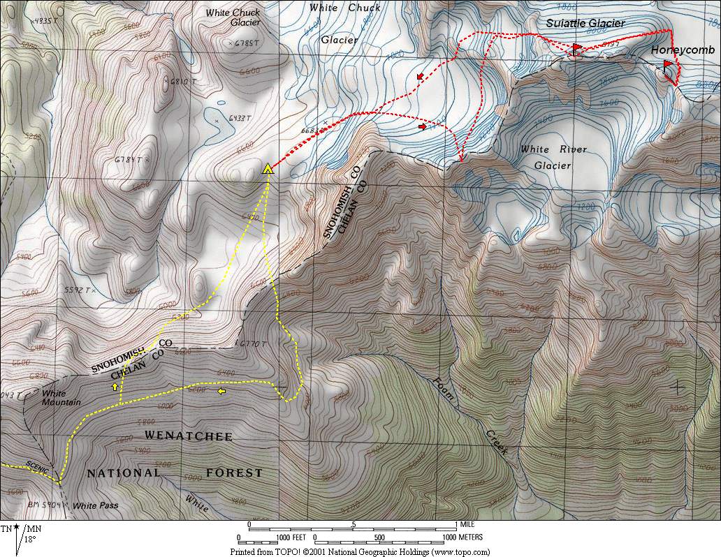
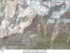
Map: White Pass to Camp to Summits
|
|

|
|
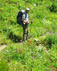
Flowers along the trail to White Pass
|
|
|
|
Mike on the trail amid flowers
|
|
|
|
Mike hiking up the hot trail
|
|
|
|
Matt hiking up the hot trail
|
|
|
|
|
|
Mike approaching White Pass
|
|
|
|
Coming over the 6600 ridge crest
|
|
|
|
Mike approaching the ridge crest
|
|
|
|
Stream & flowers among the rocks
|
|
|
|
Matt in the lower glacial basin
|
|
|
|
|
|
A refreshing swim
|
|
|
|
Mike in camp
|
|
|
|
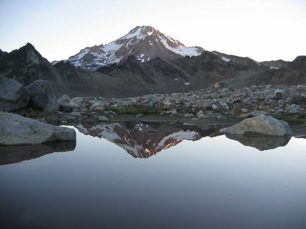
Quiet morning reflection
|
|
|
|
Lakes silvery before sunrise
|
|
|
|
Morning shadows on the White Chuck Glacier
|
|
|
|

|
|
First light illuminating the glacial lakes
|
|
|
|
Matt on the Suiattle Glacier
|
|
|
|
Looking down the White River Glacier
|
|
|
|
Mike hiking along a wind gallery near the Kololo crest
|
|
|
|
Mike coming up the Honeycomb Glacier
|
|
|
|
|
|
Matt on Kololo East Summit
|
|
|
|
Tracks to the East Summit
|
|
|
|
Mike on West Summit with Luahna & Clark
|
|
|
|
Mike reclining on the summit
|
|
|
|
Dirtyface Peak Fire
|
|
|
|
|
|
Glacial lakes below the White Chuck Glacier
|
|
|
|
Note the rubble on the walls marking how high the glacier once reached.
|
|
|
|
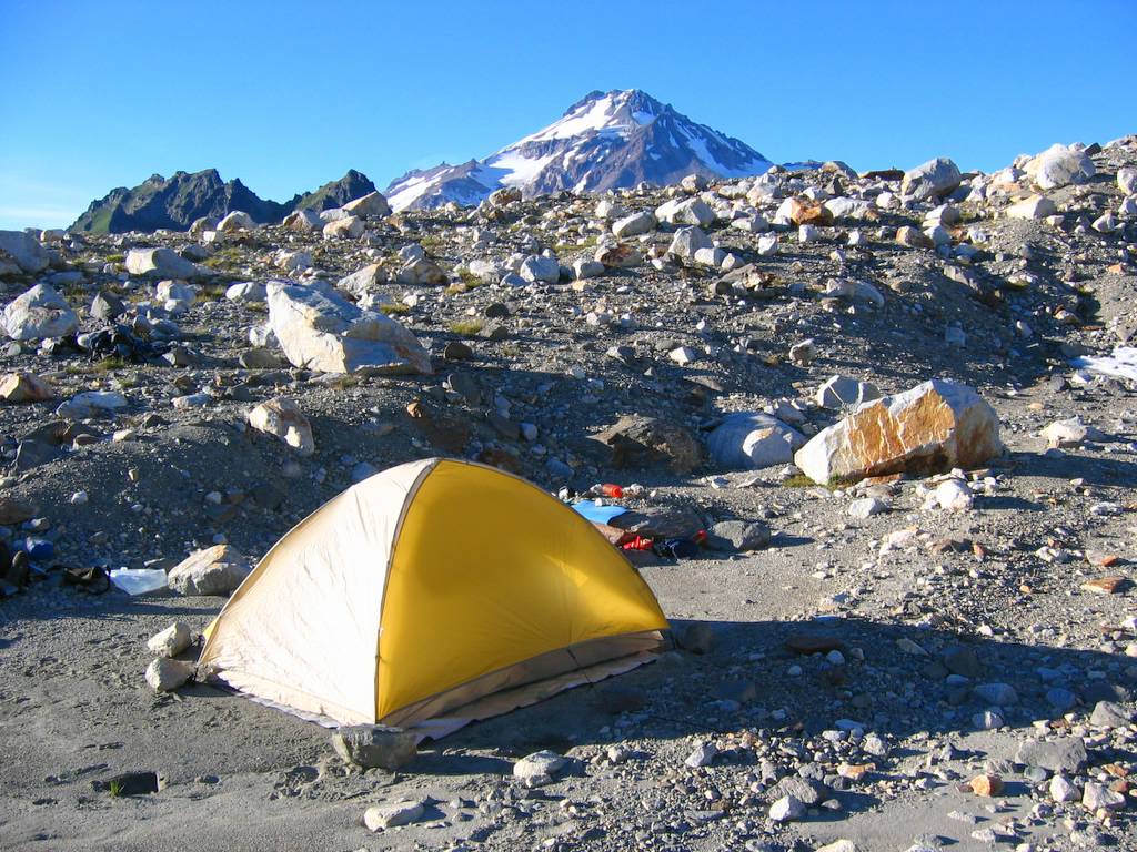
Little yellow tent among the rocks
|
|
|
|
Mike crossing the toe of the glacier
|
|
|
|
Meltwater stream running on the glacier
|
|
|
|
|
|
Stream running down to the toe of the glacier
|
|
|
|
Beginning of the White Chuck River
|
|
|
|
Lakes on the way back to camp
|
|
|
|
Lakes & White Mountain
|
|
|
|
Lake and Glacier Peak
|
|
|
|

|
|
Camp with glacier at top and tarn at right
|
|
|
|
Mike at camp
|
|
|
|
Lake & White Chuck Cinder Cone
|
|
|
|
Foam Basin
|
|
|
|
Family of marmots by the trail
|
|
|
|
|
Click
here for even more pictures of flowers and lakes.
|
|
Top of Page
|
|