|
|
|||||||||||||||||||||||||||||||||||||||||||||||||||||||||||||||||||||||||||||||||||||||
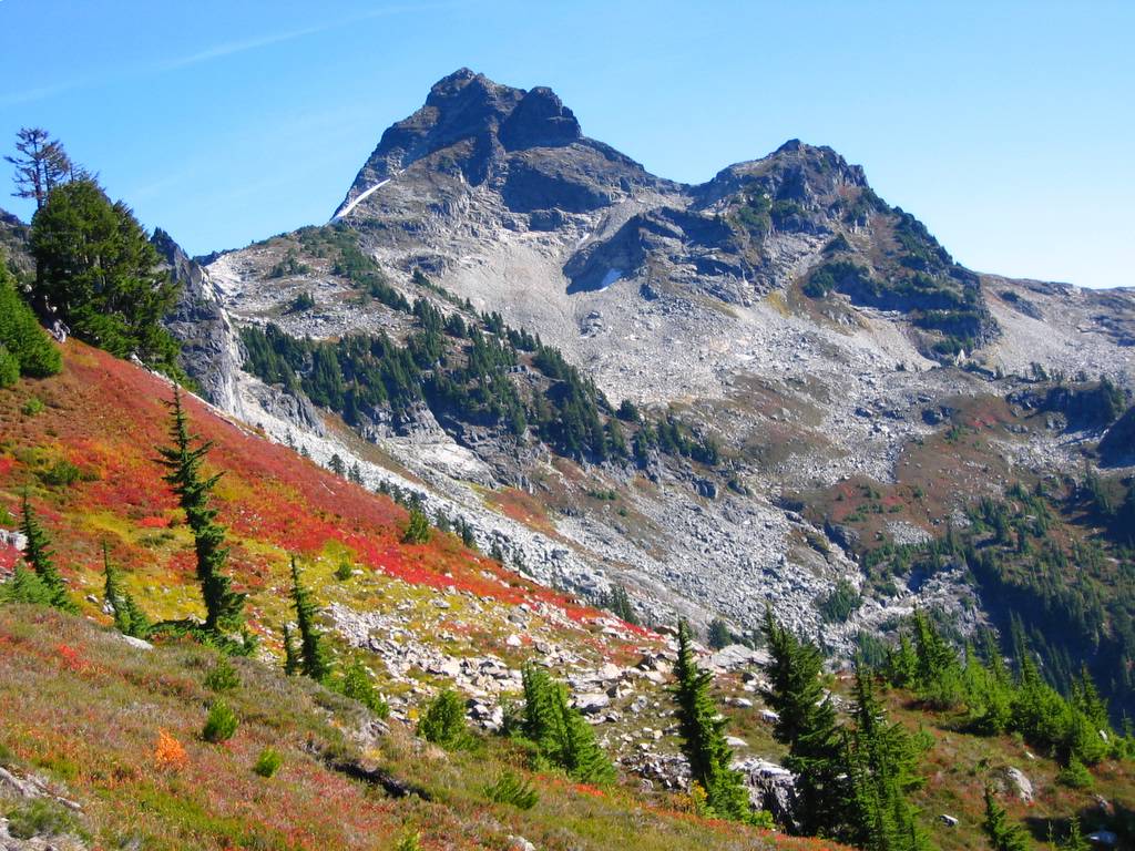
Mt. Chaval 7127(USGS Snowking, GT Snowking)September 24-25, 2005 |
|||||||||||||||||||||||||||||||||||||||||||||||||||||||||||||||||||||||||||||||||||||||
|
|
|||||||||||||||||||||||||||||||||||||||||||||||||||||||||||||||||||||||||||||||||||||||
|
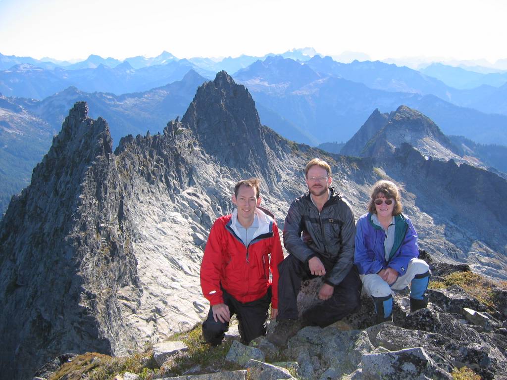
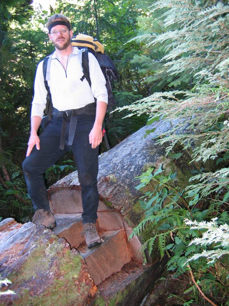
Party: Billie Butterfield, Eric Johnson, Matt Burton
We approached Chaval via Bluff & Cliff Lakes and ascended via the west route.
The trip included a little of everything:
|
|||||||||||||||||||||||||||||||||||||||||||||||||||||||||||||||||||||||||||||||||||||||
|
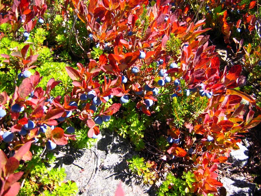
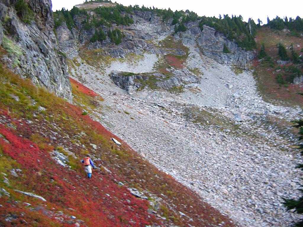
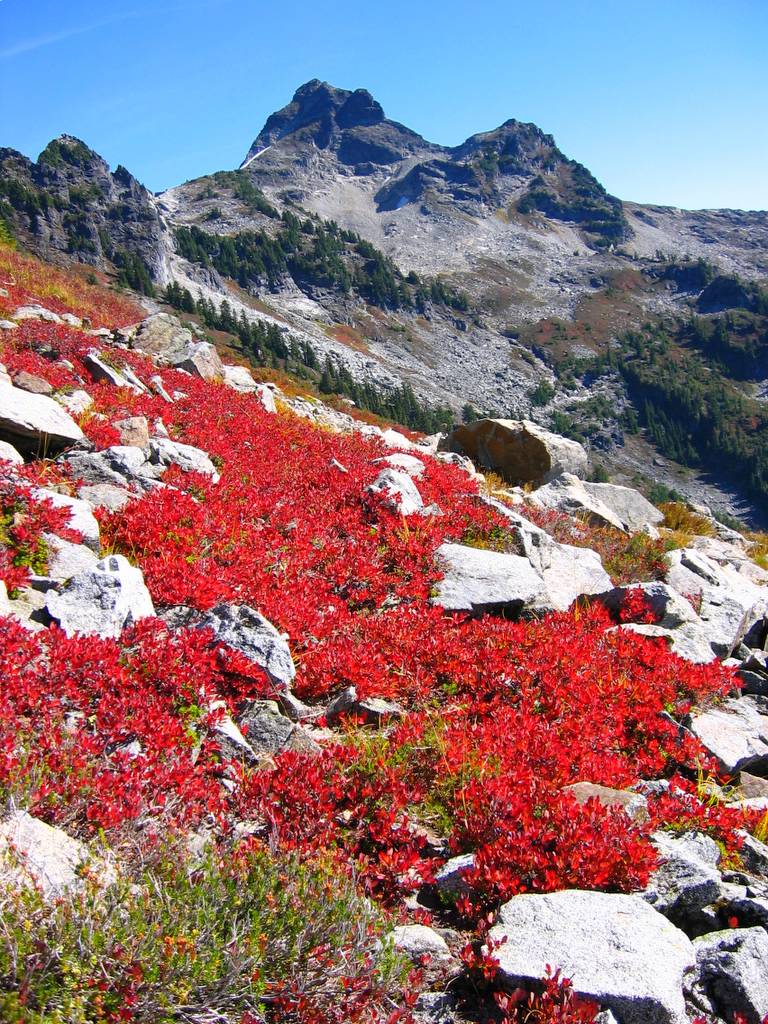
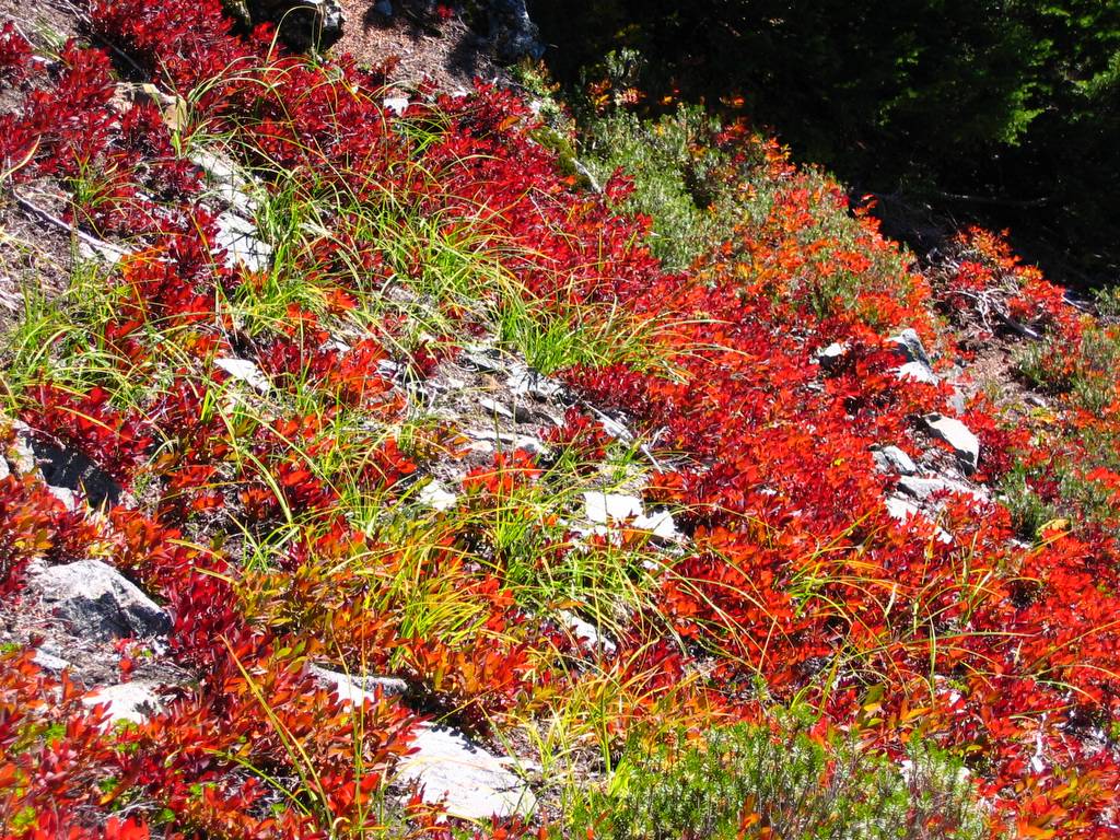
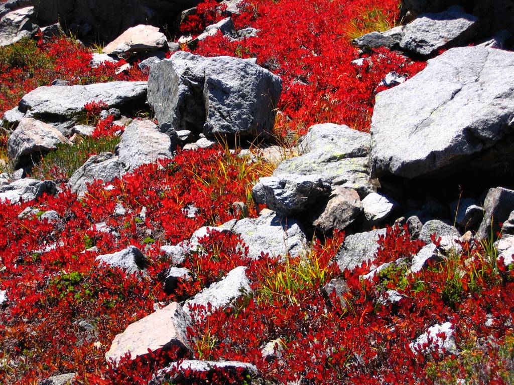
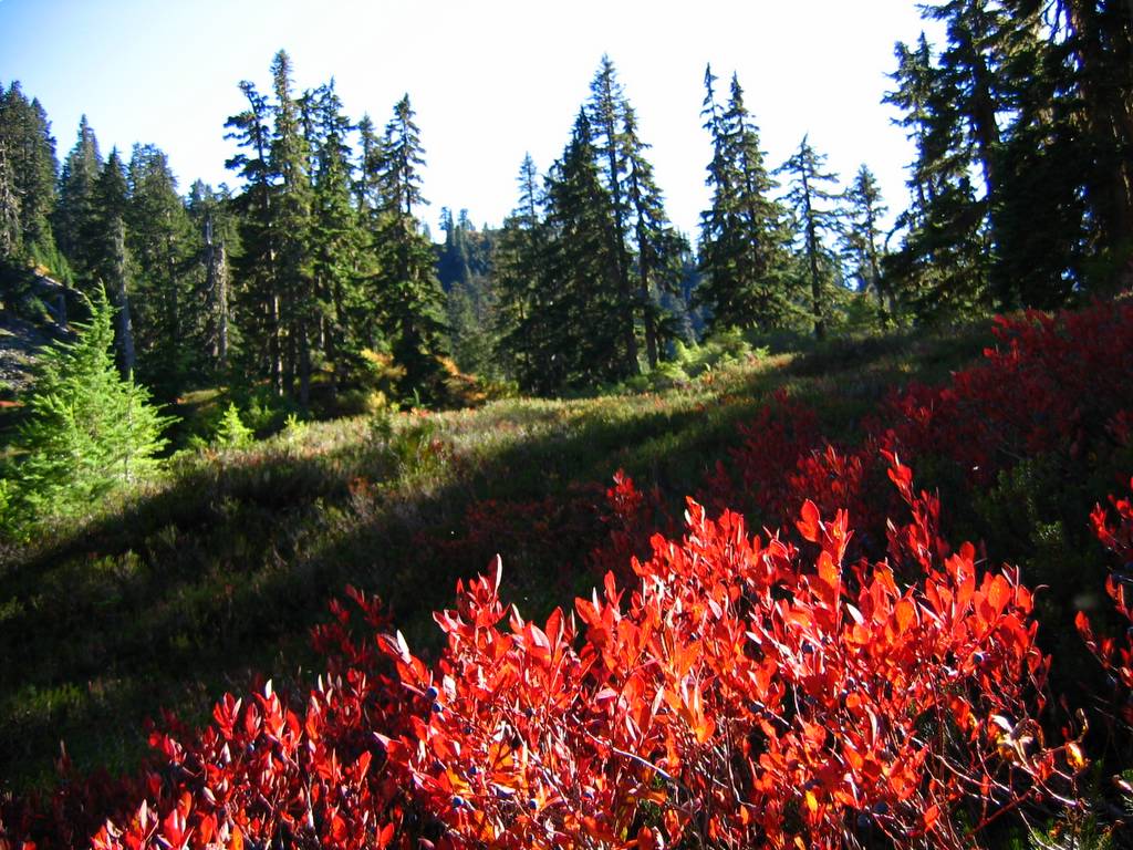
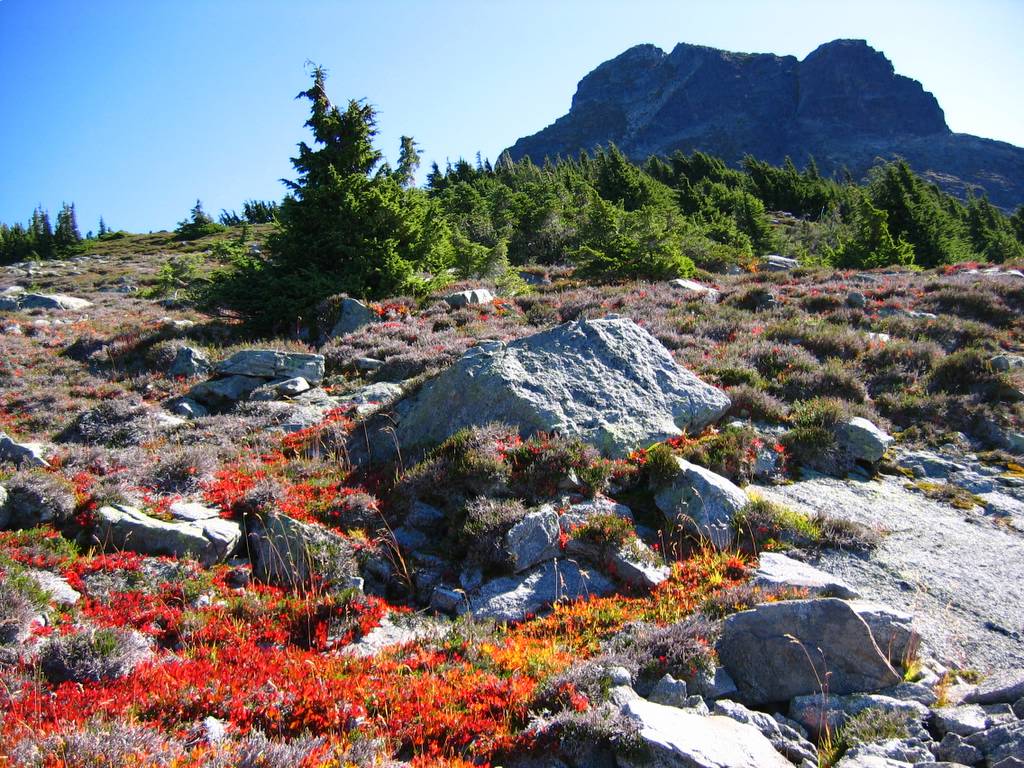
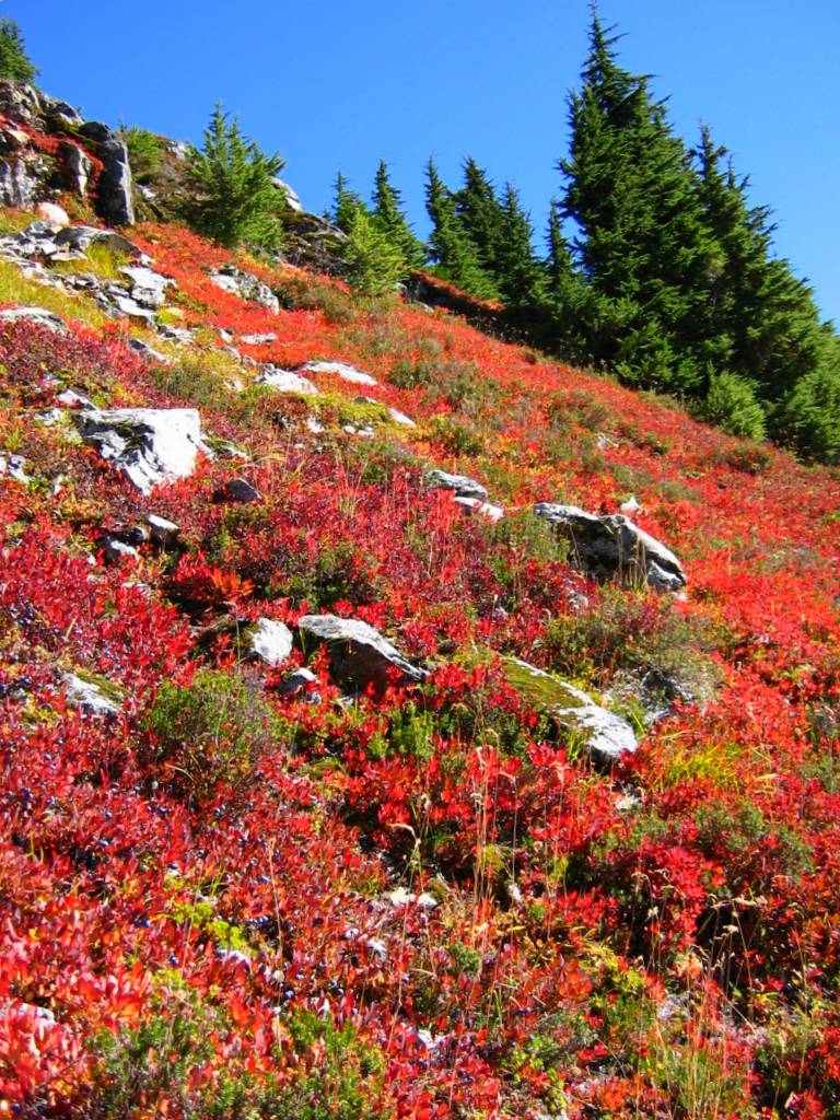
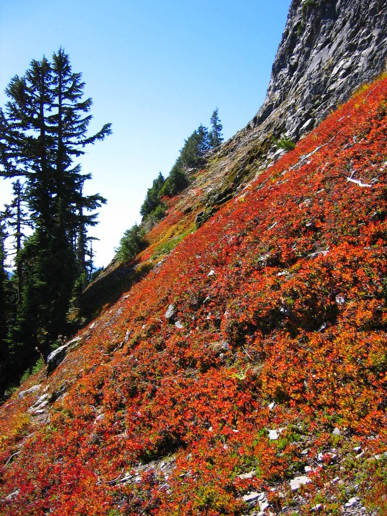
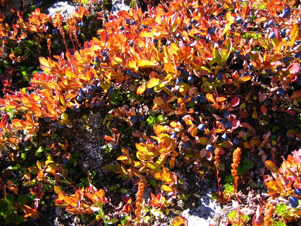
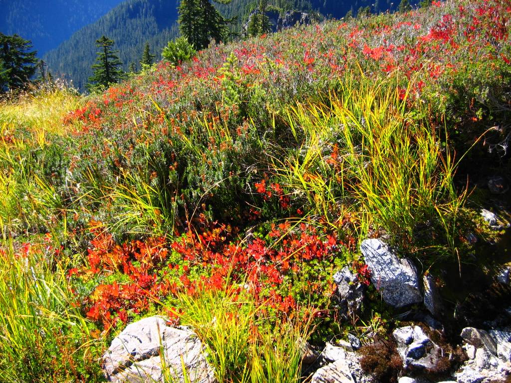
Best of all, the trip had blueberries in full color and full fruit. My descent seemed to halt every few steps for another handful of tasty berries or another picture of brilliant red leaves. |
|||||||||||||||||||||||||||||||||||||||||||||||||||||||||||||||||||||||||||||||||||||||
|
|
|||||||||||||||||||||||||||||||||||||||||||||||||||||||||||||||||||||||||||||||||||||||
|
Report:
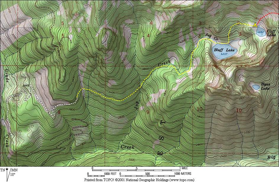
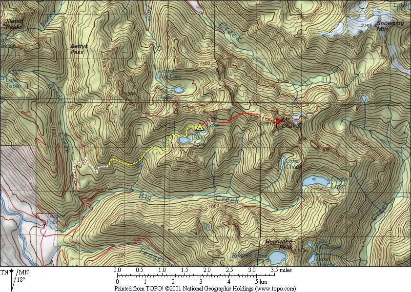
We parked at about 2200 feet on a spur from the Grade Creek Road. Departing at 8:40am, we hiked up the spur for a couple miles. At 3100, we turned to follow a fisherman’s track 3½ miles that took us to Jug Creek and Bluff Lake.
The fisherman’s path exemplified the concept of a necessary evil. It was a rough track twisting up and down around obstacles, but it traversed slopes that would have been almost impassable otherwise. The earlier part of the trail had many cut logs, including one with stairs cut up and down its sides. Later on the route, we had to keep a sharp eye out for flags to mark the track’s unpredictable twists and turns. Fortunately, there were always flags to be found – pink, orange, yellow, and some faded simply to white. The worst part was crossing the many gullies. One early gully was filled with huge downed trees to climb over and under. Another gully traversed a slope of hard-packed sandy gravel that even had a fixed line.
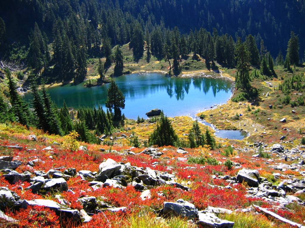
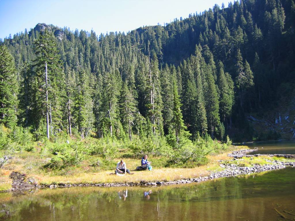
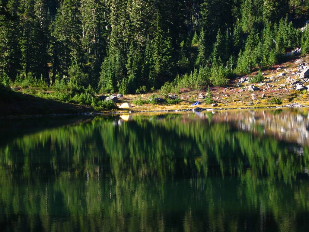
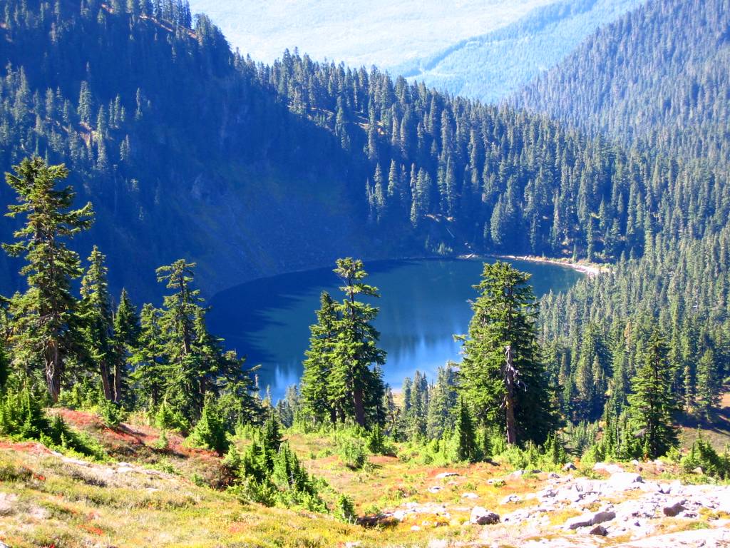
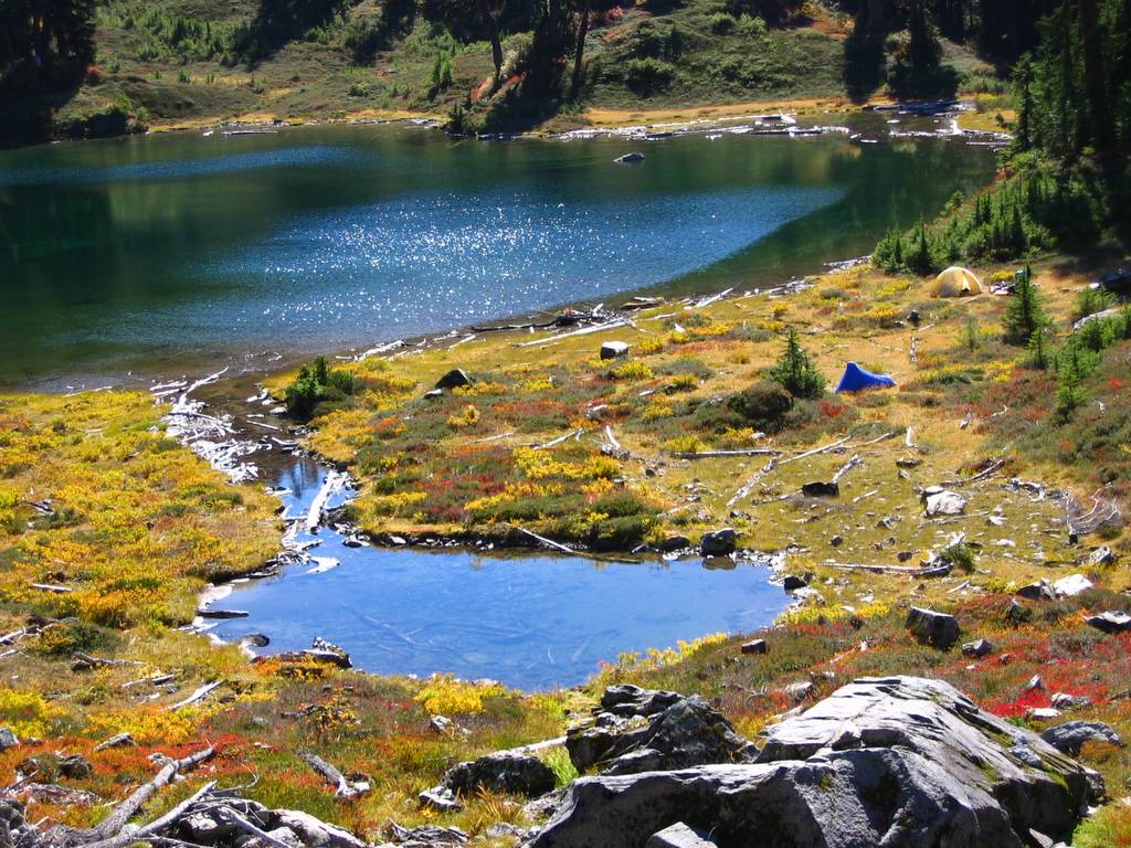
Bluff Lake 4237 was a wide circle of water with forested cliffs shadowing its north side and sunny meadows on the south side. I feasted on blueberries near the outlet, and then we had lunch on the grassy shoreline near the inlet.
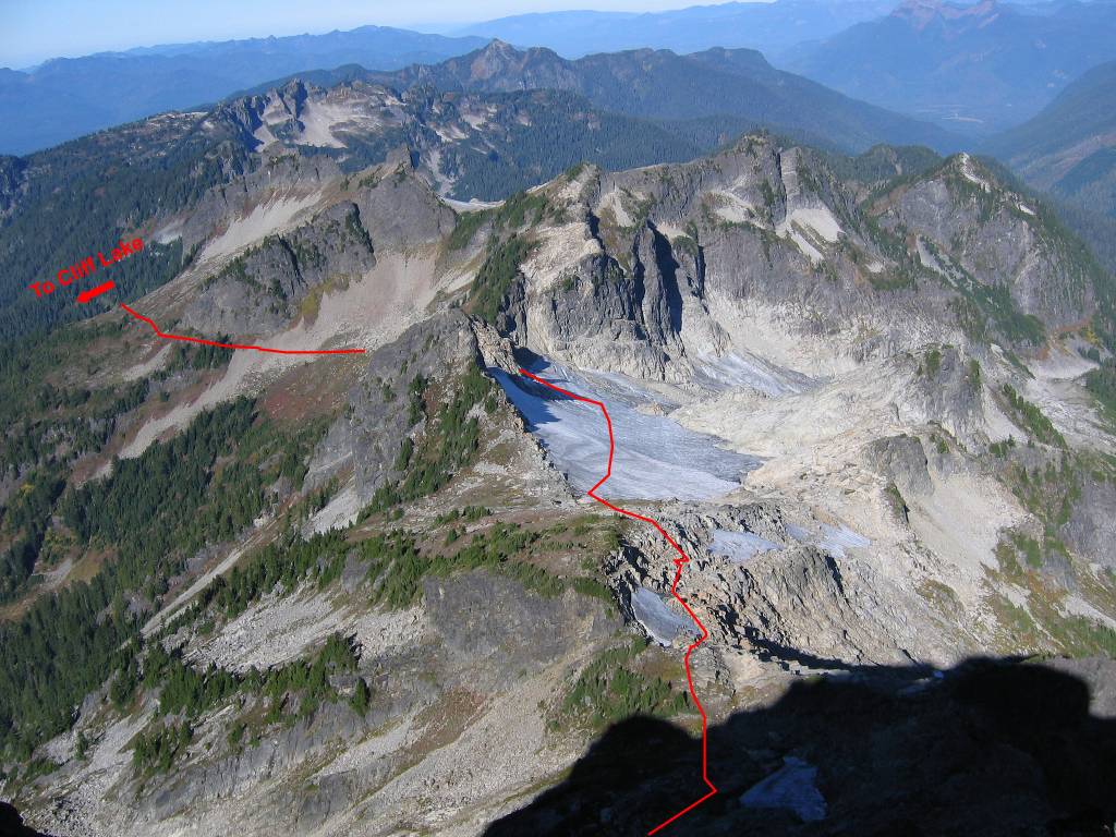
To reach Cliff Lake, we followed the contours that looked easiest on the map. From near Bluff Lake’s outlet, we headed uphill in a gradual curve from north to northeast and east, traveling through moderately steep forest and occasional brush, and arriving neatly at Cliff Lake about 3:15pm.
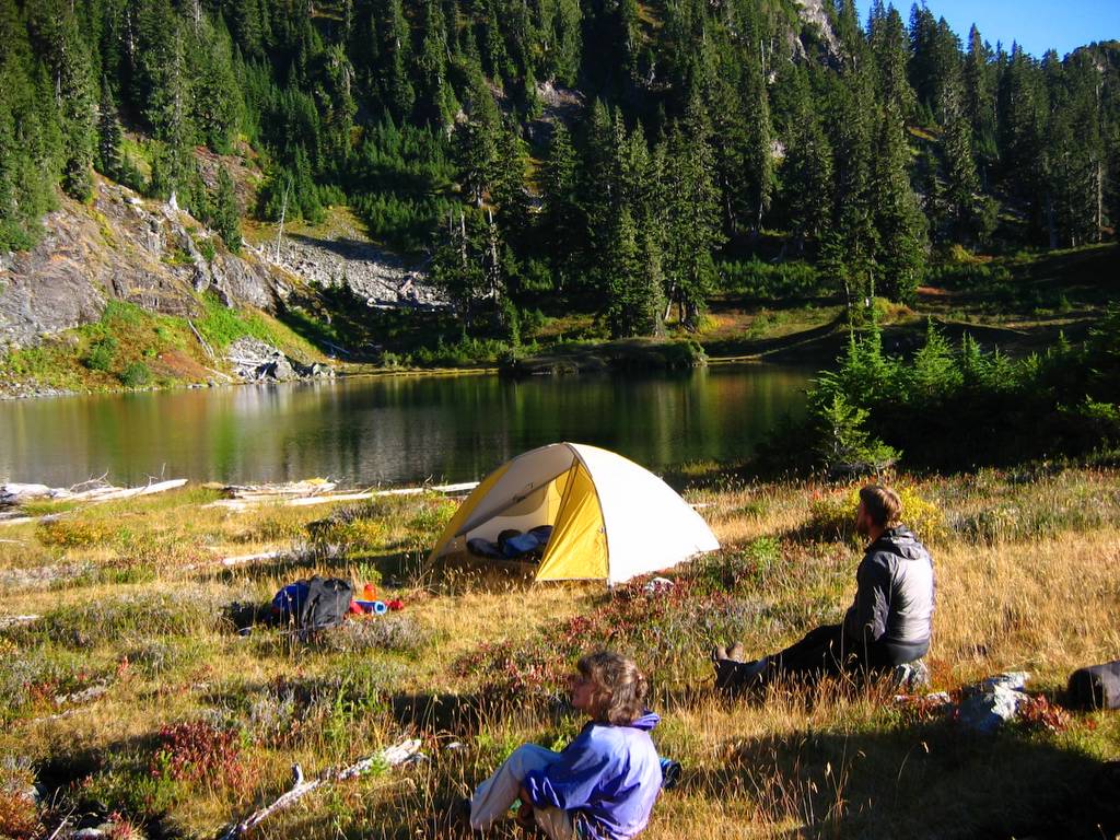
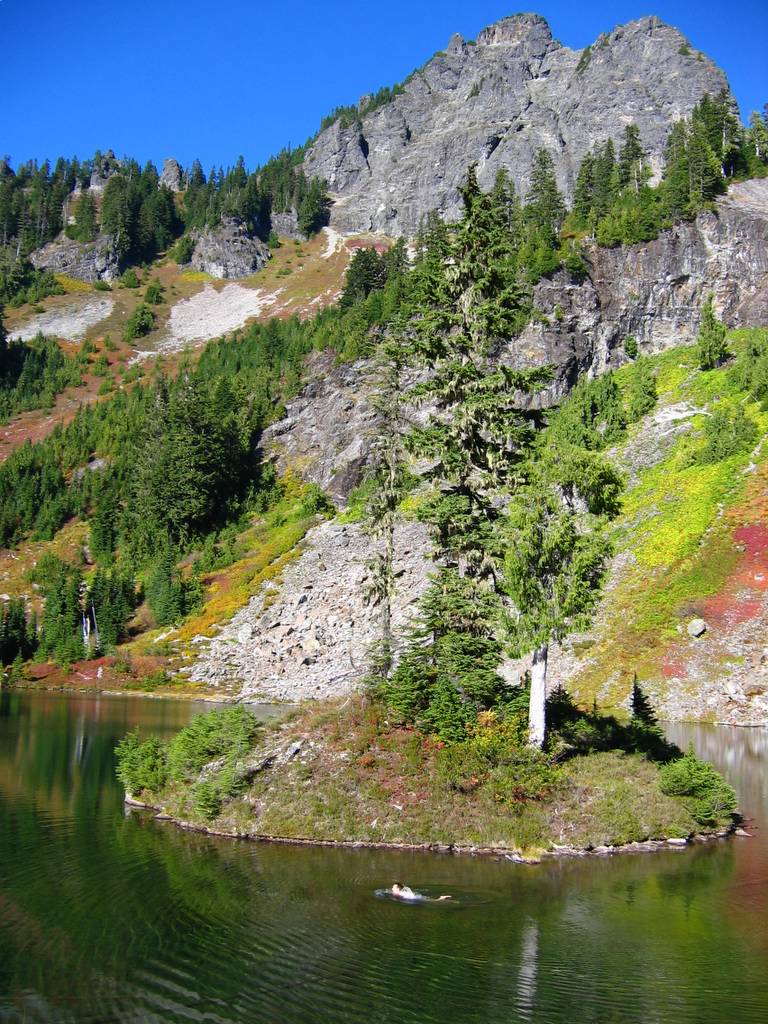
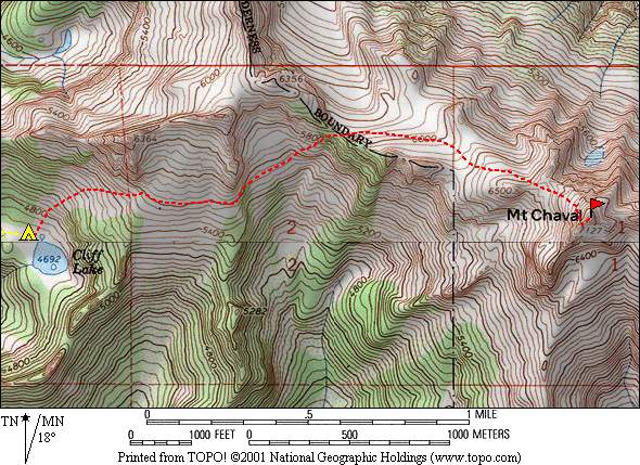
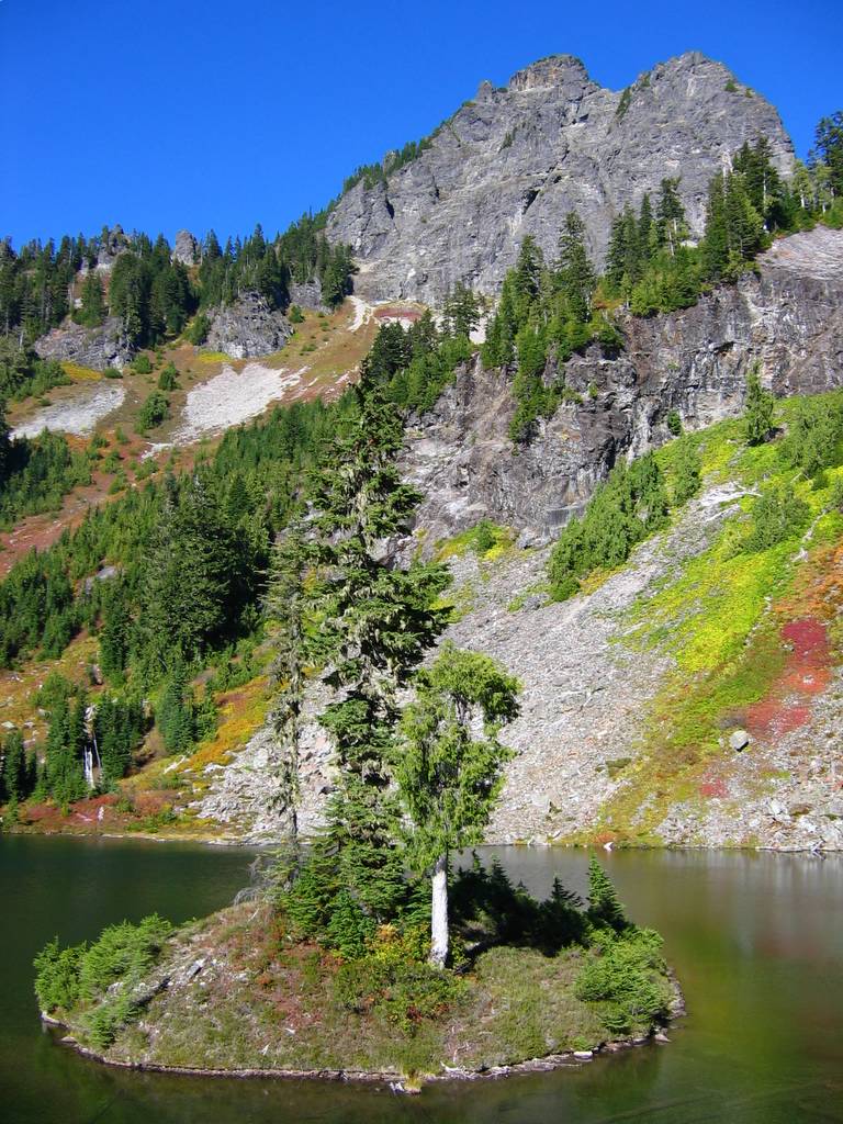
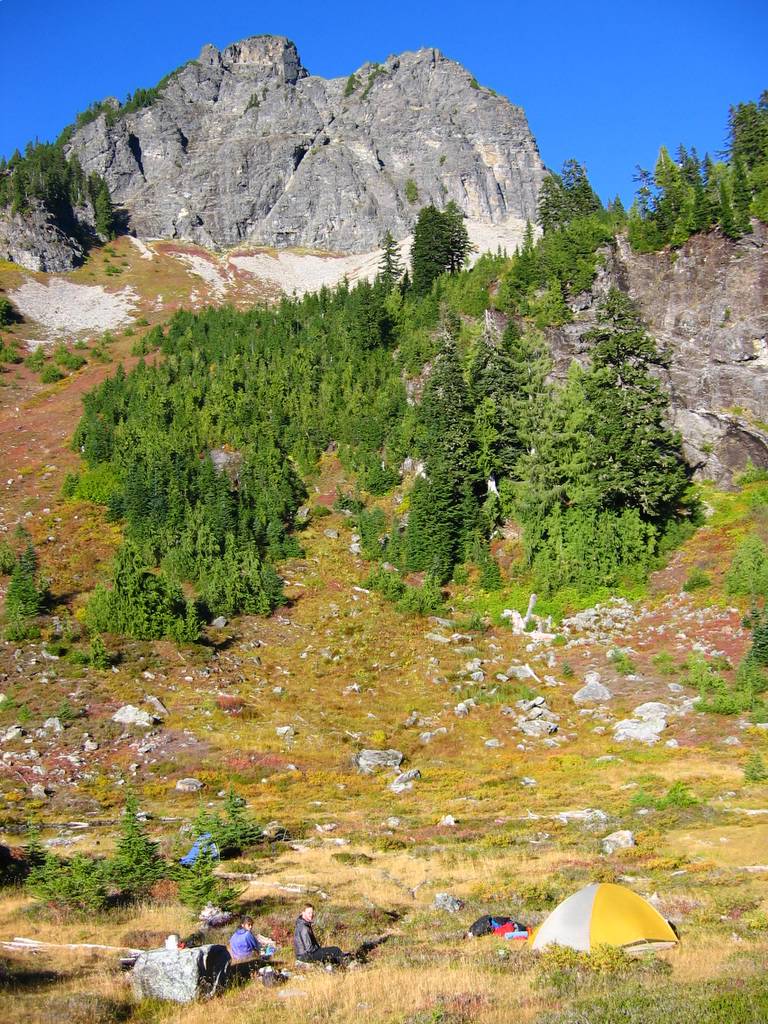
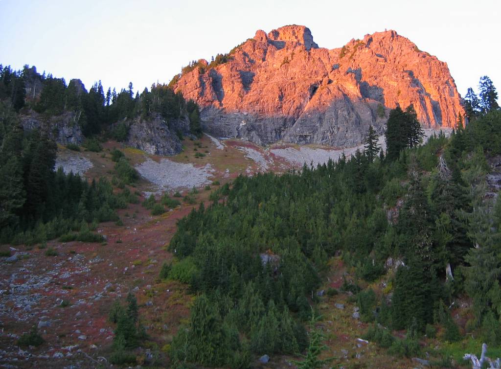
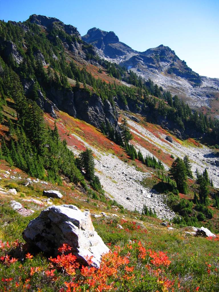
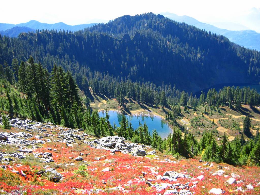
We set up a very comfortable camp on meadows at the northwest end of Cliff Lake. I went for a swim near the island, but didn’t climb out onto the island, because the water was too chilly to endure getting out and back in again. Sunset lit up Point 6364 above our camp, with a nice line of colored meadows and gray talus marking the route. Late in the evening, a flock of bats fluttered low over the lake, apparently hunting insects. As we settled into our tents, an owl circled in silhouette overhead and made several passes over the lake, perhaps hunting bats.
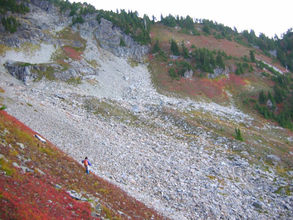
On Sunday we arose early and headed north up the meadow at 5:55am. There was enough light to see by 6:30, but we remained in Chaval’s shadow for most of the morning. The route led us north and then northeast up the meadow to traverse at about 5600 feet below the outcrops of Point 6364 and the next point. Then we dropped slightly to traverse talus and meadows toward the col at 5900. (We didn’t drop into the gully below the col, but rather took meadows to the crest just west of the col and made a few steep steps down to the col.)
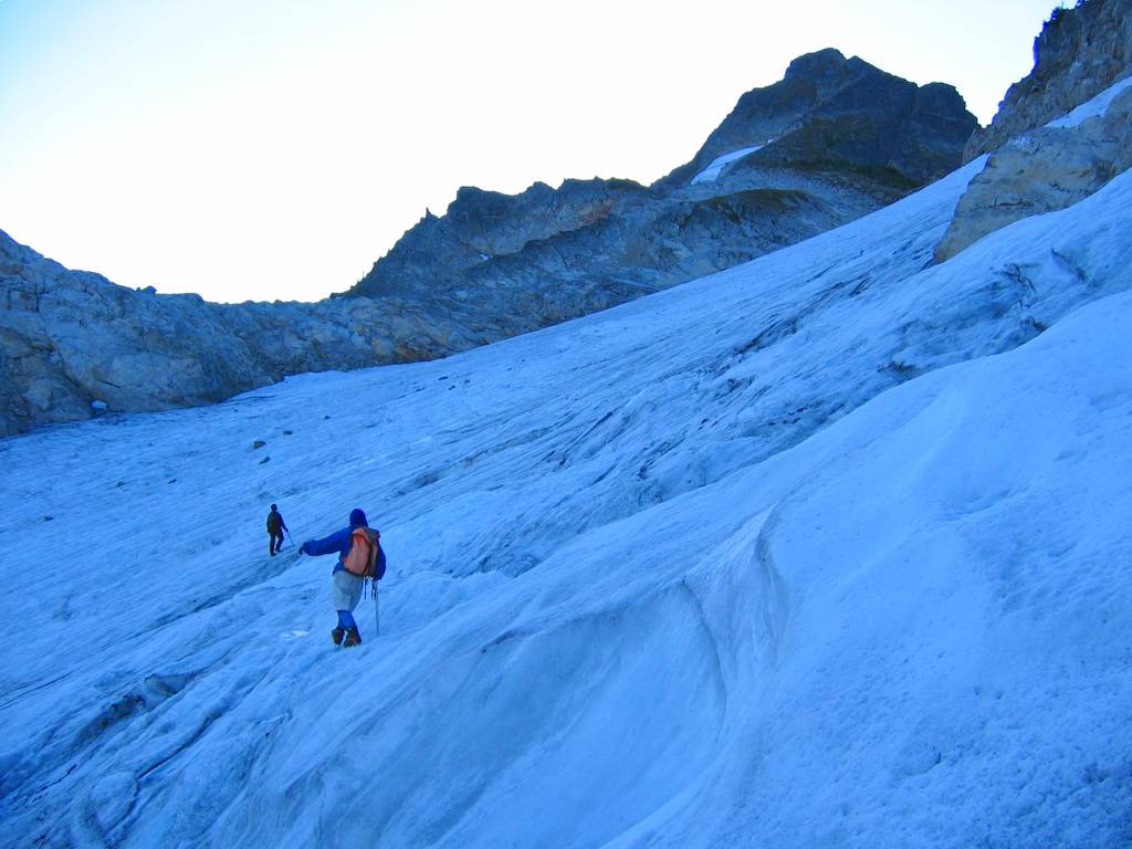
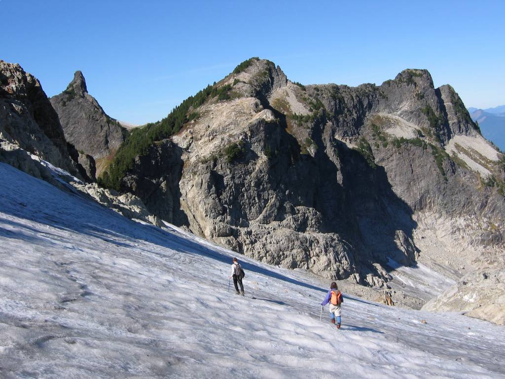
North of the col was a glacier that’s not shown on the map. It was bare ice but low-angled, so we cramponed upward, carefully avoiding spots of smoother water ice where the afternoon sun had melted the surface. At the top of the glacier, circa 6100, we finally reached sunlight. From there we walked up meadows to reach the ramp that angles up the west face. The ramp looks steep from below, but it was at least eight feet wide and provided an easy course up to the summit ridge and a brief scramble to the summit, arriving at 9:30am.
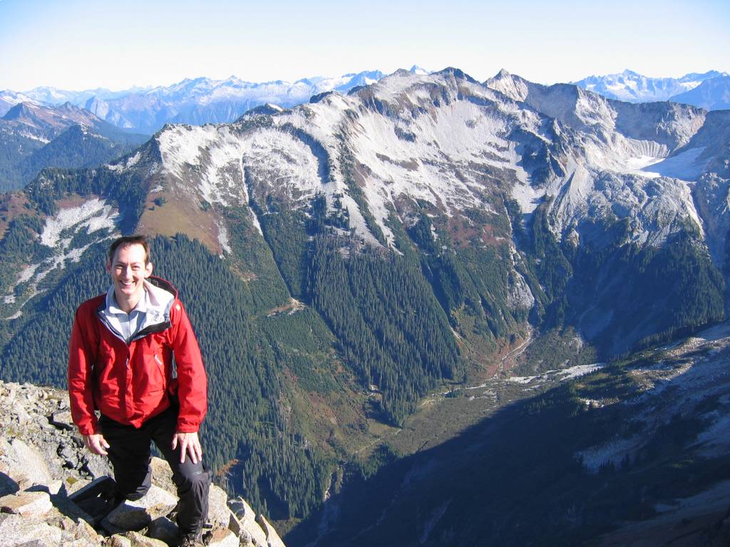
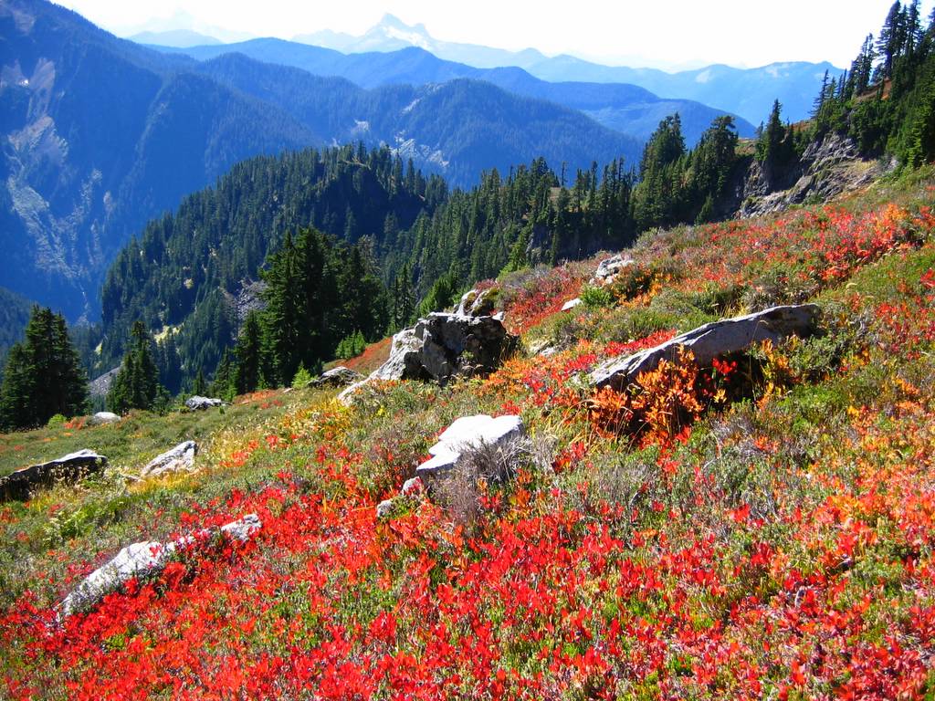
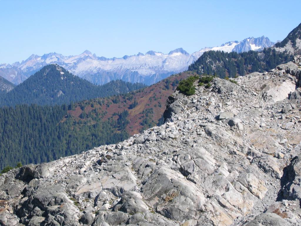
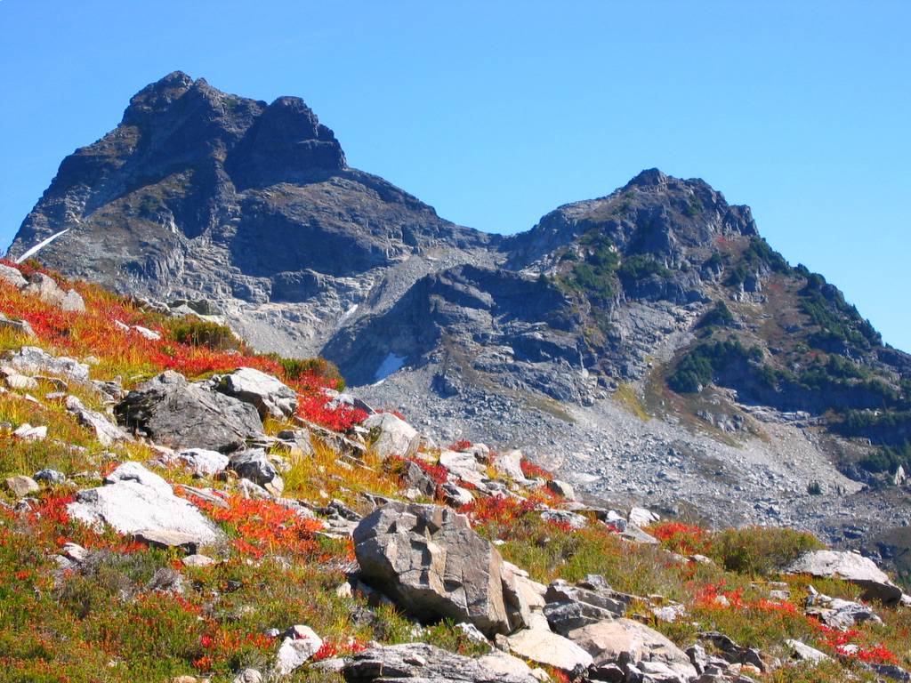
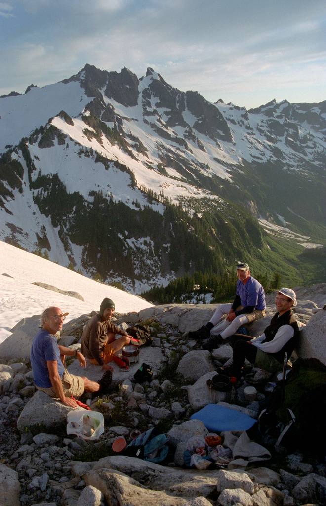
Across the Illabot Creek Valley stood Snowking. At the right hand edge of the peak, I could see the high snow bowl where we had camped and admired Chaval on the Buckindy Traverse. Going left, I could trace our whole exit path across the south face of Snowking and down the ridge. Like all the surrounding peaks, Snowking looked disturbingly dry and bare of snow.
We left the summit at 10:30, reached camp at 1:30, left there at 2:20, and reached the car at 6:00.
On our way down, the meadows were warm and bright in the late morning sun. My path was only an erratic approximation of the route, as I turned back and forth trying to pick berries with one hand and take pictures with the other hand. |
(Click any picture to enlarge!) Looking Back at Chaval |
||||||||||||||||||||||||||||||||||||||||||||||||||||||||||||||||||||||||||||||||||||||
|
|
|||||||||||||||||||||||||||||||||||||||||||||||||||||||||||||||||||||||||||||||||||||||
|
|
|
||||||||||||||||||||||||||||||||||||||||||||||||||||||||||||||||||||||||||||||||||||||
|
Statistics: Road 2177 to Cliff Lake 4692: 5.5 miles, 6:25 hours, 2515 net gain, 3190 cumulative gain. Cliff Lake to Chaval 7127 round trip: 4.8 miles, 7:35 (including 1 hr on summit), 2435 net gain, 2830 cumulative gain. Exit: 3:40 hours, 460 gain. Total: 15.8 miles, 6480 gain. Other
Route Info:
|
|||||||||||||||||||||||||||||||||||||||||||||||||||||||||||||||||||||||||||||||||||||||
|
|
|
|
|||||||||||||||||||||||||||||||||||||||||||||||||||||||||||||||||||||||||||||||||||||
|
Buckindy Traverse, 6/30 - 7/4/01: a traverse of the range immediately north of Chaval. Pictures
& Maps:
|
|||||||||||||||||||||||||||||||||||||||||||||||||||||||||||||||||||||||||||||||||||||||
|
|
|||||||||||||||||||||||||||||||||||||||||||||||||||||||||||||||||||||||||||||||||||||||
