|
|
|||||||||||||||||||||||||||||||||||||||||||||||||||||||||||||||||||||||||||||||||||||||||||||||||||||||||||||||||||||||||||||||||
Ptarmigan Peak 8614 & Dot Mtn 8220(USGS Mount Lago, GT Pasayten Peak)October 8-10, 2005 |
|||||||||||||||||||||||||||||||||||||||||||||||||||||||||||||||||||||||||||||||||||||||||||||||||||||||||||||||||||||||||||||||||
|
|
|||||||||||||||||||||||||||||||||||||||||||||||||||||||||||||||||||||||||||||||||||||||||||||||||||||||||||||||||||||||||||||||||
|
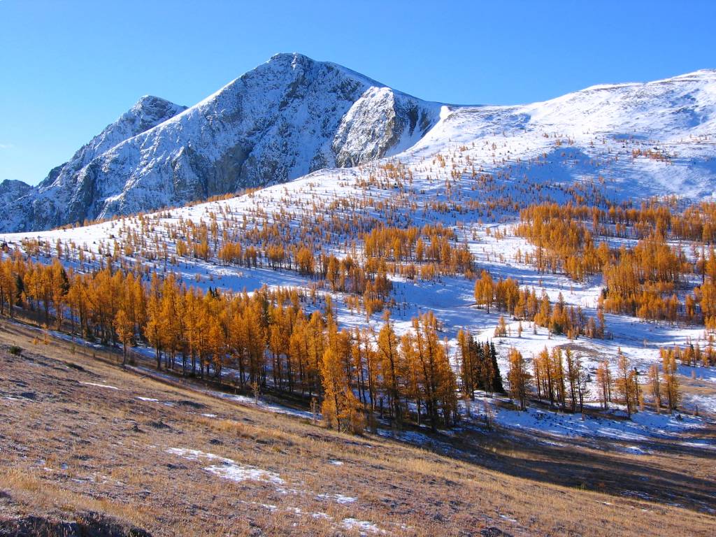
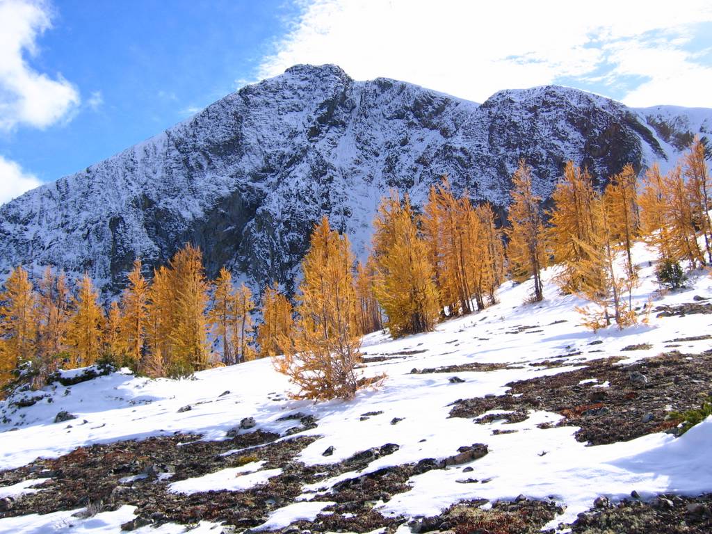
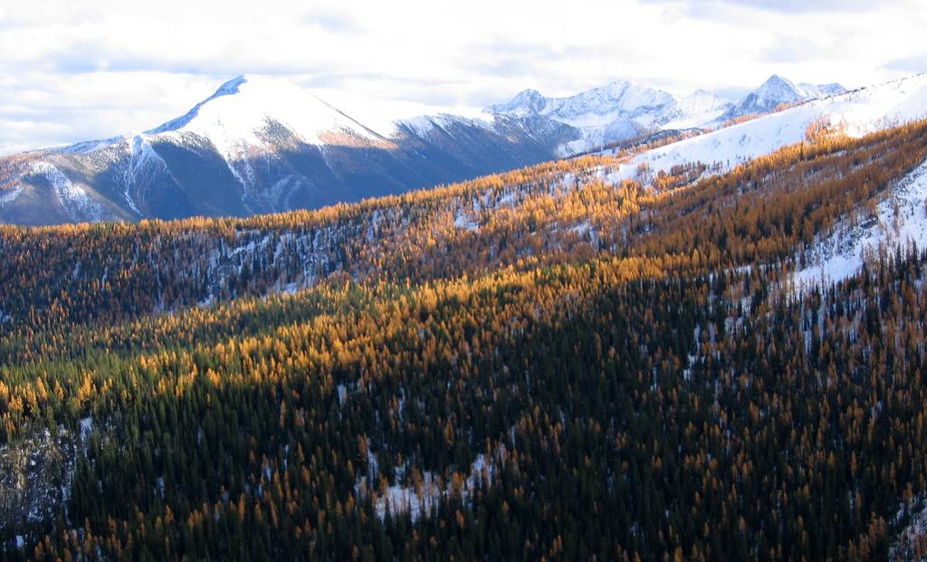
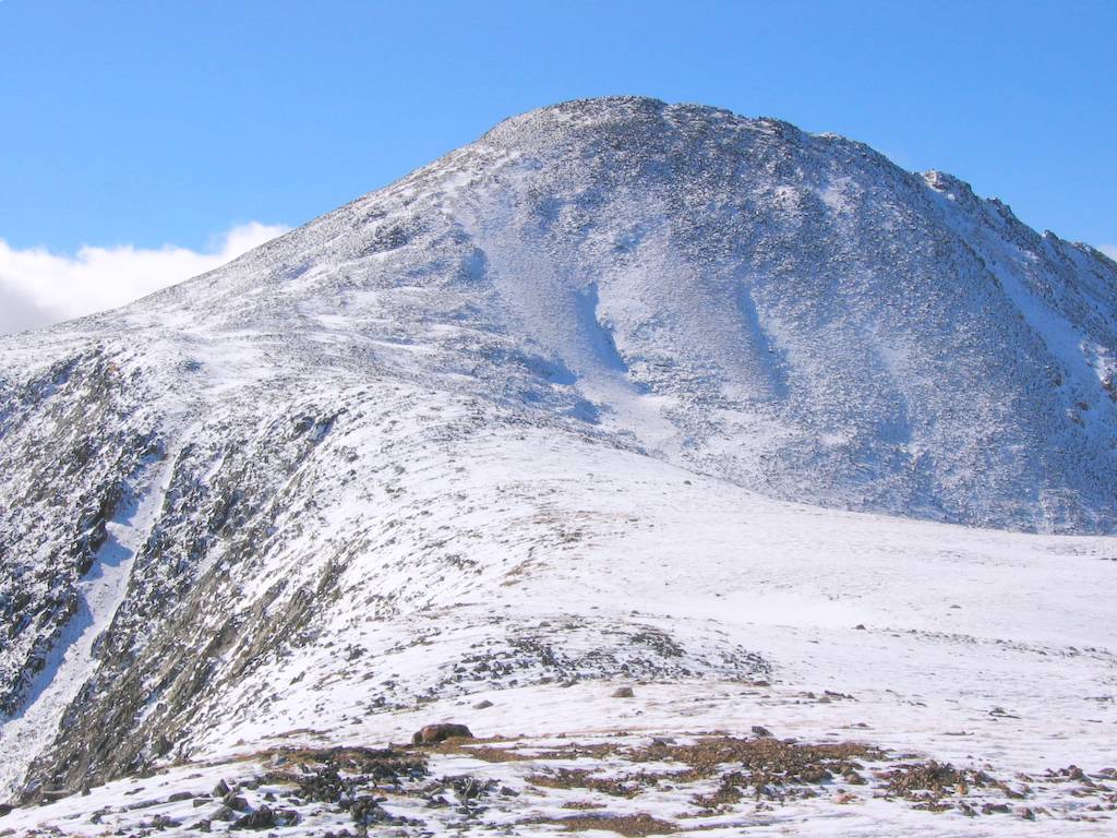
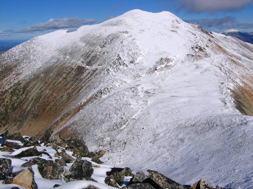
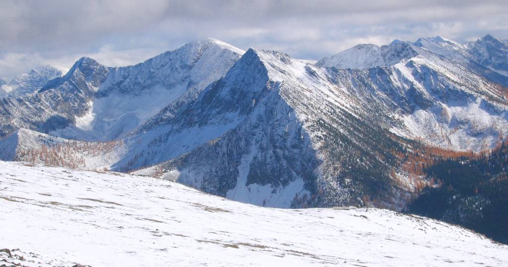
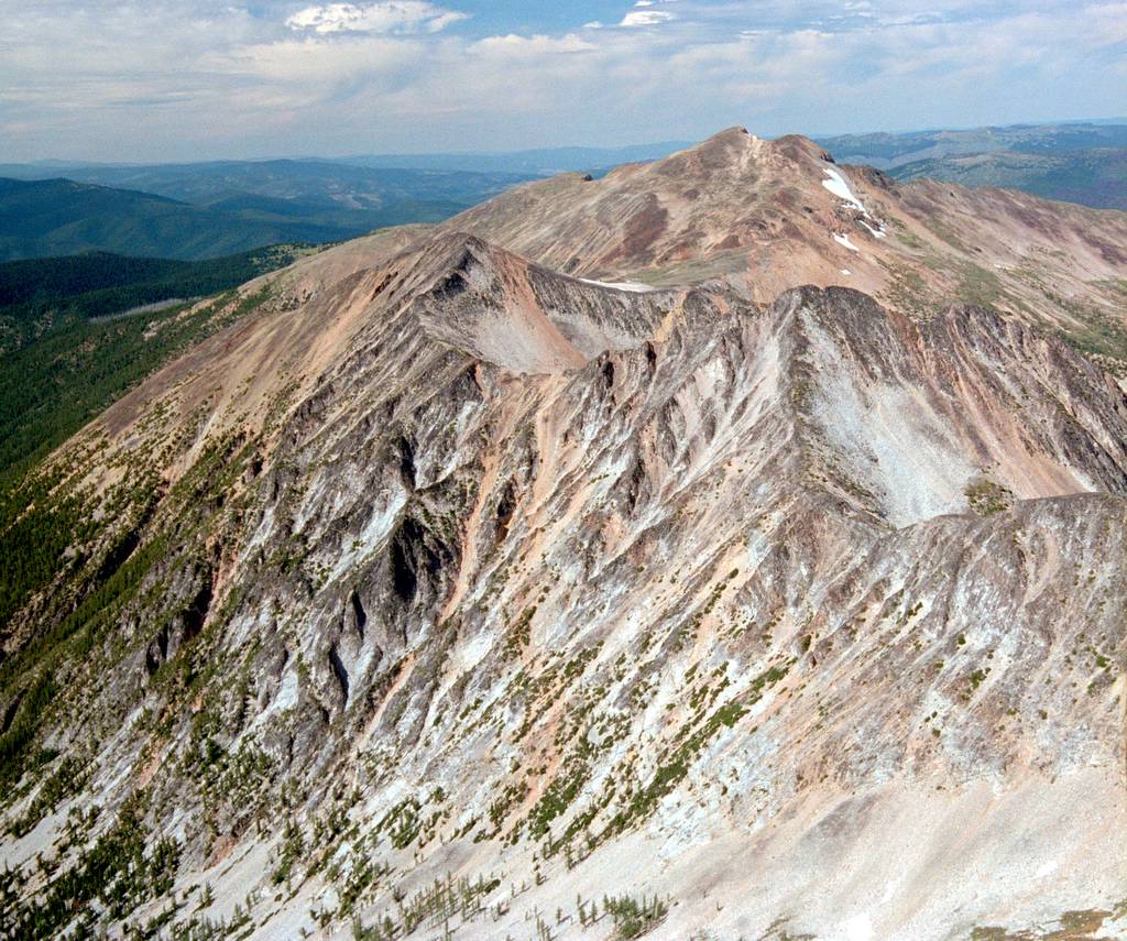
Ptarmigan Peak turned out to be a beautiful October trip. My previous impression of Ptarmigan had been that it’s just a big lumpy hump of tundra. Well, actually that is how it looks from the south in summer (from Lago/Carru/Osceola). But, approaching from the north in October, just after a snowstorm, it rose up in beautiful sweeping curves of white snow, golden larches, and dark rock. On a crisp clear fall day, our Tatoosh Butte approach made for delightful roaming along high alpine ridges suspended between autumn meadows below our feet, bright skies above out heads, and ever-higher slopes ahead of us.
Ptarmigan was my 80th Top 100 peak. For much of the summer, it looked like I would never make it out of the 70s. Since doing Argonaut in July, I had scheduled trips every other weekend, but each trip was cancelled by weather, illness, party changes, or competing summits. Ptarmigan was my final backup peak for this weekend, because it had easy terrain that would go in almost any weather. We lucked out, and the weather gave us a brief clear window between storms. |
|||||||||||||||||||||||||||||||||||||||||||||||||||||||||||||||||||||||||||||||||||||||||||||||||||||||||||||||||||||||||||||||||
|
|
|||||||||||||||||||||||||||||||||||||||||||||||||||||||||||||||||||||||||||||||||||||||||||||||||||||||||||||||||||||||||||||||||
|
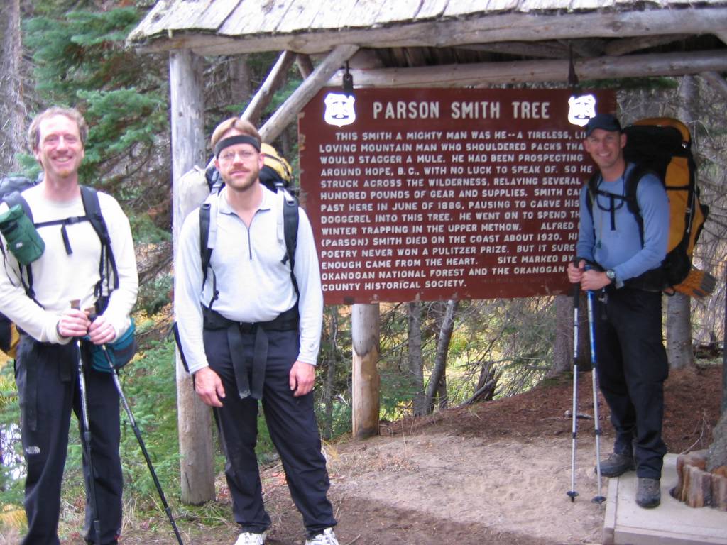
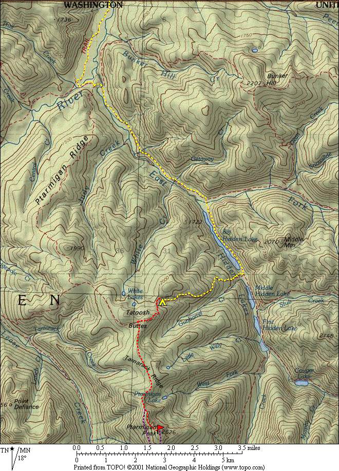
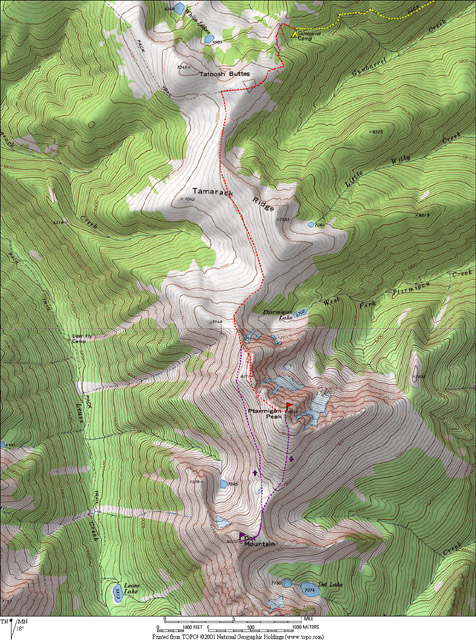
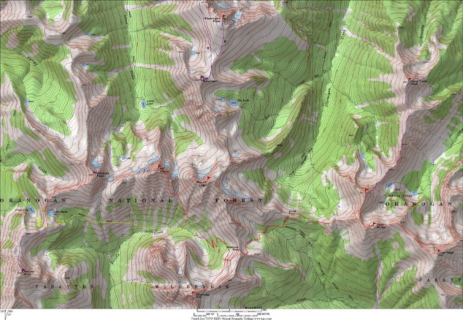
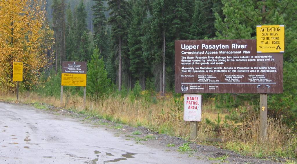
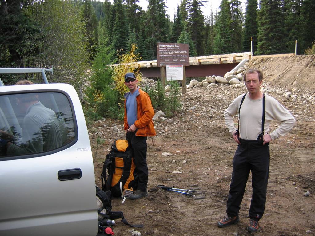
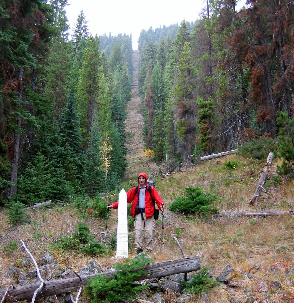
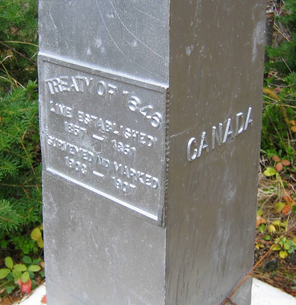
We approached from the north by driving to the Pasayten
River in Canada, hiking south to the border, and then taking the Border Trail,
Hidden Lakes Trail, and Tatoosh Buttes trail to camp at Gunbarrel Camp high on
Tatoosh Butte. This was a shorter distance and easier terrain than any of the
southern approaches.
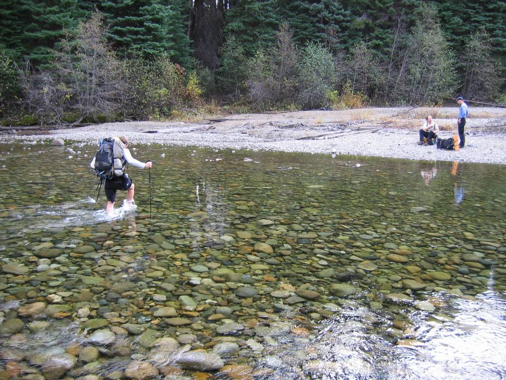
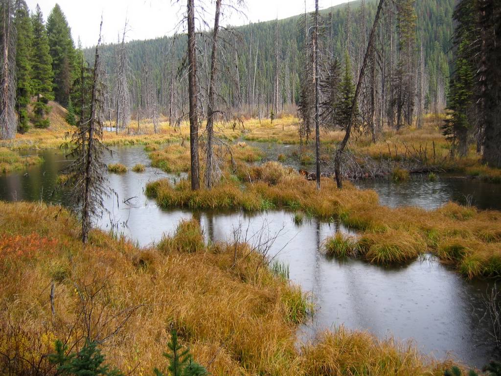
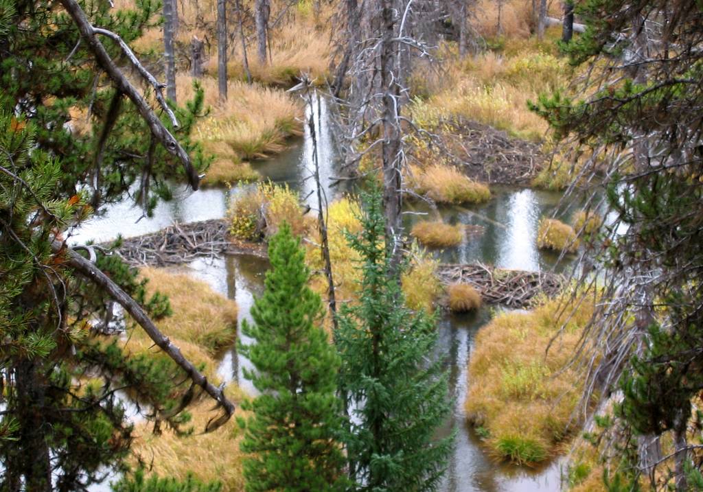
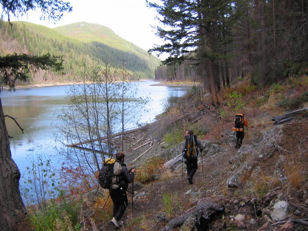
We headed south on Border Trail #461, which was also in good condition. After another 1.5 miles, we found lots of blue tape and signs marking the temporary trail to ford the Pasayten River. The ford was easy knee-deep water, but it was wide, and our bare toes got very cold. From here on, the trails were old roads and virtually flat, so we had easy going along the East Fork Pasayten to Hidden Lakes.
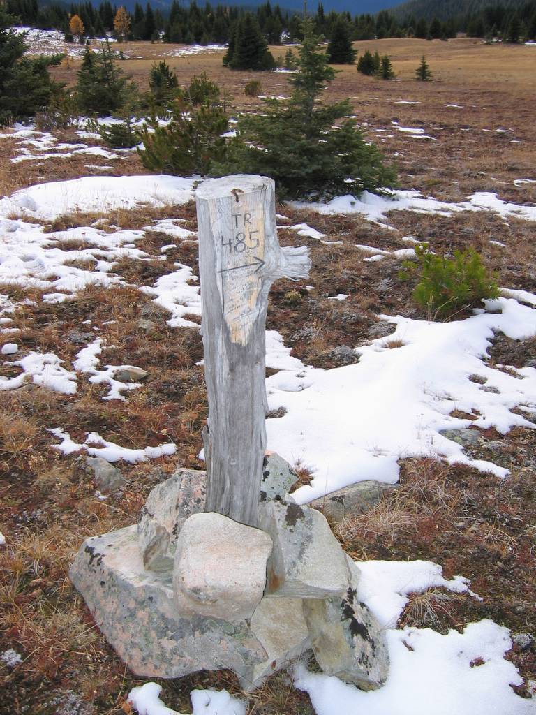
The dry summer had left Big Hidden Lake (4318) sunk about six feet below its permanent level. The lake still stretched for most of a mile down the valley, but its upper end had wide stretches of exposed lake-bottom. On the far shore of the lake, we saw a large coyote or small wolf. We continued onward to Middle Hidden Lake (also recessed from its banks), and then backtracked to find Tatoosh Buttes Trail #485 in the middle of the swampy area between the lakes. Once we looked for it, the junction (4350) was easily visible, but there was no trail sign.
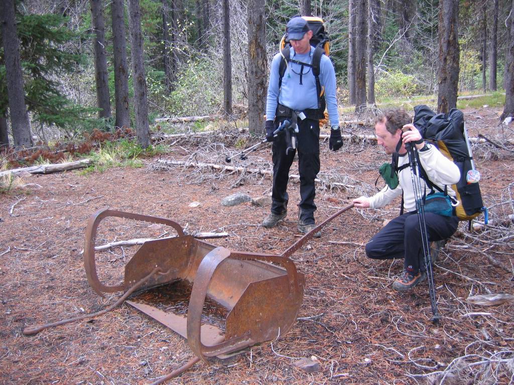
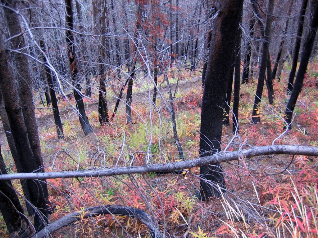
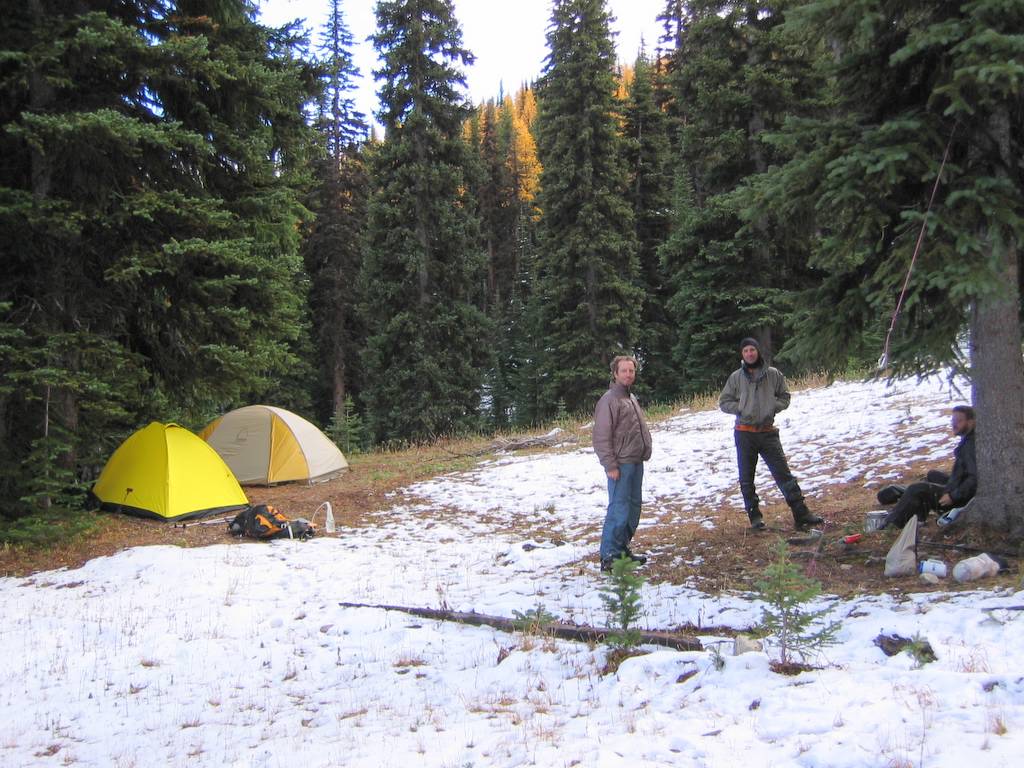
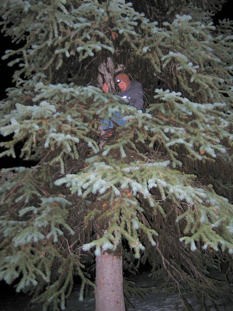
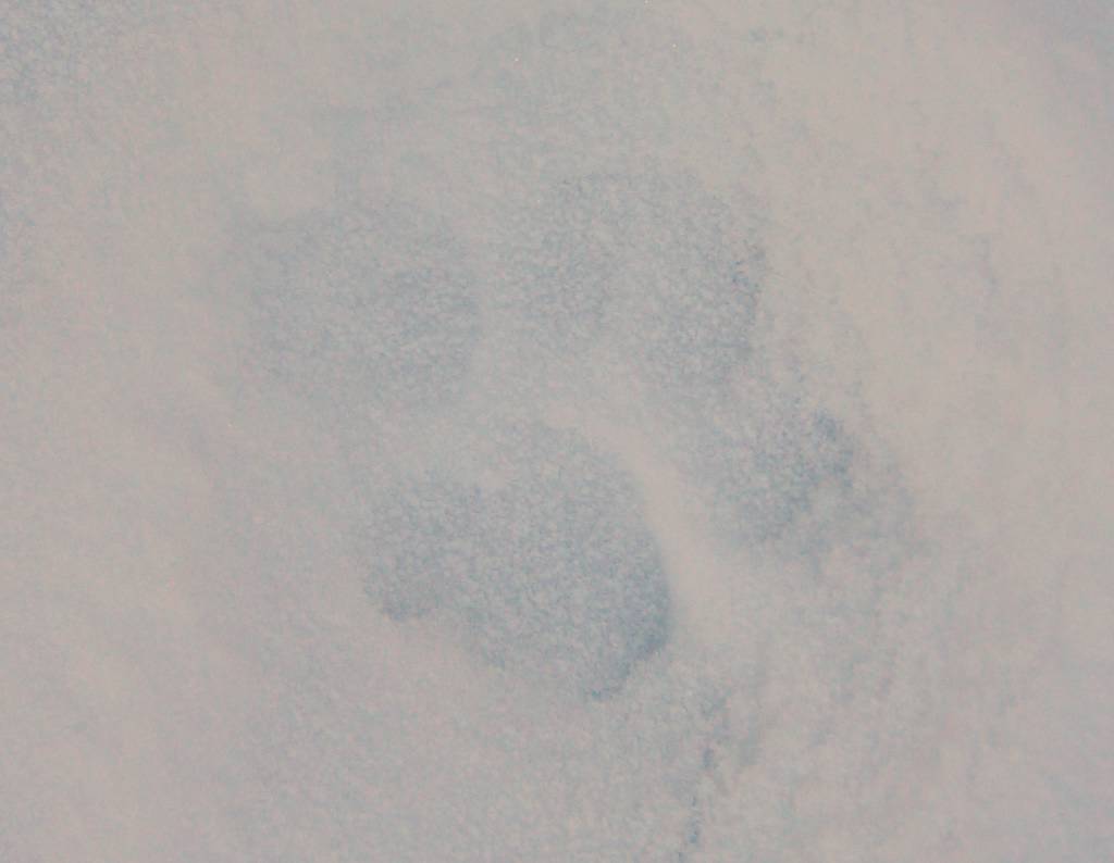
Now the trail headed steeply uphill in the Gunbarrel Creek drainage, gaining 2000 feet in the next three miles. The lower part of the trail switch-backed through an old burn, with new grasses showing bright fall colors between the bare black trunks. By the time we reached Gunbarrel Camp (6450), it was fully dark. The meadows were covered with a couple inches of brand new snow, but we found a comfortable dry area under the trees for our tents. We cooked under a different tree, because Nick had found bear tracks earlier. The creek near the camp was dry, so my new pot got lots of work melting snow for water.
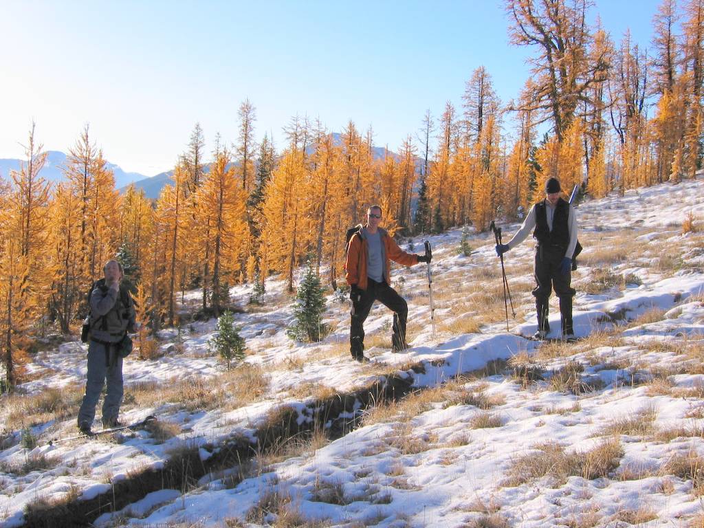
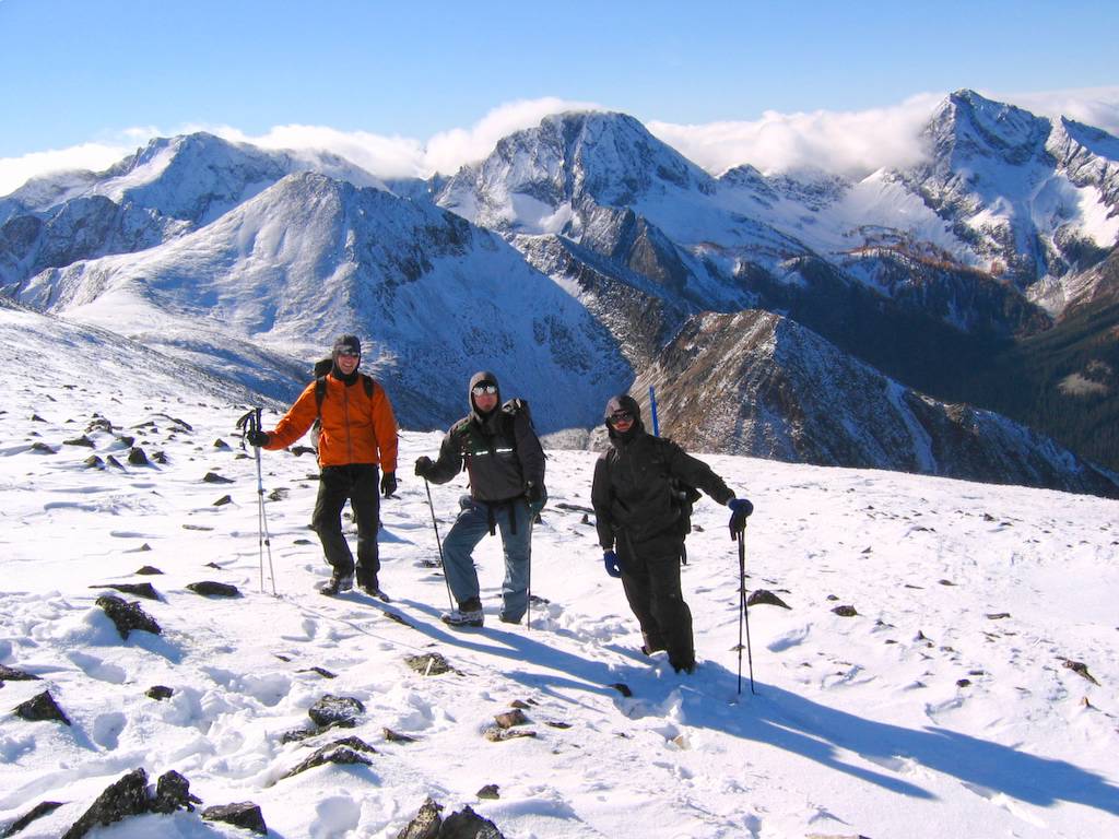
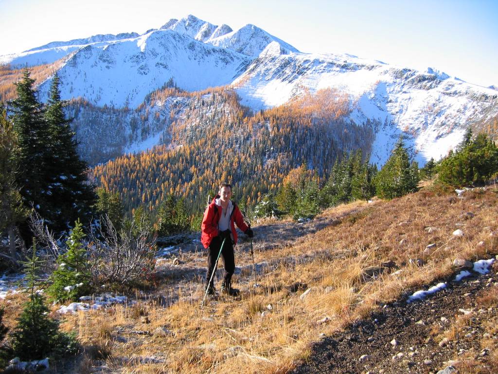
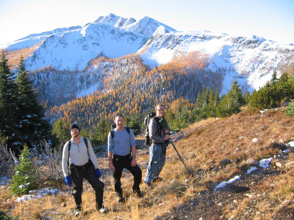
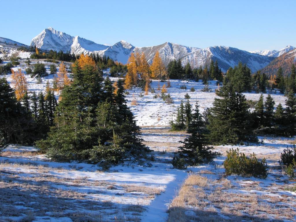
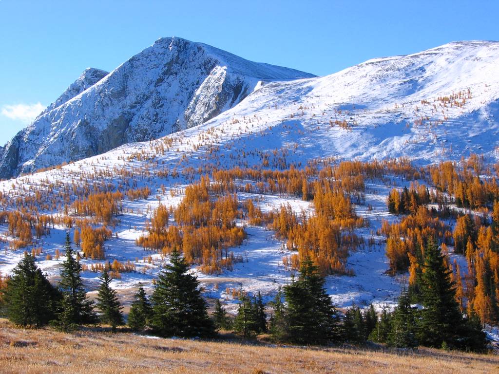
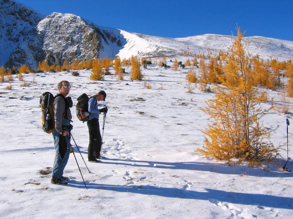
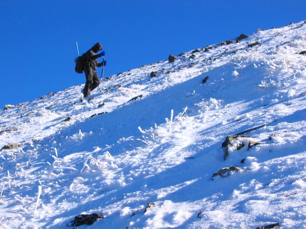
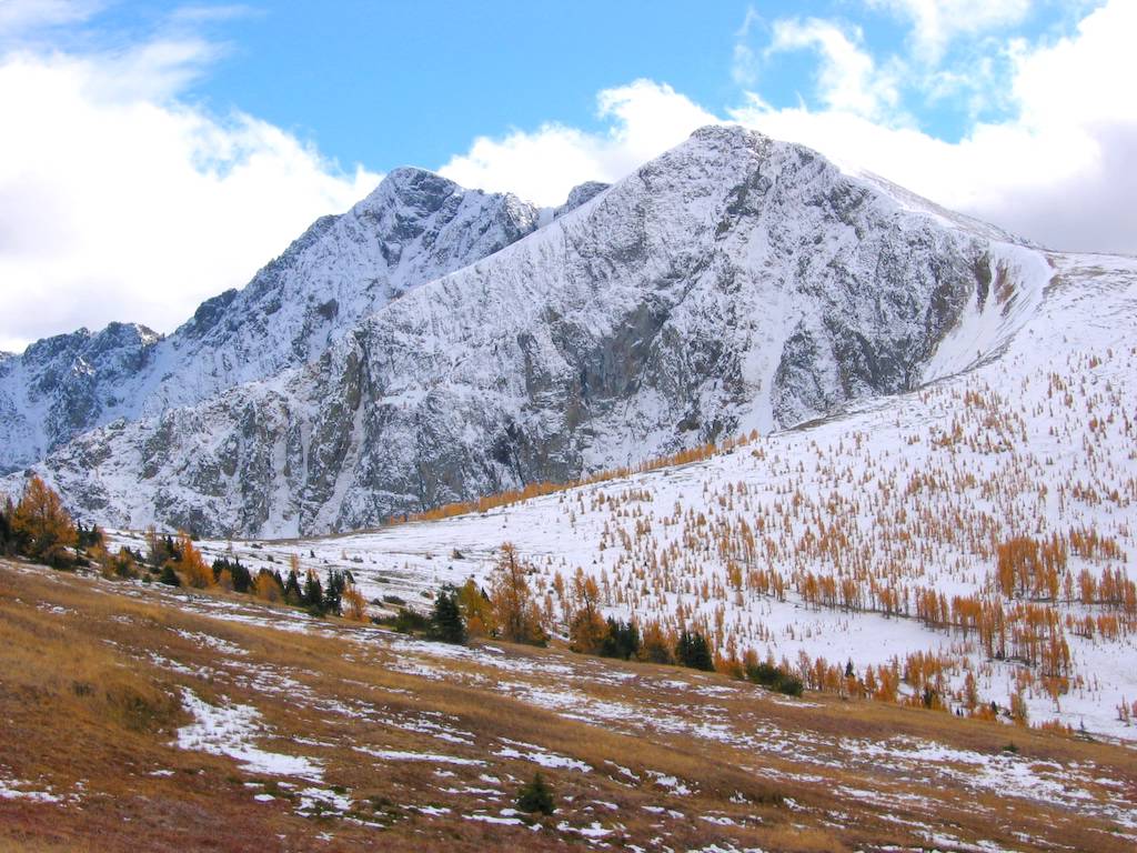
In the morning we headed up to the high point of the trail at about 7100. Along the trail, we saw many small animal tracks in the snow, and several sets of coyote tracks. Then we headed south along Tamarack Ridge. It was delightful high traveling, with light snow or low grass underfoot and small trees scattered about the ridge. Ptarmigan Peak stood out ahead with a white carpet of snow lying under the groves of larches and curtains of snow plastered to the black rock of the northeast cliffs.
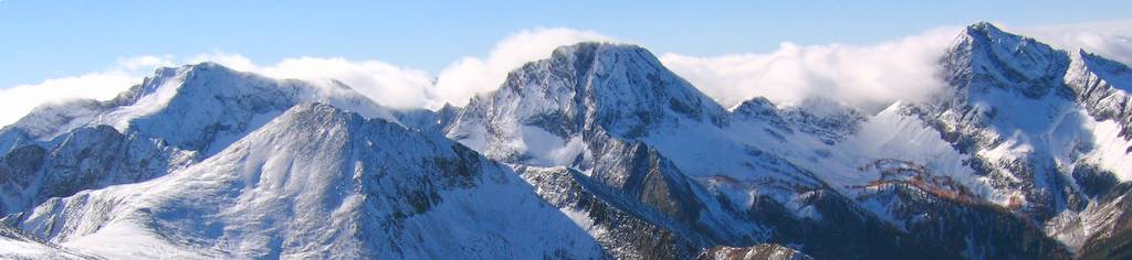
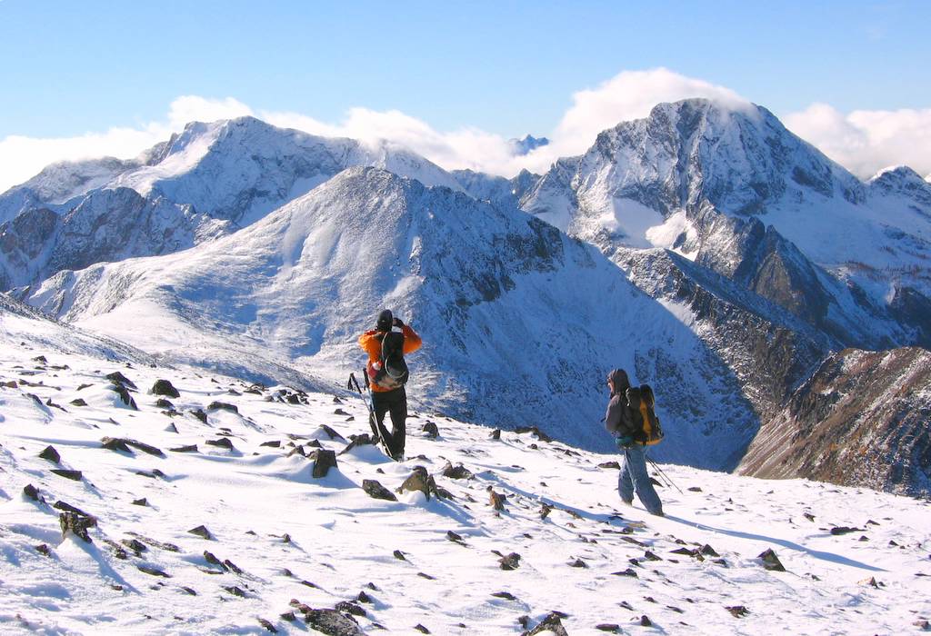
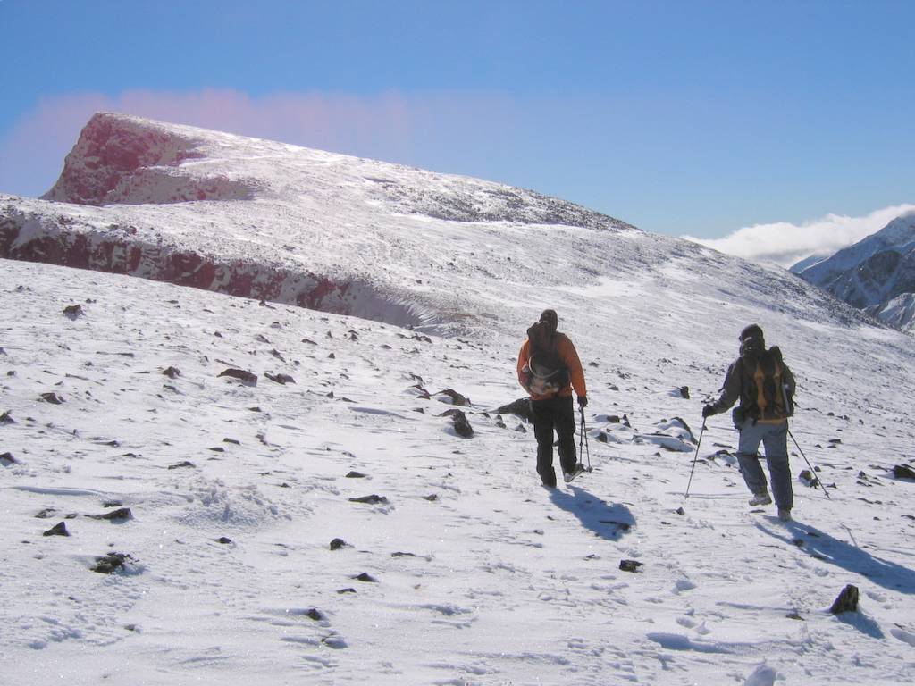
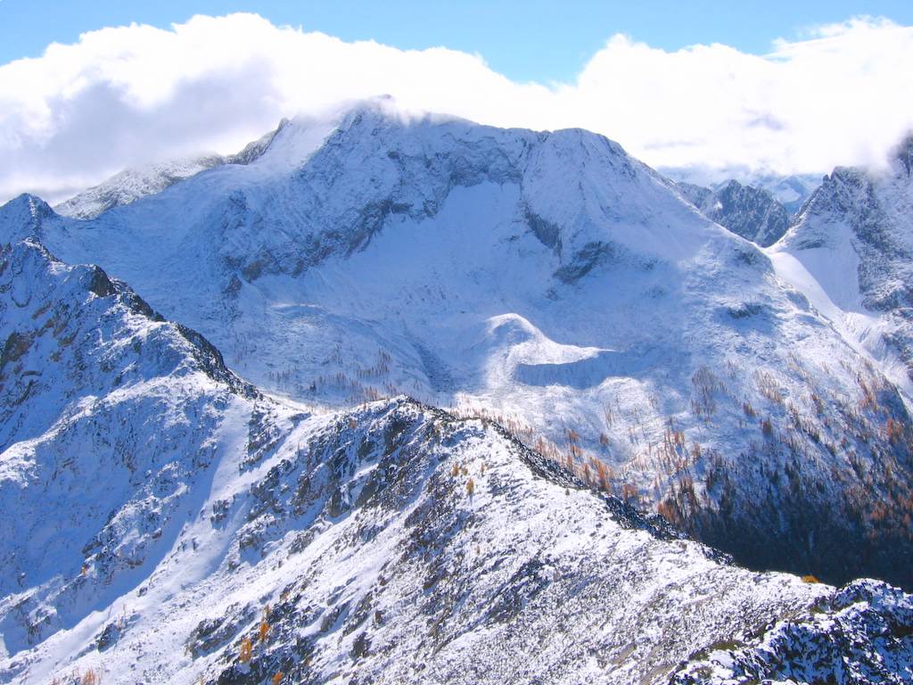
We followed easy slopes curving around the west side of the peak and up to the summit. Coming around the peak, we could see the Osceola-Carru-Lago (OCL) ridge to the south, with Dot Peak forming a lower bump in between. Thickening clouds surrounded the summits further south and west.
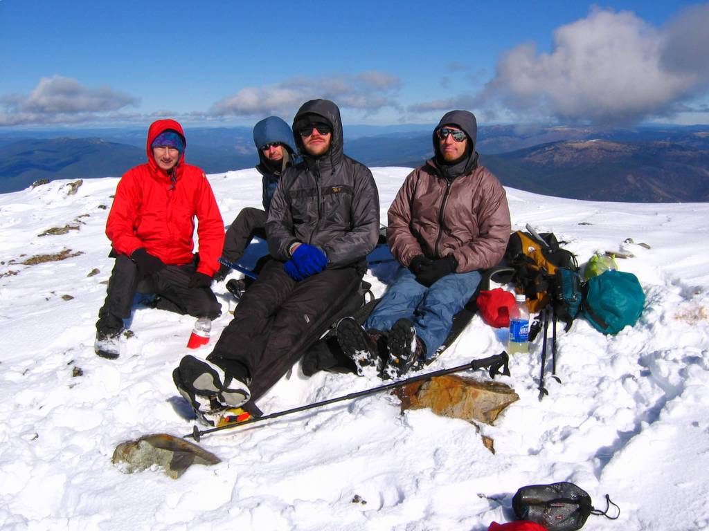
We stayed at the sunny but cold summit for half an hour. The clouds pushed up to the summits of the OCL ridge, but never reached us. Butte Pass and Pass Butte were also visible to the southeast, but the summit of Lost was lost in the clouds. (Try this sentence from my 2003 trip: On my way to find Lost, I passed Butte Pass but bypassed Pass Butte.)
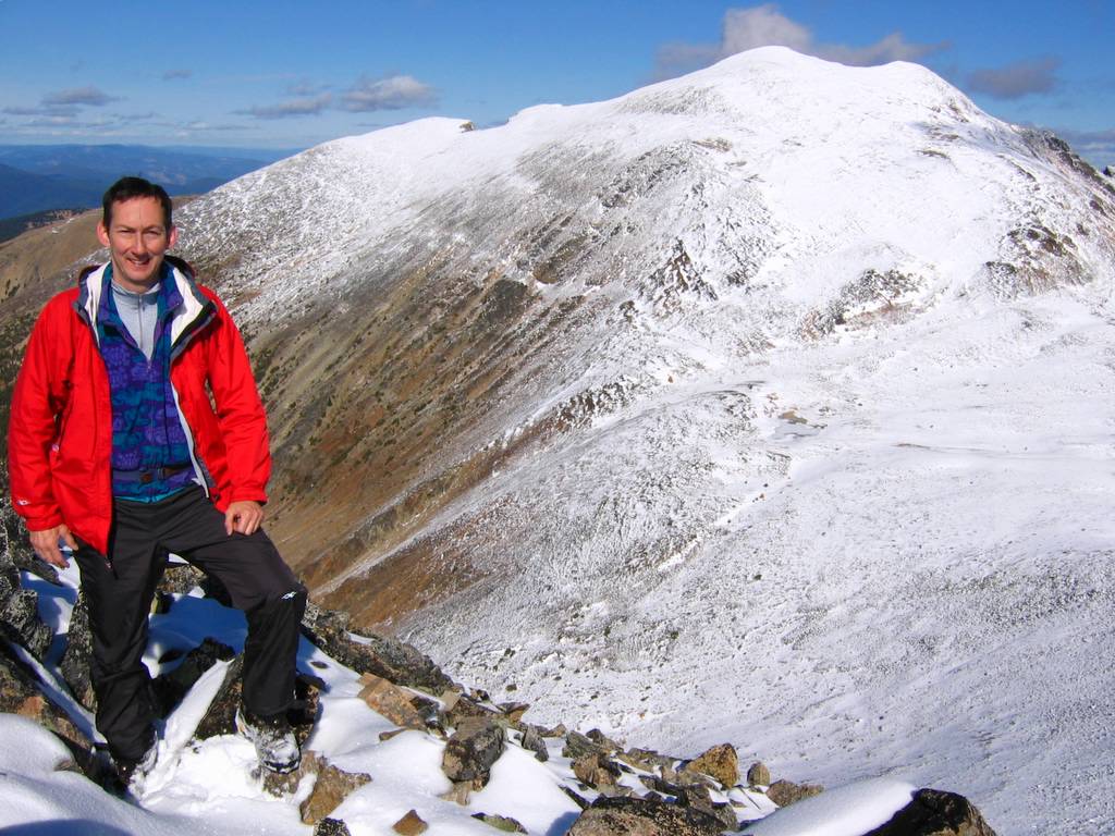
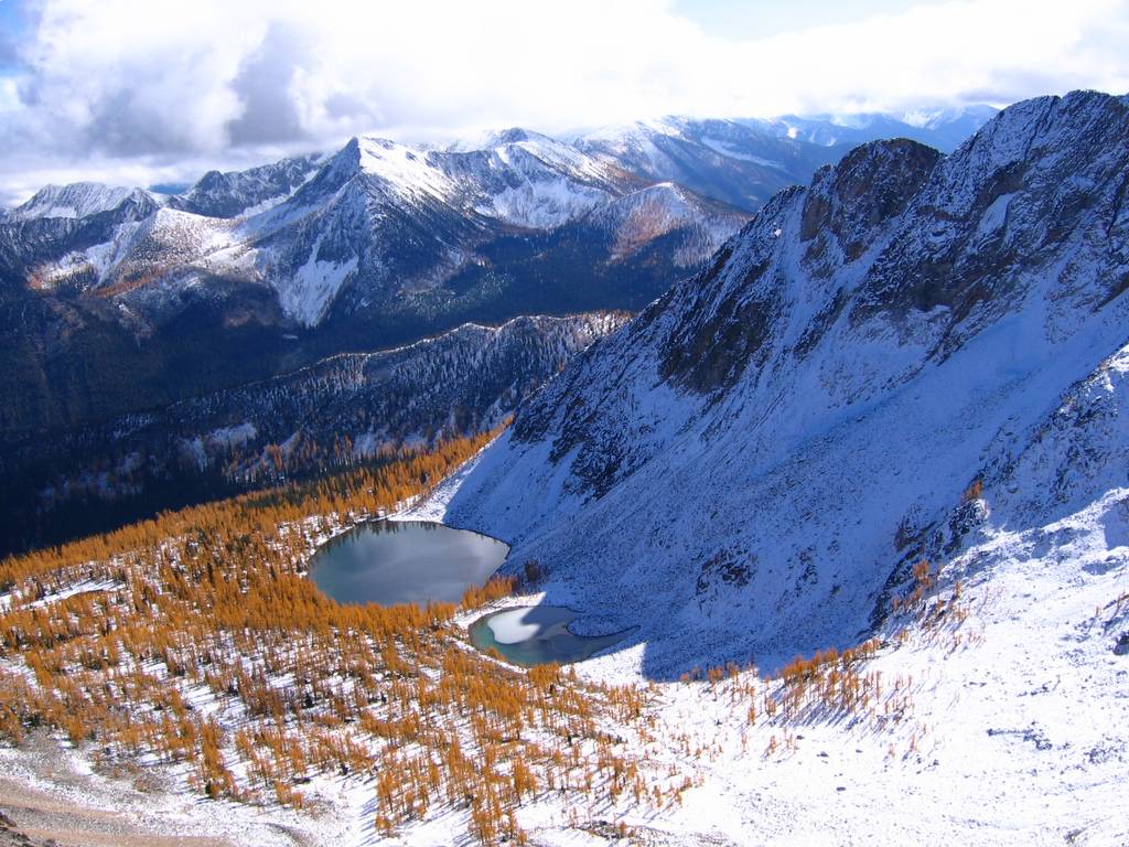
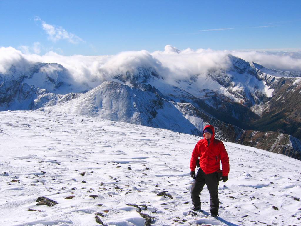
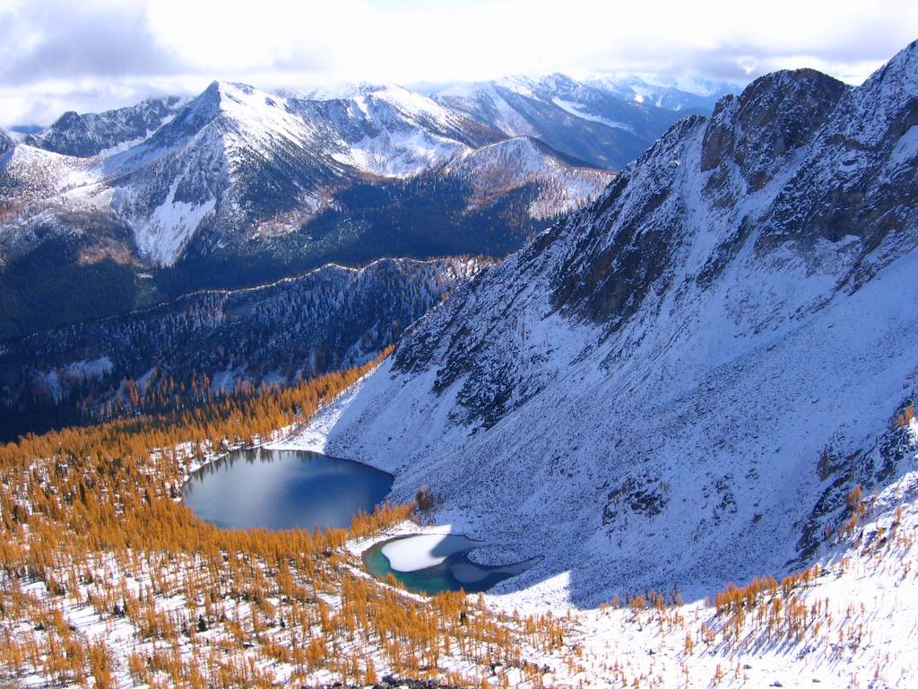
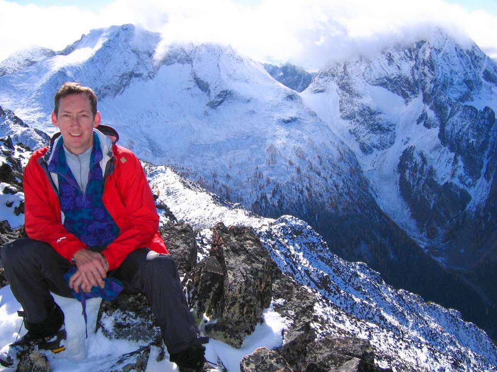
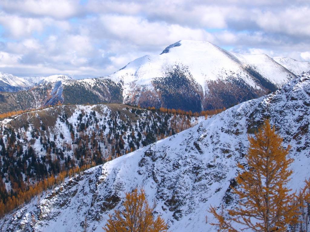
I headed onward to Dot, while the others returned to the warmer meadows of Tamarack Ridge. It was an easy descent about 800 feet to the col and 450 feet back up to Dot’s summit (8220). Dot’s summit was the highlight of my day. It was perfectly calm and warm, and I could easily have napped for an hour if the others weren’t waiting. Ahead of me, the constantly shifting clouds sent moving accents of light and shadow across the peaks and cols of the OCL ridge. Below me, Dot Lakes reflected bright blue amid a basin filled with larches. Behind me, I could trace the variable snow line around the sides of Ptarmigan and down the col toward me.
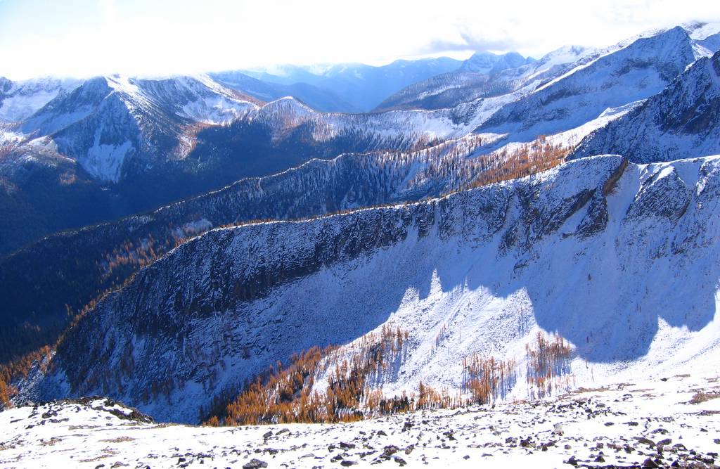
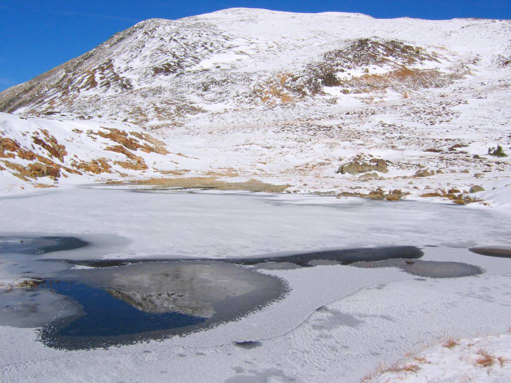
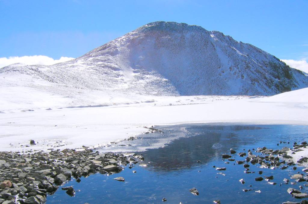
I returned to the Ptarmigan-Dot col and visited the small tarn that was almost iced over. To get around Ptarmigan, I traversed up to about 8000 and then back down. For a while, larger waves of clouds poured over the crest of the OCL ridge, but then the clouds retreated. Lost Peak finally showed its summit, and Many Trails Peak gleamed especially bright white above larch-edged valley ridges.
Back in camp we had a relaxed dinner and got a long night’s sleep after the 6:30 sunset. We woke to a misty dawn and thicker clouds overhead, but made it to the trailhead with only a few sprinkles. Just after we arrived at the truck, it began to rain harder and continued for hours. We escaped with no effect but a bright rainbow in the Nooksack Valley and memories of sunny white summits. |
(Click any picture to enlarge.) |
||||||||||||||||||||||||||||||||||||||||||||||||||||||||||||||||||||||||||||||||||||||||||||||||||||||||||||||||||||||||||||||||
|
|
|||||||||||||||||||||||||||||||||||||||||||||||||||||||||||||||||||||||||||||||||||||||||||||||||||||||||||||||||||||||||||||||||
|
Statistics: Drive 4:45 from Lynnwood to bridge on Upper Pasayten Road in Canada. Pasayten Bridge 3900 to Gunbarrel Camp 6450: 12.6 mi, 3230 gain, 7:50 hrs. Gunbarrel Camp to Ptarmigan 8614: 4.2 mi, 2360 gain, 3:10 hrs. Ptarmigan to Dot 8220: 1.2 mi, 800 loss, 480 gain, 1:00 hr. Dot to Gunbarrel Camp: 5.2 mi, 770 gain, 3:00 hrs. Gunbarrel Camp to Bridge: 12.6 mi, 570 gain, 6:10 hrs. Total: 35.8 mi, 7410 gain. Click here for more info on driving, trails, and camps.
|
|||||||||||||||||||||||||||||||||||||||||||||||||||||||||||||||||||||||||||||||||||||||||||||||||||||||||||||||||||||||||||||||||
|
|
|||||||||||||||||||||||||||||||||||||||||||||||||||||||||||||||||||||||||||||||||||||||||||||||||||||||||||||||||||||||||||||||||
|
Related
Trips: Pasayten Outing, 7/18 - 7/22/03: My first view of Ptarmigan, from the Osceola/Carru/Lago ridge. Pictures
& Maps:
|
|||||||||||||||||||||||||||||||||||||||||||||||||||||||||||||||||||||||||||||||||||||||||||||||||||||||||||||||||||||||||||||||||
|
|
|||||||||||||||||||||||||||||||||||||||||||||||||||||||||||||||||||||||||||||||||||||||||||||||||||||||||||||||||||||||||||||||||
